-2")

Friday overview: No signs of spring, other than baseball
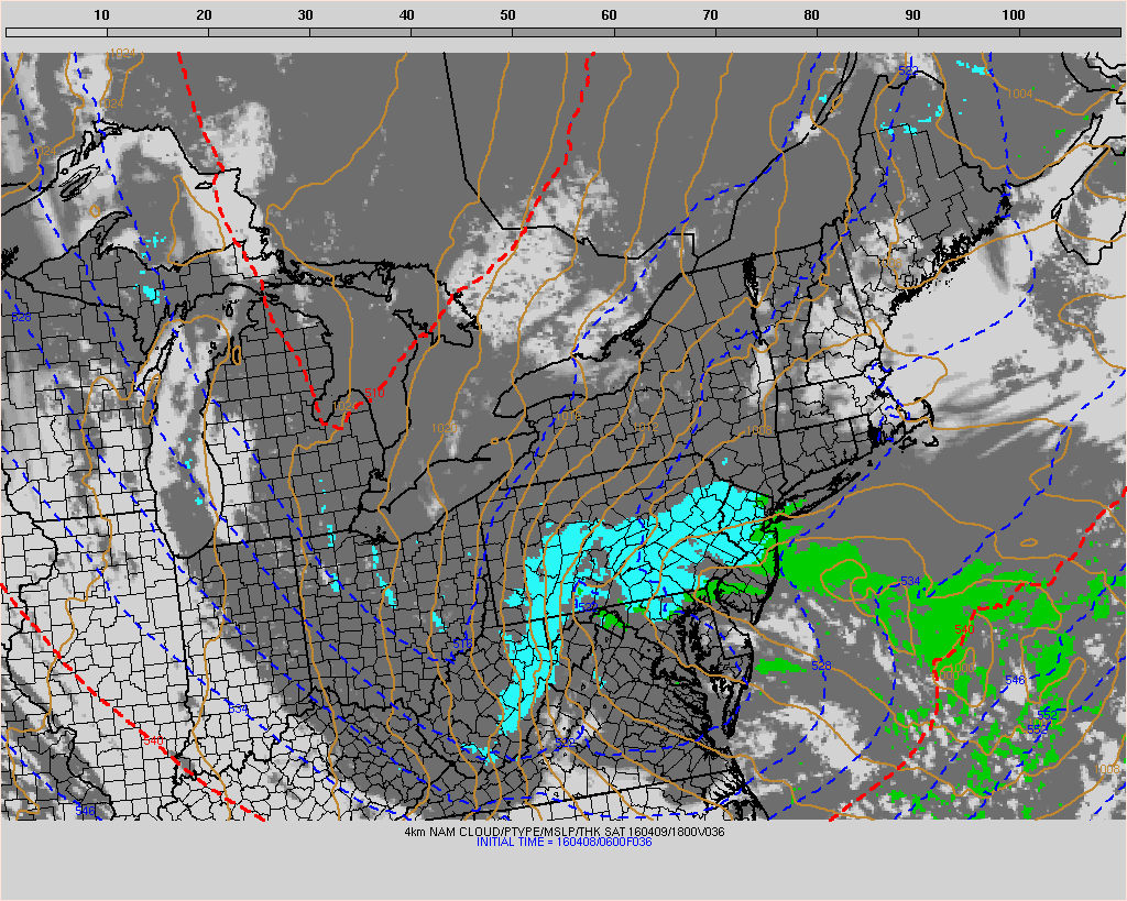
Cold air has returned to the area this morning, which you’ve probably already noticed. This airmass will continue pushing into the area over the next several hours as west-northwesterly winds usher in the drier and colder airmass. A few scattered showers are possible today, but should remain generally un-impactful. The main story over the next day or two will be the potential for snow (yes, you read that correctly) on Saturday with a system developing off the coast of New Jersey.
Models are in agreement that a strong shortwave and atmospheric disturbance will drop southeastward from Canada into the Great Lakes and eventually underneath the Mid Atlantic states on Saturday. This is a pattern that is much more typical in January of February — not in April. Nevertheless, the storm system is well signaled on all models. The question, over the next several hours, will be pinning down when and where heavy precipitation will occur. Essentially, while most areas will experience rain with this storm, heavier precipitation rates can allow for “dynamic cooling” in the atmosphere, allowing precipitation in heavier bands to fall as snow.
Meteorologists will be working diligently to pin down when and where these bands will set up over the next 12 hours or so. Early indications are that this band will pivot from Southeast PA into Northeast NJ on Saturday morning, with snow possible across the suburbs, interior, and higher elevations while rain falls along the coast. Snow is even possible for brief periods of time near the coast during very heavy precipitation. Overall, accumulations are expected to be relegated to the grass and car tops, while roads remain relatively wet. We’ll have more updates and a specific thread for this storm in a few hours.
Meanwhile, here’s the latest and greatest with the forecast over the next few days:
- Cold air has returned today, and high temperatures are only expected to reach into the 40’s and 50’s. Northwest winds will continue through the day, keeping the air feeling much cooler than yesterday. The Mets home opener looks safe, but chilly, so bundle up.
- Saturday’s potential snow event continues to be the main story in the meteorological community. Forecast models continue to shower ht potential for snow with heavier bands of precipitation, and some light accumulations are possible on grass and colder surfaces where these bands set up.
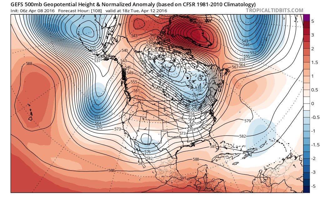
- Colder than normal air is likely to continue to dominate through the early to middle part of next week, thanks to a developing Greenland Block. These blocks help force cold air, which usually settles in the Arctic regions this time of year, further south. That’s not good news for anyone ready to break out the tanning oil.