-2")

Tuesday Overview: More showers & t-storms later this afternoon
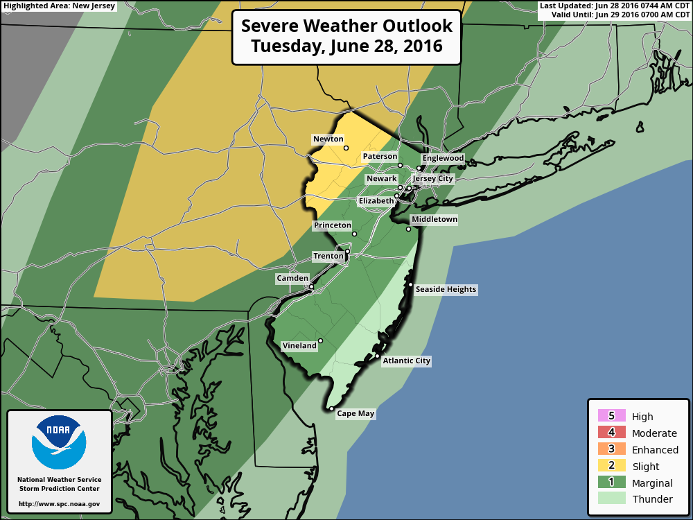
Unsettled weather continues this afternoon, with a cold front and upper-level trough slowly approaching the region. Skies clearing to the west will cause instability to increase enough for showers and thunderstorms to develop over Central and Eastern Pennsylvania later this afternoon by early this evening. These thunderstorms will gradually move into western parts of New Jersey and the Lower Hudson Valley by early this evening. Strong or severe thunderstorms will be capable of producing heavy rainfall and isolated damaging wind gusts. For this reason SPC has placed Northwest NJ and Orange County NY in slight risk for severe weather.
A marginal risk remains for Northeast New Jersey New York City and rest of Lower Hudson Valley. More cloud cover and onshore flow will keep the rest of region in a more stable airmass, most likely causing stronger thunderstorms to weaken, as they approach the coast this evening. Some heavy downpours and lightning are still possible with showers and thunderstorms this evening. Where clouds break for any sunshine later this afternoon, temperatures will slowly rise into the upper 70s or lower 80s. Other areas, especially closer to the Coast, may remain cooler. Showers and thunderstorms may linger around until late tonight with the cold front and shortwave trough still moving slowly through the region. This storm system could have an impact on the Yankees Game tonight.
Some other highlights for rest of this week.
- Some widely scattered showers or thunderstorms are still possible on Wednesday with the frontal boundary slowly moving east of the region.
- Thursday looks like a pleasant, very warm and mostly sunny day with high pressure over the region.
- Another cold front and shortwave trough could bring more showers and thunderstorms on Friday.
For more details on the forecast, including a look out to July 4th weekend, the long-range outlook and of course, our well-known discussion videos, sign up for Premium Membership today. You will not be disappointed!