-2")

Unsettled Weather with Heavy Rainfall Possible on Friday
A prolonged heat wave, which has brought temperatures in the upper 90’s and near 100 over the past several days, will continue through Thursday. But changing weather is on the way thereafter, beginning as early as Thursday Night. A storm system approaching from the southwest will bring more unsettled weather, and the potential for heavy rain. There is some uncertainly with the exact impacts from the system over the region, but the potential exists for heavy rainfall which may cause flooding and local travel impacts on Friday morning.
A shortwave trough will be moving into the region from the Ohio Valley late in the day on Thursday. This will cause an area of low pressure to develop near the Virginia Coast then track northeastward by Thursday night and Friday. Some widely scattered showers and thunderstorms may start developing over parts of the region, well ahead of this system, later Thursday afternoon and early evening. There might enough lift and instability for strong thunderstorms with a surface trough or sea-breeze boundary pushing inland over the region.
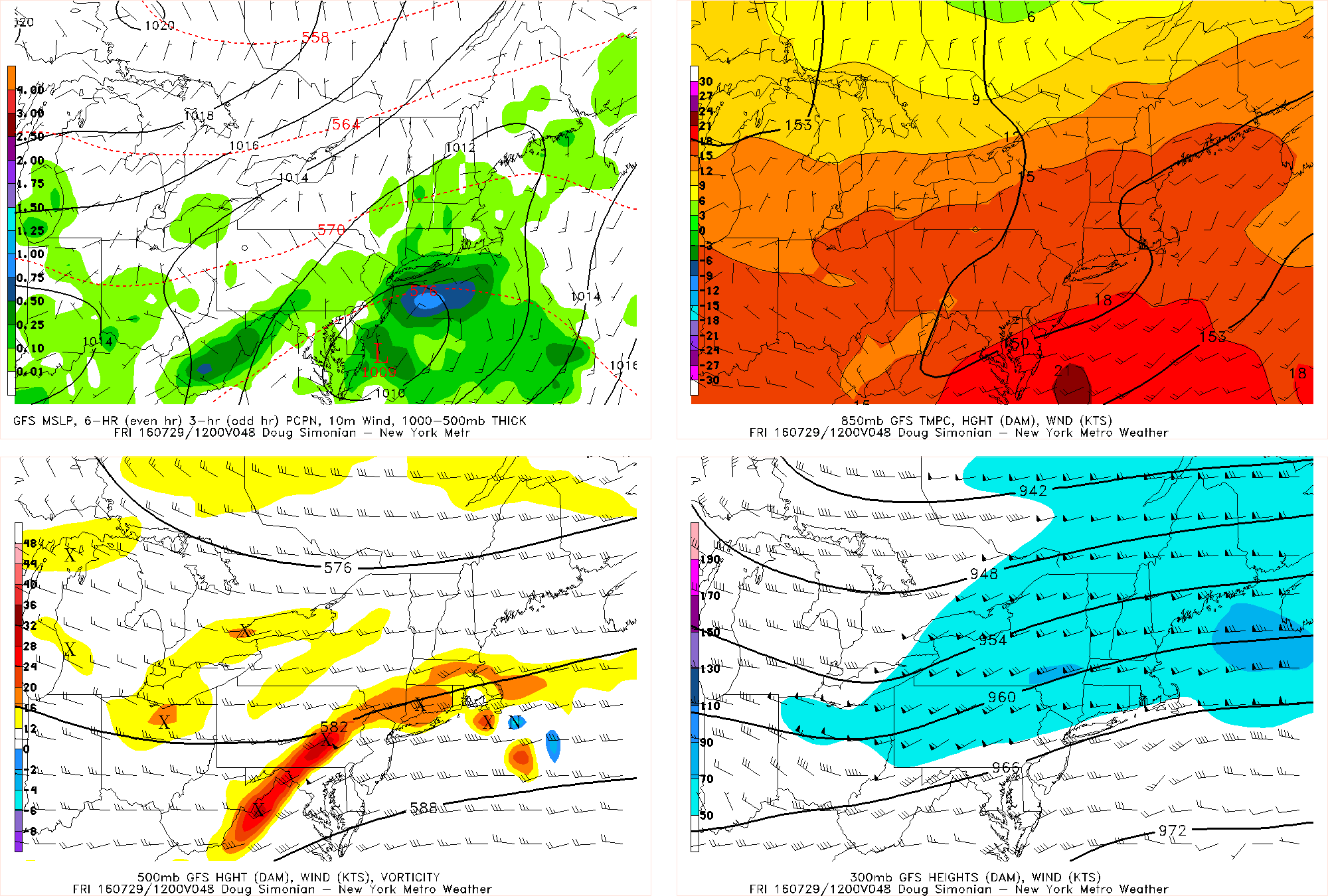
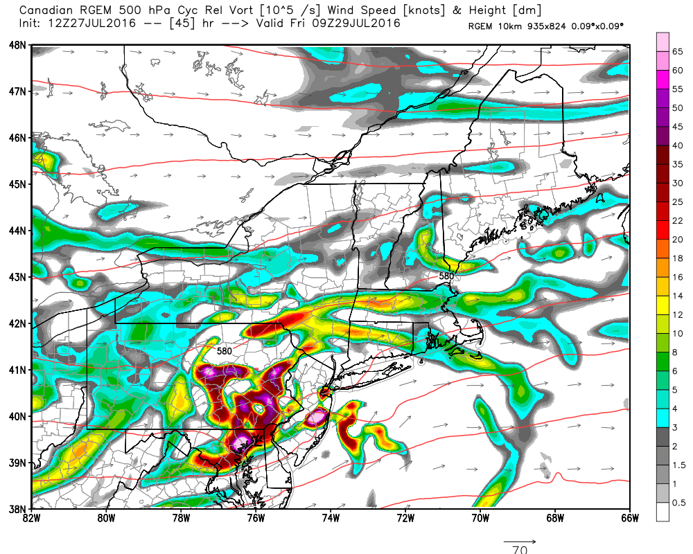
Then as the low organizes and approaches the region later Thursday night and Friday, more rainfall may be spreading northward over the region. There are still some significant model differences with the track, organization, and strength of this low — largely due to the handling of shortwave energy along and embedded inside the trough. Some model solutions have shown this energy more sheared out with a broader trough–such as the latest GFS, which results in a flatter, disorganized wave further south. Other model solutions show the shortwave energy stronger and more consolidated with a sharper trough, like the latest RGEM model.

The NAM Model showing heavy rainfall in parts of the area with surface low pressure and 5000mb shortwave trough.
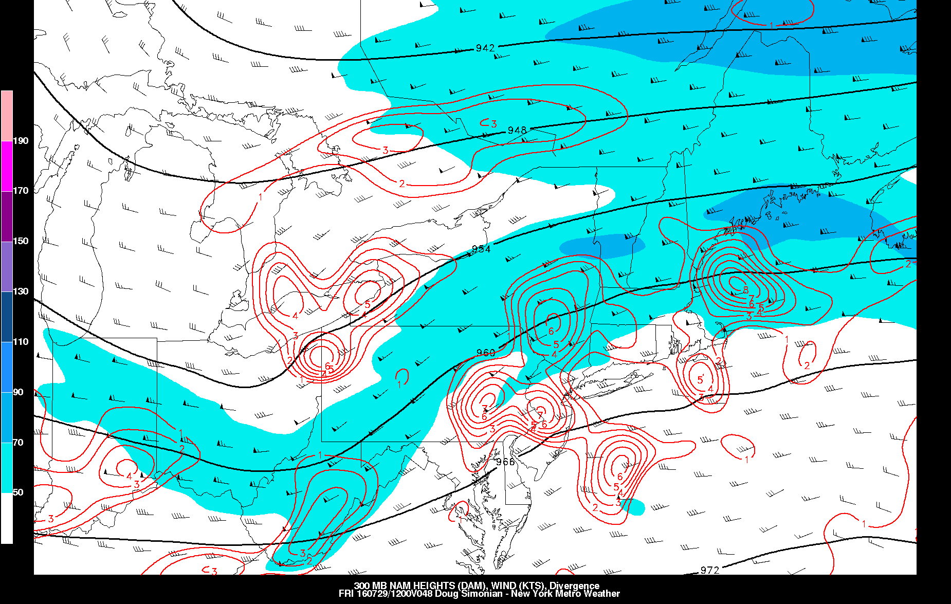
So with these model differences, the amount of rainfall is highly uncertain right now. Some parts of the area could be drier or wetter than others parts of the area. But most model guidance has the entire region underneath the right-rear quadrant of a fairly modest upper-level jet streak running over to our north. A plume of subtropical moisture will also be accompanying this low with precipitable water values over 2.00”– which is very high for this area and more often associated with tropical systems. This is one of the reasons why the threat for torrential downpours is relatively high.
Models indicate a band of heavy rainfall near and just north of the low track, at least partly due to some isentropic lift along the baroclinic gradient. But a 30-40kt southerly low-level jet ahead of this system could enhance some instability along the moisture convergence zone. These dynamics might support some elevated convection or thunderstorms with drenching downpours and localized flash flooding over some spots. Rainfall totals between 1” to 3” are possible.

The NAM model showing precipitable values over 2.00″ with some SBCAPE over the region that could support showers and thunderstorms with very heavy rainfall.
Any organized severe weather hazards aren’t anticipated at this time. Despite some differences, most model solutions keep the low pressure to the south of New York City and Long Island, which keeps warmer and unstable air further south of the region. However, with the southerly low-level jet enhancing directional and speed shear with helicity and some lowering LCL heights (lifting condensation level) , an isolated damaging wind gust or a weak tornado from thunderstorms can’t be ruled out — particularly for parts of Central or Southern NJ, closer to the low track. For that matter, the Storm Prediction Center has issued a marginal risk for southern parts of the region.
This system should begin exiting the region Friday night, bringing any rainfall to an end. More sunshine is anticipated for Saturday with high pressure in the region. But another disturbance may bring more unsettled weather by Sunday or Monday. Don’t dread it, though. Rainfall is needed to alleviate moderate drought conditions over the region. Model guidance is also showing more ridging developing over the region later next week. Stay tuned here for the latest updates on the possible impacts for the storm system for Friday, as well more updates for the weekend and long-range coming out by tonight.