-2")

Strong cold front will bring Autumn air to Northeast
A strong cold frontal boundary, currently situated across New York State and New England, will drop southward through the Northeast states Friday evening and early Saturday morning. While a north to south moving cold front may seem somewhat uneventful this time of year, the temperature gradient associated with this particular front is quite impressive.
Moreover, the airmass behind it is quite cold — even for this time of year — with temperatures 10 degrees below average or more, even in parts of New England where seasonal averages are rapidly falling now. The mid to upper 80 degree temperatures located ahead of the front will become a distant memory throughout most of the region by Saturday, when highs will struggle to reach the low 70s, and may not reach 70 in northern suburbs. A northerly breeze will help it feel truly like Autumn.
As the weekend draws on, the airmass will become more impressively cool. Overnight low temperatures on Sunday and Monday morning are likely to be 10 or more degrees below average in many spots, especially throughout the interior and Pine Barrens. Here, low temperatures in the 30s will be particularly common. Highs on Sunday will struggle to reach 70 in most locations.

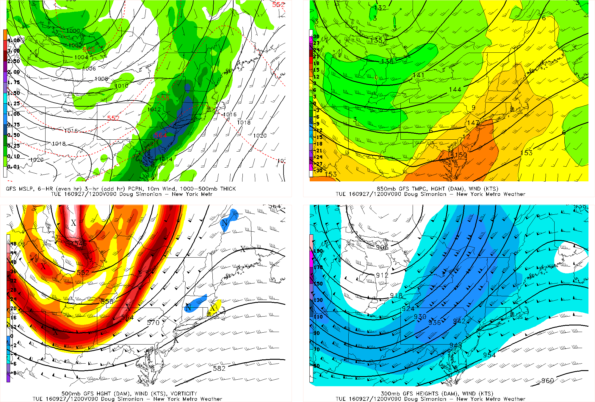
This afternoon’s GFS Model valid for Sunday night/Monday morning shows lows in the 30s in NW NJ, SE NY, and most of CT. Elevated areas in Upstate NY could drop into the 20s — thus the concern for a frost or freeze.
As is typical for this time of year, areas closer to the coast and cities will remain warmer than their surroundings during the overnights. Low temperatures generally in the 40s are expected there, which are still below average, but not as impressive so when compared to neighboring interior areas. The city itself may hold around 50 or in the low 50s.
Harvest and crop interests will need to pay particular attention to the overnight temperatures on Sunday morning and Monday morning. Forecast models show very favorable radiational cooling conditions, which suggests that higher elevations and interior locations could fall near freezing — or at the very least, observe a frost — during the overnight and early morning hours.

Today’s GFS Model valid for the latter part of next week shows a large ridge building back into the Eastern US, with a shortwave triggering some thunderstorms in the southwest part of the Corn Belt.
The refreshing airmass won’t be long for our area, however. Its duration seems somewhat limited (seems like a trend, no?) as the hemispheric pattern again keeps things progressive. After a cut-off low swings through and gives the area rain on Monday night and Tuesday morning, the middle and latter part of the upcoming week will see temperatures again rebound toward and then above seasonal averages, as a large high pressure ridge builds in and settles over the Northeast. This will coincide with an active and transitional pattern back west over the Ohio Valley and Corn Belt.
Details further out? We’ve got ’em. You just have to head over to our Long Range Dashboard for the latest.