-2")

3/10 Early AM All Zones Update: Light to Moderate Snowfall Today
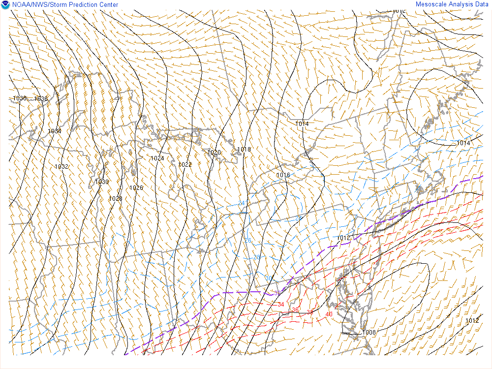
A wave of low pressure moving east from the Delmarva region, will bring a light to moderate snowfall to much of the region. Over the higher elevations over Northwest NJ and parts of Lower Hudson Valley snow has been falling over past few hours and surface temperatures have dropped to near freezing. So some accumulation is likely occurring on colder surfaces.
Closer to the coast, boundary layer temperatures may initially support some rain or wintry mix at the start, But it should quickly change over to snow, as lower dewpoints and wet-bulb temperatures, will support more cooling down to surface. Surface temperatures should fall down into low to mid 30s everywhere over by 9am.
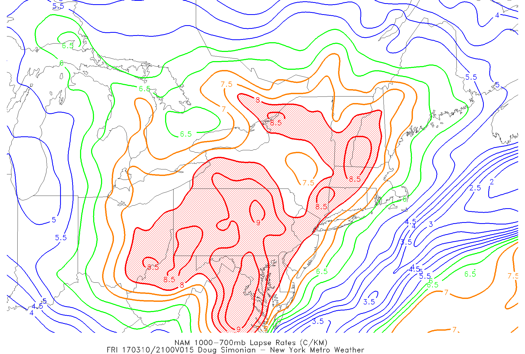
Then snow will become moderate to possibly heavy at times during the mid-morning hours. Snowfall could accumulate at the rate 1” to 2” per hour, especially on grassy and colder surfaces. Roadways might not see snow accumulating as much, due to the higher March sun angle. The heaviest banding will likely where the best mid-level frontogenesis setup. Latest mesoscale models suggests this will be over Central New Jersey and Eastern Long Island. This will be monitored through the morning.

Latest NAM showing 600-800mb stronger mid-level frontogenesis over Central NJ and Long Island by 10am.
However, there is some concern surface temperatures with increasing isolation, in these areas may be a little too warm (mid 30s?) support more significant snowfall. So we are keeping snowfall totals in our forecast more in line, with 3”-5” and locally 6” over much of the region. We believe with steadier and heavier snowfall arriving earlier, that snow will begin accumulate quickly just north and west of the I-95 corridor.
Further south through Central and Southern NJ and Southeast PA, more rain or wintry mix is likely at the start, before a changeover to more steady snow after 8am this morning. This combined with warmer surface temperatures or more insolation will likely lead less snowfall for these regions.
Snow will taper off early this afternoon as low pressure moves further offshore. But an inverted trough and high instability with steep low-level lapse rates could trigger more isolated or scattered snow squalls across the region later this afternoon and early this evening.

Latest snowfall forecast map for today
These snow squalls could contain wind gusts up to 45mph, reduce visibilities to near zero, and leave a minor accumulation up to 1″, very quickly on roadways that have already plowed or treated. Temperatures will continue falling into the 20s by this evening. Then into the single digits over the Interior and low to middle teens closer to the coast.
Finally, more frigid temperatures are in store for this weekend, as a Greenland block with the tropospheric polar vortex over Southeast Canada, supports an arctic airmass over the Northeast and Mid-Atlantic region. High temperatures each day will be in upper 20s or lower 30s. A tight pressure will also cause blustery conditions, on Saturday, where winds could gust between 35mph to 45mph. These will result in windchills in the teens and single digits. Winds will gradually diminish Saturday night and Sunday.
Temperatures may rebound slightly into the mid-upper 30s by Monday, the Greenland block weakens and tropospheric polar vortex begins to lift out. However, latest model and ensemble guidance are still indicating the potential for a large coastal storm for the region by Tuesday, with a strong West Coast ridge and some northern and southern stream energy phasing. The exact intensity, track and impacts of this system is still somewhat uncertain. But with are becoming increasing confident in some heavy snowfall for at least some parts of the region. Stay tuned more zone forecast and other updates later today on this storm system.