-2")

3/24 NYC & South Zones AM Update: Warmer Through Saturday, Cooler by Sunday
Happy Friday! Today will see a mixture of sunshine and clouds. A warm front and shortwave is currently producing some light wintry mix over Interior NY and PA. But much drier-air in low-level could cause this precipitation to diminish as moves southeast. Low and mid-level temperatures have also warmed enough to support mainly rain by time reaches coastal sections. High temperatures will be mid-upper 40s to near 50.
Any lingering rain showers should taper off late this afternoon and evening. Some clearing is likely overnight. But with a light southwest flow, temperatures will likely hold steady or even slowly rise during the night into the middle to upper 40s. High pressure building into New England will start to force the warm front to return south as a backdoor cold front on Saturday. After some sunshine through the midday hours, more clouds will increase with some scattered showers possible late in the afternoon and evening.

GFS showing the backdoor cold front a little further north with keep warmer temperatures over North-Central NJ and NYC southward.
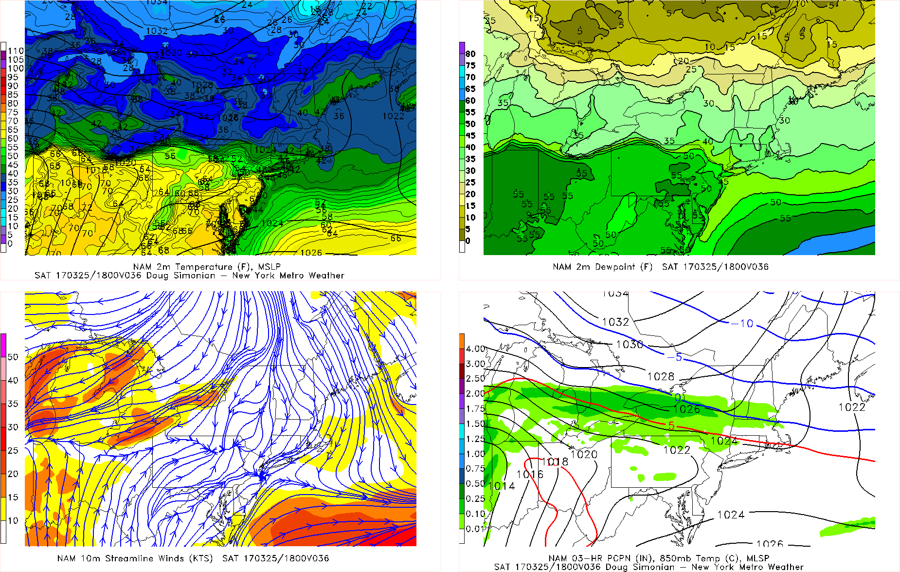
Based on the latest GFS and ECMWF model guidance we anticipate temperatures to rise into the upper 50s to lower 60s over much of North-Central NJ, NYC and Long Island by early in the afternoon. While parts of Central and Southern NJ have a greater chance of seeing temperatures rise middle to upper 60s or even near 70. However, if the backdoor cold front is further south Saturday afternoon, as the latest NAM model suggests then temperatures may wind up cooler. Then temperatures will fall back into 40s and 30s later Saturday evening and overnight. Sunday will be a much colder and dreary day, with lots of clouds around and some light rain or drizzle . High temperatures will only be in the mid-upper 40s, which is several degrees below normal for this time of year.

GFS showing below normal temperatures over much of the region on Sunday
More steadier rainfall could arrive with a couple of waves of low pressure moving into Ohio Valley and Mid-Atlantic coming Sunday night or Monday. Then more temperature swings and unsettled will follow for next week. This is as multiple disturbances move through and the local region lies between the Southeast ridge and a confluence zone to the north. Stay tuned for zone forecast updates on the weather for this weekend and next week.