-2")

Stormy Pattern Continues With Heavy Rain Possible Friday
The active storm track that has been running from the Central Plains to the Northeastern states, courtesy of an extremely strong jet streak out in the Pacific, looks to continue into the foreseeable future. Multiple, large cutoff lows are forecast to travel just to the south of fast-moving high pressure systems over southern Canada during the next seven to ten days, and this will lead to numerous chances for moderate to heavy rain chances over the next few days. As mentioned in the last update, this rain will be much-welcomed (for now) as some location in the Northeast are still experiencing moderate to severe drought conditions. However, if this active pattern continue with multiple heavy rain threats affecting the Northeast, we may have to worry about possible flooding later on.
Today and Into This Evening
After a frontal passage earlier this morning, the mostly-cloudy conditions that have been present over much of the area these past few days have finally been warded off by cooler and dry northwest winds from Canada. While still only slightly above normal, temperatures have been able to rise into the middle to upper 50’s across the entire area with only very isolated clouds noted on visible satellite imagery.
Even though temperatures are still slightly above-normal for this time of year they may “feel” slightly colder as there are some gusty winds of around 25-30 mph being reported across the area. These gusty winds are courtesy of a large area of high pressure over Canada and a low pressure off of the East Coast creating a pressure gradient over the region, which will briefly enhance winds. Despite rather pleasant conditions with mostly sunny skies and temperatures in the 50’s this afternoon, you may still need a jacket when going outside due to gusty winds at times.
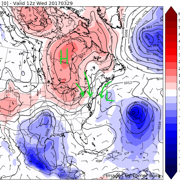
As we move into this evening, the aforementioned high pressure in Canada will begin to overspread the region, which should all but end any remaining windy conditions. In addition to eliminating the gusty winds, this high pressure will usher in much cooler temperatures this evening, as lows should fall into the 20’s for inland areas and struggle to remain in the 30’s for the NYC metro as well as areas further to the south.

Latest visible satellite imagery, radar mosiac, and current temperatures for the Northeast showing relatively tranquil conditions (Courtesy of GREarth)
Thursday and Thursday Evening
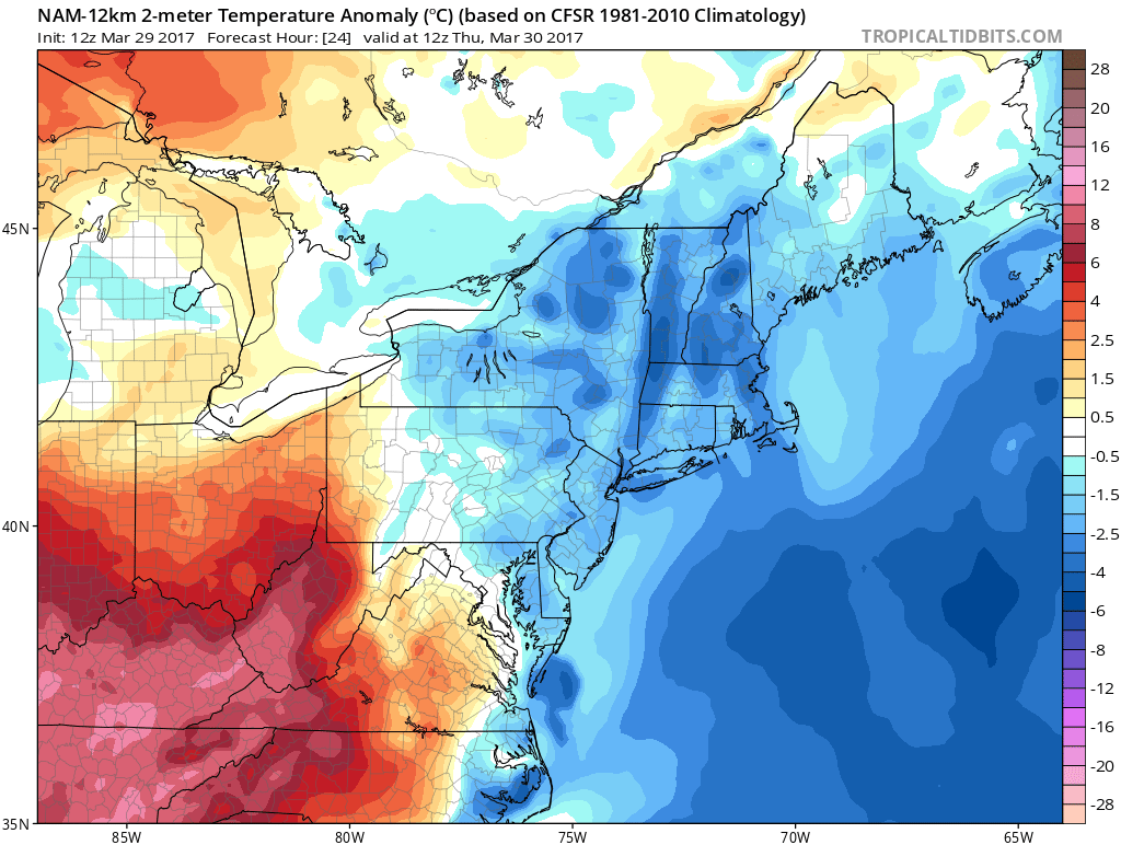
As we head into Thursday morning, the area of high pressure previously located over Canada should be completely in control of the weather for the Northeast. With mostly sunny skies, light northerly winds, and colder air just above the surface, we’ll more than likely have below-normal temperatures to start off the day. Conditions for the morning commute should be quite chilly with temps in the upper 20’s to the north of New York City, and low to mid 30’s to the south. As the day continues on, temperatures should only be able to rise into the mid to upper 40’s across the entire area, which is still a good 5-10 degrees below normal for this time of year.
Conditions should remain tranquil through the late afternoon and evening hours as the high pressure that was in control begins to move off the coast, with clouds beginning to increase ahead of a massive area of low pressure system that will be centered over the Ohio Valley. These clouds in combination with onshore flow will prevent temperatures dropping all that much, and lows in the low to mid 40’s should be commonplace for the majority of the area tomorrow night.

3km NAM temperatures at 5000 feet showing cold temperatures just above the surface Thursday morning along with a much warmer airmass just to our south west
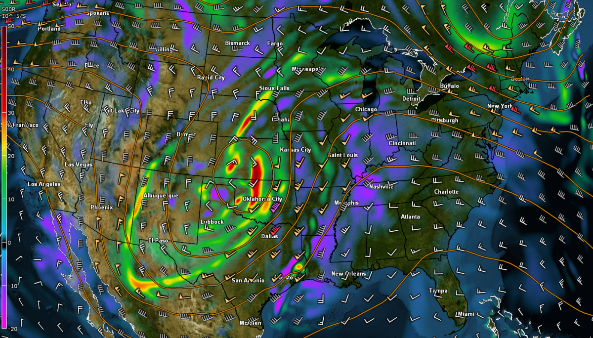
Upcoming Friday and Saturday Rainstorm
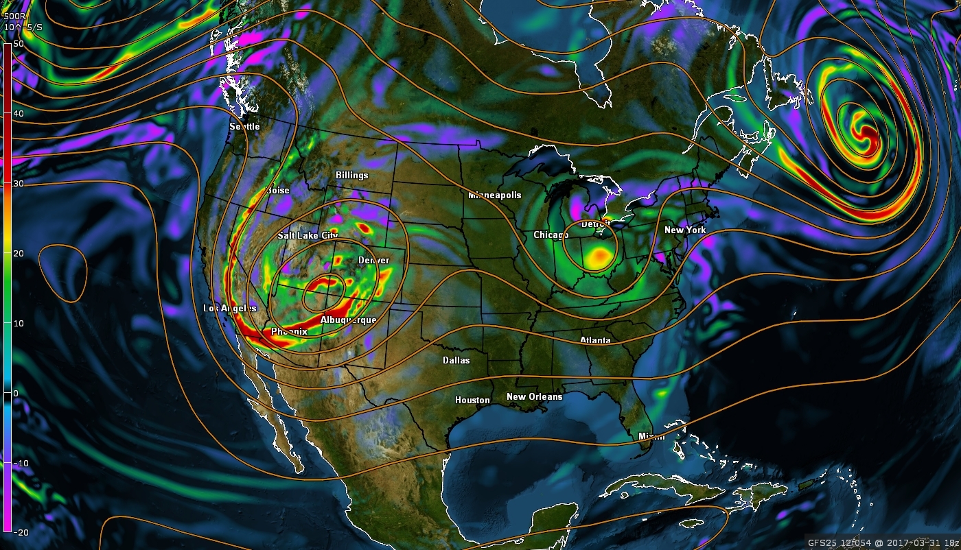
The storm potential that we have been discussing for over a week now looks to be in relatively good agreement on this afternoon’s model guidance for prolonged moderate to heavy rainfall over portions of the Northeast on Friday and Saturday. A large upper level trough currently positioned over Kansas will continue to head east underneath “confluence”-or a very tight height gradient to the north. As this system continues to head east tomorrow, it will ignite multiple rounds of severe thunderstorms across the Tennessee Valley and sections of the Southeast US. As this system continues to head east, then slightly to the north later in the day tomorrow, it will have a very strong and direct connection to the very warm Gulf of Mexico to its south. Strong low-level winds will take this warm, moist water vapour from the Gulf and begin to transport it to the north as a surface low continues to track through the Ohio Valley on Friday morning. This will lead to highly-anomalous levels of precipitable water in the atmosphere as the moisture connection for this system extends all the way down to Mexico!
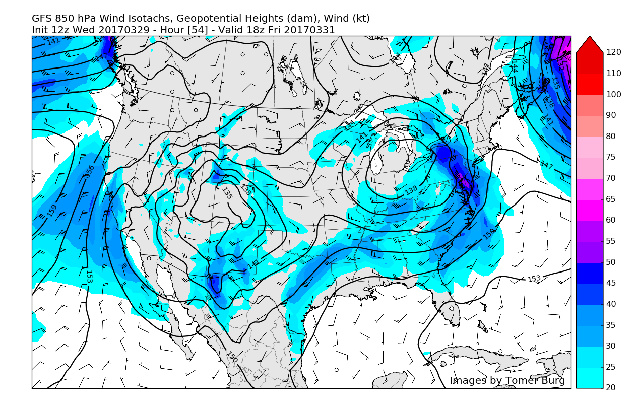
As this upper level trough begins to tilt negatively on Friday morning, precipitation should begin to intensify and continue to break out across the Northeast, possibly beginning just before daybreak in western locations of New Jersey. This setup of a blocking mechanism to the north and a trough going negative over the Ohio Valley is something that we would look for in the winter months for widespread significant snowfall, but rain is expected from this setup, with very warm temperatures in the lowest few thousand feet of the atmosphere. As the low pressure tracks over Ohio early Friday afternoon, low level winds in the atmosphere should begin to strengthen quite a bit, leading to more intense precipitation developing across the Mid-Atlantic states, which should head to the north and east. This initial heavy precipitation may be convective in nature due to the strengthening of the low level jet, so very intense rain rates and even a few rumbles of thunder are possible Friday afternoon.

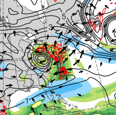
12z GFS Precipitable Water imagery showing a very impressive flow of moisture from the Gulf of Mexico and Bay of Campeche, flowing directly into the gathering storm over the Ohio Valley (Valid 8pm Thursday)
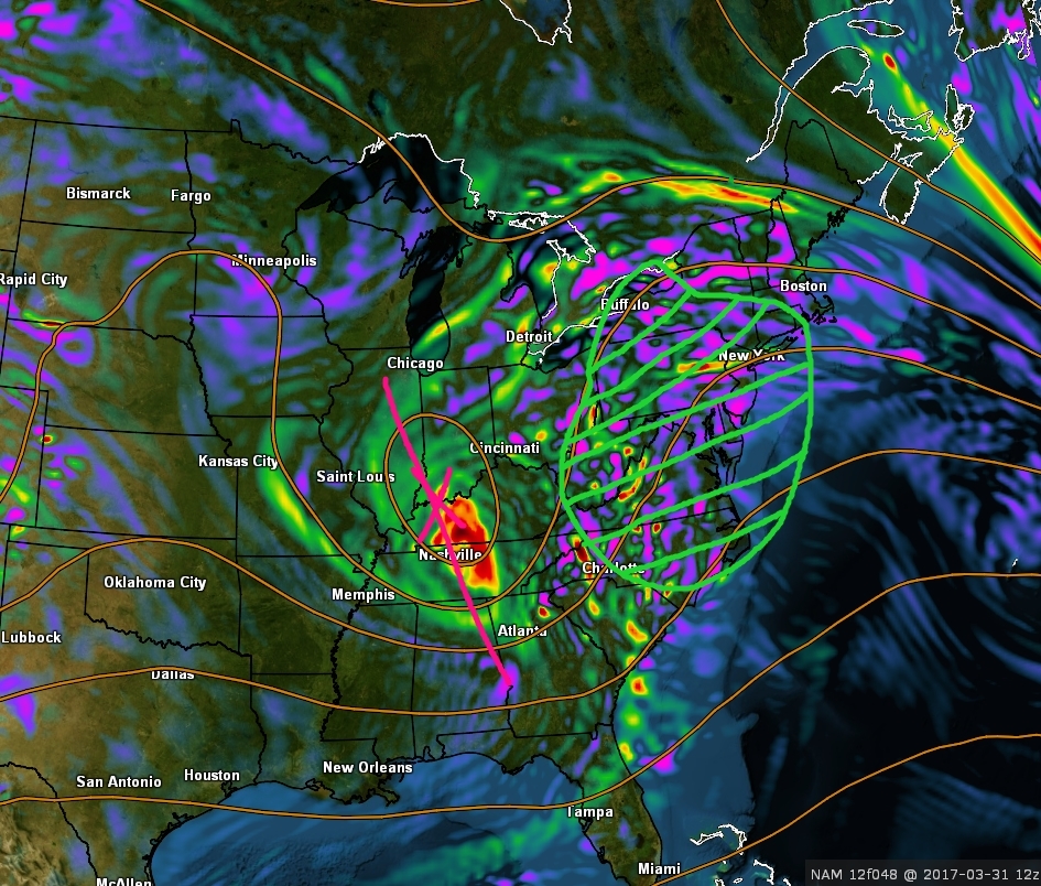
Widespread moderate, to locally heavy rain should continue into Friday evening as the negatively tilted upper level trough begins to encourage the development of a secondary low pressure system off of the New Jersey coast. As this low begins to form off of the coast of New Jersey very late Friday/into Saturday morning, the rich Gulf moisture that the initial low pressure was bringing north will transfer and then become focused over Maryland/Delaware/Eastern Pennsylvania/New Jersey/New York/Connecticut. In conjunction with this abundance of moisture, will be some strong lift in the atmosphere, which could work to locally enhance rainfall in some locations. As the coastal system continues into early Saturday morning, we could see maintained areas of moderate to locally heavy rainfall falling along portions of NY/NJ/CT as the coastal low intensifies and begins to head eastward. The secondary low pressure system should gradually begin to head out to sea Saturday afternoon, finally bringing an end to the precipitation from west to east.
Due to the prolonged nature of this potential system and the increasing potential for heavy localized rainfall amounts, there is an increasing chance of flooding Friday and Saturday in urban/low-lying areas. Also, due to the recent moderate to heavy rainfall over the past few days, the ground is still quite saturated, and this presents a problem for this future storm. Due to high saturation levels of the soil across the area, the amount of rainfall needed within a 6-12 hour period to cause flooding is unusually low, so this is why we are becoming somewhat concerned about possible localized flooding issues this weekend. This is something that will need to be monitored closely over the next few days as more guidance becomes available to us.

“Flash Flood Guidance estimates the average number of inches of rainfall for given durations required to produce flash flooding in the indicated county. These estimates are based on current soil moisture conditions. Note, in urban areas, less rainfall is required to produce flash flooding. “
We still have time for things to change and will be updating you on this potential storm system over the next two to three days, so make sure to check back for future updates!
For more information and posts like this one, make sure you sign up for Zone Forecasts — where multiple detailed articles, videos, and interactives are posted each day. Also, come interact with our staff and many other weather enthusiasts at 33andrain.com!
Have a great day!
Steve Copertino