-2")

4/01 All Zones AM Update: Dreary Start to the Weekend, Active Pattern Continues Next Week
Happy Saturday and welcome to April! Unfortunately this weekend and month is off to another dreary start. Low pressure that has brought over 1″ of rainfall to much of the region since Thursday night, is now moving slowly offshore. A mid-level dry slot has cause steadier rain (and wintry mix well north) overnight to taper off this morning some light rain or drizzle. Some areas of fog have also developed. These cloudy and damp conditions will likely continue for much region into early this afternoon, with perhaps some additional showers from a upper-level trough coming through for northern areas.
As low pressure continues move further offshore, winds will turn more northerly with drier conditions later this afternoon and evening. High temperatures will remain below normal in mid-upper 40s to lower 50s with cloudy and damp conditions much of the day. Skies will gradually clear more later tonight with temperatures dropping into the 30s over the region. Then more pleasant, dry weather is in store for Sunday, as high pressure from the northwest begins building into region. Mostly sunny skies with downsloping northwest winds will help temperatures rise to more closer to normal, into the mid-upper 50s to lower 60s. It will be little breezy with northwest winds between 15mph to 25mph by afternoon.

ECMWF model forecast high temperatures for Sunday
High pressure will move over the region with mostly clear skies and calm winds. This will allow for rationalizing cooling, especially over the suburbs. Low temperatures could drop into upper 20s to lower 30s over the Interior valley and Pine Barrens. While lows in the mid-upper 30s to around 40 are likely elsewhere.
Then high pressure will begin sliding offshore on Monday with winds turning more southeasterly. This will allow for more clouds, well ahead of storm system approaching from the southwest to move into region during the day. But it should remain dry with some sunshine, at least during the morning hours. High temperatures might be a little cooler than Sunday, in the mid-upper 50s closer to the coast due to more marine influence. While areas further inland could see high temperatures in the lower to middle 60s.
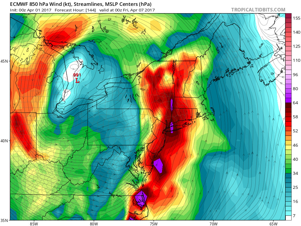
But conditions will deteriorate again as active pattern continues into next week. Low pressure associated with closed mid-level low over the Southwest US, will be tracking into the Ohio Valley and Northeast, with periods of rain likely in the local region late Monday night into Tuesday. A warmer airmass surrounding this system, will support only rain for the entire region. A strengthening low-level jet with Atlantic and subtropical moisture could also result in more heavy rainfall and localized flooding over the region.

GFS model showing storm system with some significant rainfall Northeast by late Monday night and Tuesday AM
This storm system departs the Northeast with some clearing by Tuesday night. Then high pressure from the northwest builds into region again on Wednesday and Thursday with more sunshine and dry weather returning. But another storm system with more rainfall, will already be on the way for the end of the week. This comes as northern and southern shortwave energy phases into a large closed mid-level low parts of MS/OH/TN Valleys. This will cause surface low pressure developing over the Southern Rockies to deepen and track northeast into the Great Lakes by Thursday night and Friday.
Currently model guidance varies from run to run on how system evolves for the area and impacts on the local region. Some shortwave energy swinging around the backside of the trough could result in a secondary low forming along the tail end of cold front boundary. This could turn phase into a stronger storm closer to the East coast, with enough cold air behind it form some wintry precipitation again for the Interior parts of the Northeast. But closer to region, more heavy rainfall and localized flooding is a much bigger concern, with a deep southerly low-level jet with an Atlantic and sub-tropical moisture streaming northward again. So stay tuned for zone forecast updates on the active pattern for next week. Until then, have a good weekend!