-2")

4/05 Late AM All Zones Update: Heavy Rainfall, Flooding, T-Storm Potential Thursday
Happy Wednesday! Today will feature more pleasant weather with more sunshine and seasonable temperatures this afternoon. But another, larger storm system we’ve been talking about this week, will be bring more heavy rainfall tomorrow.
For today, any clouds or fog linger from this morning will clear, as ridging builds over the region. High temperatures will be range from upper 50s to lower 60s across the most of the region. Winds will remain light out of the northwest for much of the day.
It will remain mostly clear into early this evening. Then more onshore flow and mid-level warm advection will cause clouds and some areas of patchy fog to return late this evening and overnight. Some showers well ahead of the next storm system could move into region after midnight. Lows will be in the mid-upper 30s over Interior to lower to middle 40s along the coast.
Then periods of rain are likely during the day tomorrow, as a large closed cut-off low impacts the region. A strong low-level jet and mid-level vorticity moving through region will cause rain to become heavy at times, especially during the tomorrow afternoon. A triple-point low developing along a warm front could enhance elevated instability and convergence for some embedded thunderstorms with very heavy rainfall.

3km NAM models with strong southerly low-level jet at 850mb Thursday afternoon
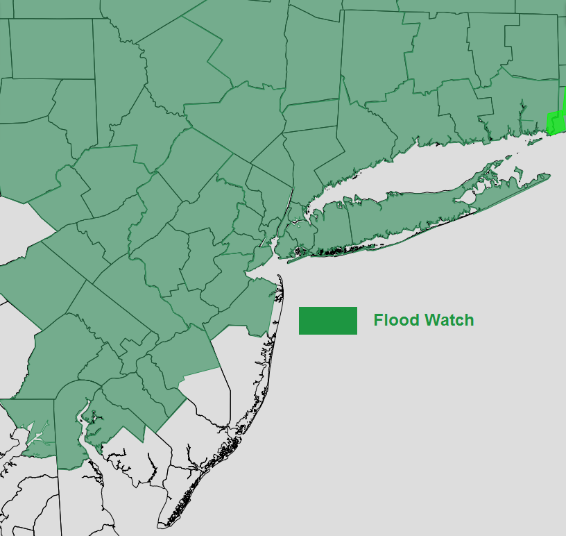
Unlike the Tuesday storm, there will multiple waves of rainfall. Precipitable will be 2 to 3 standard deviations above normal. Rainfall totals in general between 1” to 3” are likely with locally heavier totals possible. This could result some flash flooding in urban areas and also small river and streams flooding. For these reasons, the National Weather has issued Flood Watches for most of the region through Thursday and Friday.
A tighter pressure gradient with deepening low to the southwest and high pressure northeast will cause winds to increase out the east or southeast during the day. A stout inversion will keep strong, more damaging winds aloft from mixing down to the surface. But some wind to near 40 mph are possible, especially along the coast. This winds may also cause some minor to locally moderate coastal flooding during high tides. Which may further be exasperated by heavy rainfall.

NAM model strong 500mb vorticity and divergence from 300mb leading the very heavy rainfall over the region tomorrow afternoon.
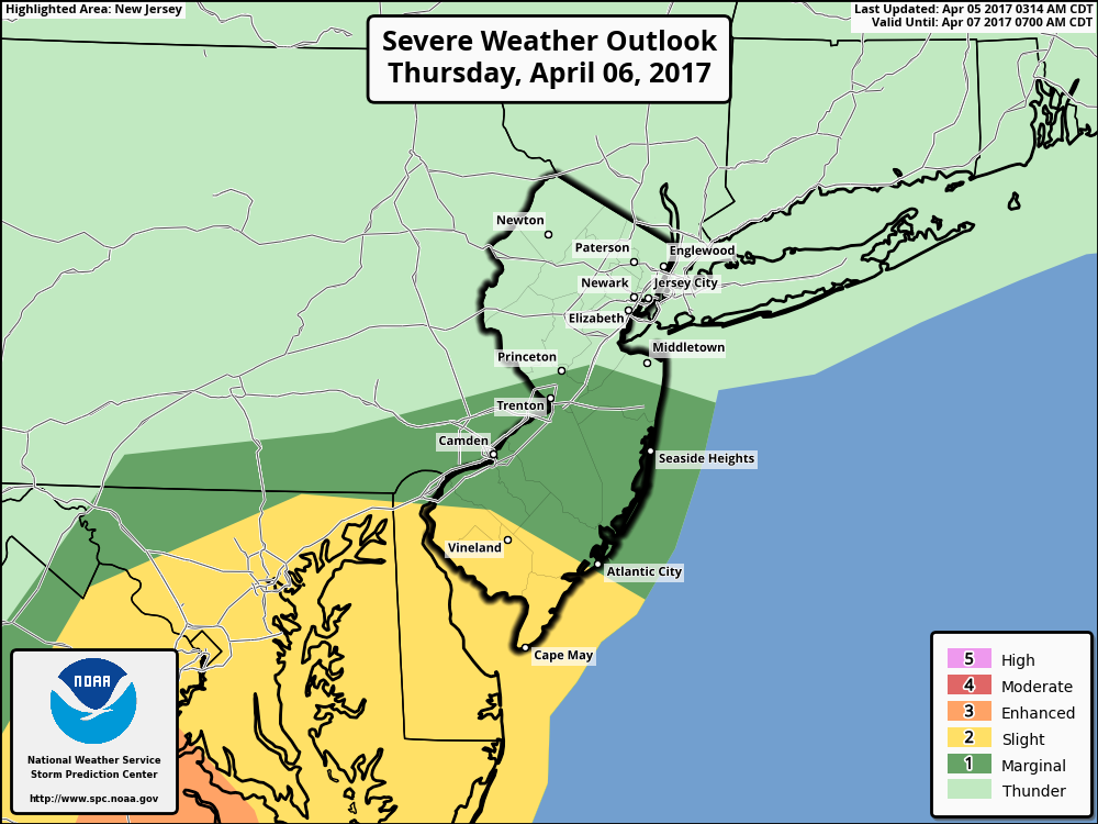
The Storm Prediction continues a marginal and slight risk for severe weather southern parts of the region on Thursday. There will likely one or two lines of strong to severe thunderstorms move northward out Chesapeake Bay/Delmarva region. Some isolated strong to severe thunderstorms with damaging winds can’t be ruled over Central-Southern NJ and Southeast PA, if these areas get into the warm sector briefly. But overall the severe weather will be mitigated by more stable marine airmass over the region.
Conditions begin improving tomorrow night with rain tapering off to showers, as mid-level dry slot moves over the region. Some more clouds and showers are possible on Friday into Friday night as the upper-level low swings through the Northeast. Then more improving weather with more clear skies will occur over the weekend, as the upper-level low opens up into a trough and moves into Canadian Maritimes. Temperatures from Friday through the weekend will be near or slightly below normal. Mainly in the lower to middle 50s through Friday and Saturday and upper 50s to lower 60s on Sunday.
Then temperatures will start moderate to above normal as strong ridge builds over the region early next week. Highs on Monday and Tuesday could be well into the 70s and approaching 80 degrees in some spots with more sunshine and southwest winds. Great news for those of us looking for some warmer, drier weather!
Stay tuned for more zone forecast update on Thursday’s storm by later this afternoon or evening.