-2")

FREE Public Analysis: Large Storm to Bring Heavy Rainfall Thursday
Good afternoon! This afternoon will continue to be feature more pleasant weather. Sunshine will be mixed with clouds over parts of the region and winds will remain light out northwest. High temperatures should reach the upper 50s to lower 60s.
But another storm system will bring more rainfall on Thursday. This will be a part large cut-off low that will developing over Ohio Valley and Mid-Atlantic. A strong southerly low-level jet with plume of Atlantic and subtropical moisture will streaming northward. This will cause rain to become heavy at times tomorrow. Some elevated instability may lead to some embedded thunderstorm with the bands of rain coming through region.

The NAM model showing large cut-off low over Ohio Valley on Thursday afternoon
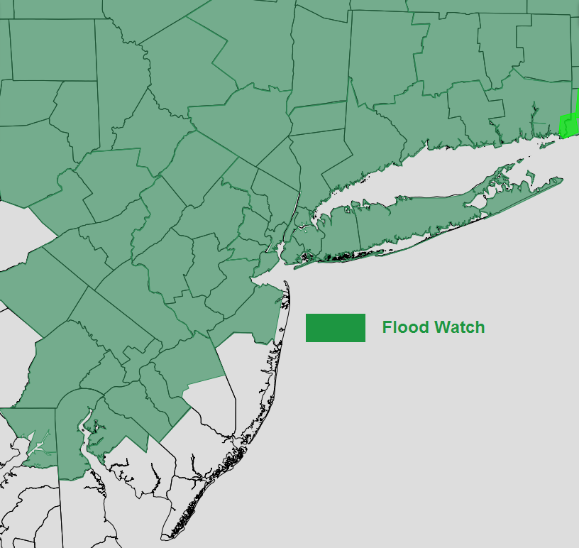
Rainfall totals are likely to range between 1 to 3 inches over the region. This could lead to some flooding in poor drainage areas and low-lying areas. Also, due to recent heavy rainfall, some flooding around small rivers and streams may also occur. Therefore, the National Weather Service has issued Flood Watches for much of the region.
Overall we are anticipating severe weather stay mostly south of the region with cooler, stable marine airmass over much of the region. But the Storm Prediction Center has a chance for isolated severe thunderstorms over Central and Southern NJ and Southeast PA tomorrow. If the warm front lifts far enough, these areas get into the warm sector, where the airmass will be more unstable, along with strong shear and forcing. Thus a few thunderstorms could strong or severe with gusty winds.

NAM model showing precipitable water values 2 and 3 standard deviations above normal
Rain will taper off to showers tomorrow night, as surface low pressure with this storm system lifts northeast of the region. However, the closed upper-level low will still be swinging through the Northeast through Friday night. So more unsettled weather with some showers are possible in the region on Friday. Temperatures
But this weekend’s weather is looking nicer, as the upper-level low should be moving into the Canadian Maritimes. Some sunshine looks likely for both days with temperatures in the middle 50s to lower 60s. Even warmer may be on the way for next week, as ridge builds over region. We could talking about temperatures in middle to upper 70s or approaching 80 degrees!
For more information and posts like this one, make sure you sign up for Zone Forecasts — where multiple detailed articles, videos, and interactives are posted each day. Also, come interact with our staff and many other weather enthusiasts at 33andrain.com!