-2")

5.22 AM Zones Update: Unsettled Weather Pattern This Week, Memorial Day Weekend Weather
Good morning! Some showers that have been moving across the region overnight and early this morning were associated with shortwave energy, undercutting upper-level ridge. More rain is likely to overspread the region from the southwest, later this morning and into early this afternoon, as a frontal system with a weak wave of low pressure along it approaches the region.
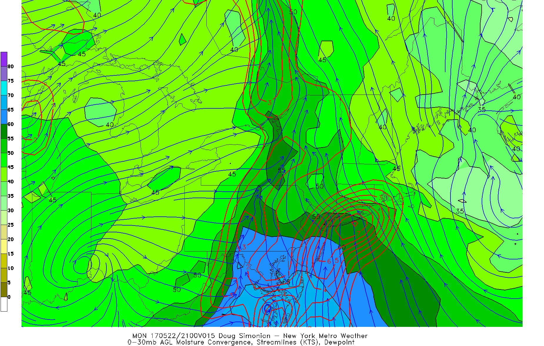
Latest model guidance indicates some weak instability and strong moisture convergence along a warm/coastal front with precipitable water values between 1.50” to 2.00”. This will likely cause rain, to become heavy at times with some isolated thunderstorms possible over Central and Southern NJ and over parts of Long Island and Coastal CT. These areas are where rainfall totals between 1” to 2” is more likely to fall today. Some locally heavier totals are possible from any thunderstorms with torrential downpours and some localized flash flooding, especially in poor drainage and low-lying areas.
For the rest of the area, lower rainfall totals are expected with only some minor flooding or ponding on some roadways expected, if any. In fact, parts of Northwest New Jersey and Lower Hudson Valley may only see some light rainfall or showers for rest of the day. But it will be not nice day for entire region with cloudy and cool conditions with temperatures only rising into the upper 50s to middle 60s, this afternoon. Warmest temperatures are likely over Central and Southern New Jersey and Southeast Pennsylvania.

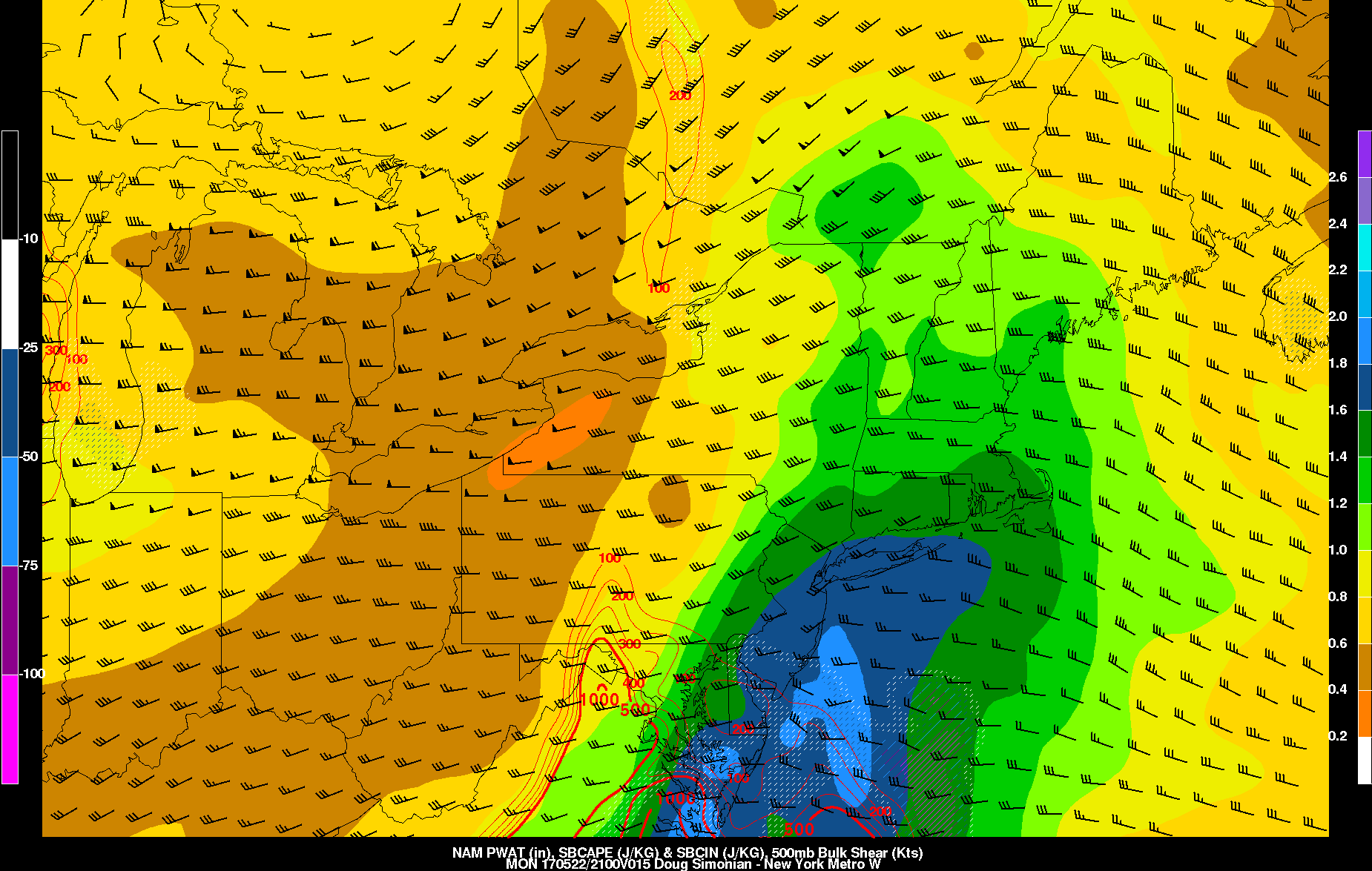
NAM model showing more rain along coastal areas this afternoon
As the moisture convergence weakens or shifts east, rain will taper to off showers and drizzle over entire region later this afternoon. Then skies remain will remain cloudy into the evening hours. Some partial clearing may occur, as overnight cold front moves through region, mostly dry. But overnight lows will be in the lower to middle 50s, will cloud cover preventing more radiational cooling. Some residual moisture may lead to areas of patchy fog developing by daybreak as well.
Partly to mostly cloudy skies are expected on Tuesday. But weak high pressure over the region will support dry conditions for much of the day. Then another wave of low pressure will be coming up moving northeastward off Mid-Atlantic coast tomorrow. Currently most model guidance keeps this wave far enough east spare most of the region, more heavy rainfall.
But some rain still possible, especially for coastal areas by Tuesday evening. This rain may continue into Wednesday morning, before tapering of later in the day. Otherwise, high temperatures both on Tuesday and Wednesday, will likely be in the upper 60s to lower 70s, outside of more clouds and rainfall. These temperatures are still few or several below normal.

GFS model showing some light rainfall for coastal areas Tuesday night from a wave of low pressure passing to the south
On Thursday and Friday, a large, amplifying upper-level trough and closed low will be moving into Eastern US. There is some uncertainty on how this system evolves at the surface. But in generally models show a Miller B type storm system, with a primary low pressure tracking over the Great Lakes/Ohio Valley and secondary low tracking over Mid-Atlantic/Northeast regions.
More steadier and heavier rainfall will be more likely on Thursday, if the storm system is stronger and more organized passing through region. However, if the storm system is weaker or more disjointed there is better chance of more convection with the region more likely warmer, unstable airmass. More scattered showers or thunderstorms that could still produce some locally heavy rainfall over the region. Overall more unsettled and wetter weather looks likely for late this week.
For Memorial Day weekend, this trough and closed low will be moving into Southeast Canada. This will allow for some mid-upper level ridging to build into region. Some improving weather looks likely for the start of the first big holiday weekend of the Summer, at least on Saturday and no washouts are anticipated each day. So don’t cancel or change any outdoor plans yet.

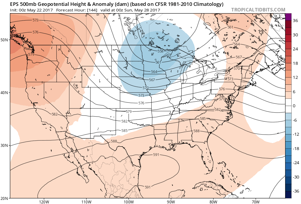
ECMWF model showing showers over region Sunday afternoon and evening with storm system over the Great Lakes
However, some residual blocking and some ridging over West Coast, will continue to support a somewhat unsettled or active weather pattern into this weekend. At this time, model guidance another storm system tracking northwest of region, that could bring some showers to the region, sometime on Sunday or on Memorial Day. But more forecast details will likely be fined tuned throughout the week. Stay tuned for another for zone forecast update later this afternoon or evening with discussion on later this week and Memorial Day Weekend .