-2")

Saturday Briefing: Heavy Rainfall Likely Tonight and Sunday
Good morning, friends! You may have noticed it’s a bit warmer outside – and you are correct, as temperatures have warmed in advance of an approaching storm system in the Northeast states. Temperatures will remain mild for much of the weekend as a southwest flow develops ahead of an approaching cold frontal boundary, with highs reaching into the 50’s in many areas (Away from the high elevations). With this gift will come a curse, as warm air advection ushers in increasing moisture and approaching lift in the atmosphere the that will bring an increasing potential for heavy rain by Saturday afternoon.
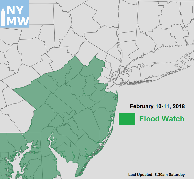
A strong southwesterly low-level jet and highly anomalous precipitable water values will also enhance more moderate to heavy rainfall tonight and into much of the day on Sunday. Rainfall totals are expected to range between 1” to 2” over most areas, but could be locally higher up to 3”. For this reason, the National Weather Service has issued Flood Watches for parts of New Jersey and Southeast Pennsylvania. Localized flooding is possible in poor drainage and low-lying areas and along small streams and rivers. It’s possible these flood watches could be expanded, or flood warnings could be issued later. We will keep you posted on these watches and warnings on social media feeds through the weekend.

3km NAM model forecast precipitation totals for the local region
Rain should begin tapering off Sunday night, as frontal boundary finally shifts offshore. High pressure from the west, will build in and aid in the development of fair and cooler and weather on Monday and Tuesday. Temperatures will be cooler — near or slightly above normal. The pattern remains progressive with temperatures moderating again later next week, with a cold shot following over the weekend and the threat for some light wintry precipitation.
In the longer range, we still anticipate the AO/NAO to gradually decline into the negative phases for rest of the month, after the polar vortex splits. The AAM will shift from positive to negative phase as well, and the MJO will continue propagating into phase 8. This will lead to a splitting of the pacific jet (or split flow) and more favorable pattern for wintry weather in the Northeast states during the late February into early March.

GEFS showing the AAM gradaully shifting towards a negative phase be late Febraury
As often is the case, these details will likely be adjusted as we move closer, as the pattern evolution and progression becomes clear. But at this time, we don’t expect the prolonged or record-type of cold that we observed from late December to early January to return in the CONUS, for natural gas interests. More updates will be coming this weekend.
Trackbacks & Pingbacks
1campaigns
Comments are closed.