Winter returns with multiple threats next week

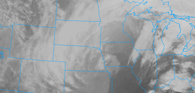
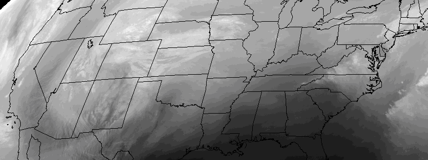
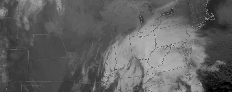
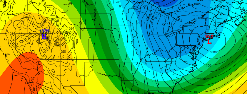
Temperatures will soar into the 50’s and 60’s during the day on Wednesday, as a strong low pressure system drives into the Great Lakes and eventually Southeast Canada.  This will, undoubtedly, leave many wondering if winter has taken its one and only stand with the blizzard at the end of January. Unbeknownst to most, however, is a large ridge driving into British Columbia and the Arctic Circle as we speak. This feature will help unload cold southward into Canada, and as a large ridge builds on the West Coast of the United States next week, multiple threats for winter weather will quickly make their way back into the forecast.

Read more

Heavy Showers and Localized Flooding Possible Wednesday

A deep low is producing blizzard conditions over the Northern Plains and severe weather over the Lower Mississippi River Valley today. This low will track into the Great Lakes and send a frontal system through the area on Wednesday, bringing the potential for heavy rainfall and some flooding in the local region.

A warm front will push slowly northward through the region during the day tomorrow. This will cause clouds to increase and areas of fog and drizzle to develop late tonight. Some scattered showers are possible early tomorrow morning and the midday hours tomorrow, especially northwest of New York City. Showers will likely become more numerous and widespread over the region later tomorrow afternoon and evening, via a strong cold front approaching the region. Some elevated instability may even support an isolated thunderstorm.

Read more

Premium: Midweek storm system hazards analysis

A significant storm system will develop this week, moving from the Southwestern United States into the Central Plains states by midweek. In the Northern Plains, blizzard conditions are expected to develop, with significant snowfall and high winds. Farther south and east, across the Arklatex, Mississippi River Valley, and northward to parts of the Ohio Valley, severe weather is anticipated as the storm system progresses northeastward.

Read more

Significant winter storm to impact the area through Saturday

A strong low pressure system, developing off the coast of the Carolinas, will move northward on Friday and Saturday while developing into a significant Nor’Easter. This storm system will move to a position off the Mid-Atlantic Coast on Saturday, pushing bands of heavy snow into New Jersey, New York City, and Long Island. Conditions are expected to rapidly deteriorate across Southern and Central New Jersey during the evening on Friday, with travel becoming extremely difficult and dangerous on Saturday.

The northern extent of the bands of heavy snow remain in question, with a tremendous cutoff in snowfall expected from south to north. Forecast models indicate the potential for gradient of almost 18 inches of snow in less than 25 miles near the latitude of New York City. Confidence is much higher in prolific snowfalls to the south of New York City, across Southern and Central New Jersey.

Read more