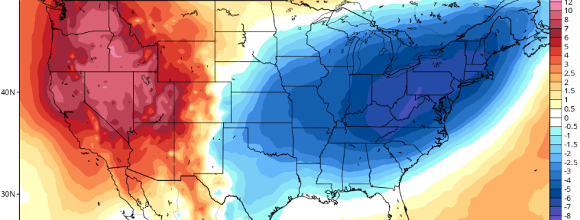
-2")
Strong Fall Storm Likely To Impact the Northeast This Weekend
Good Afternoon!
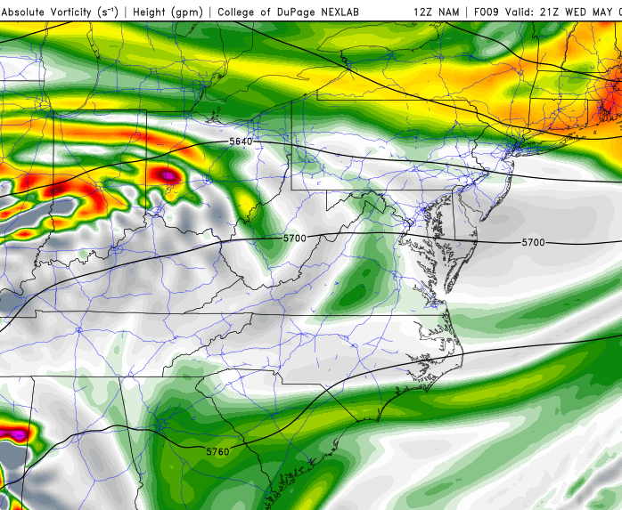
Today was another in a series of cooler and more fall-like days after the passage of a strong cold front earlier in the week that has worked to keep temperatures rather seasonable and the humidity low. Most of the area is currently under the influence of a large area of high pressure currently situated off of the North Carolina coast, which extends northeast into the Atlantic. This area of high pressure has been providing much of the Northeast with light winds out of the south/southeast this afternoon, which has allowed for slightly warmer mid level temperatures to work their way northward. These ever-so-slightly warmer mid level temperatures in conjunction with relatively clear skies have allowed highs to only reach into the low to middle 60’s across the Northeast. The rest of the day should remain quite clear and clam, with only a few high cirrus clouds likely during the day due to strong sinking air associated with the high pressure to our south. This evening should also be quite pleasant in terms of sensible weather as low dewpoints, clear skies, and light winds dominate the area. These conditions will also allow for radiational cooling to take place once again this evening, but not quite as expansive/severe as last night due to slightly warmer temperatures located a few thousand feet above the surface. Lows tonight will likely range in the upper 30’s to middle 40’s across the area, with the lowest temperatures located to the north and west of the immediate city.
Tomorrow (Saturday), we should see a pretty clear and pleasant start to the day, but southerly flow will increase in earnest ahead of a strong cold front which will be located over the Ohio Valley. As the southerly flow increases, we can expect mid level clouds to develop by the afternoon hours, but with even warmer mid level temperatures, highs will likely warm up into the upper 60’s to lower 70’s tomorrow despite the cloudier conditions. As we head deeper into the afternoon and early evening hours, the strong cold front will likely be located over western/central Pennsylvania with moderate to heavy rain over that region. Closer to the metro area, we can expect overcast to take over before dark, with a chance at a few showers over the region. Humidity will be on a rapid increase Saturday evening, and the strong frontal system begins to funnel deep tropical moisture to the north, associated with a tropical system down near Florida. The increase in cloud cover and the additional moisture will lead to temperatures remaining relatively mild for this time of year, with lows in the middle to upper 50’s.
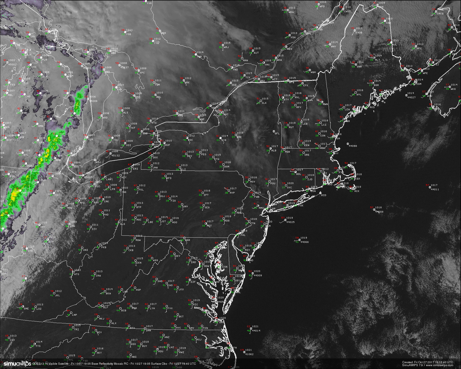
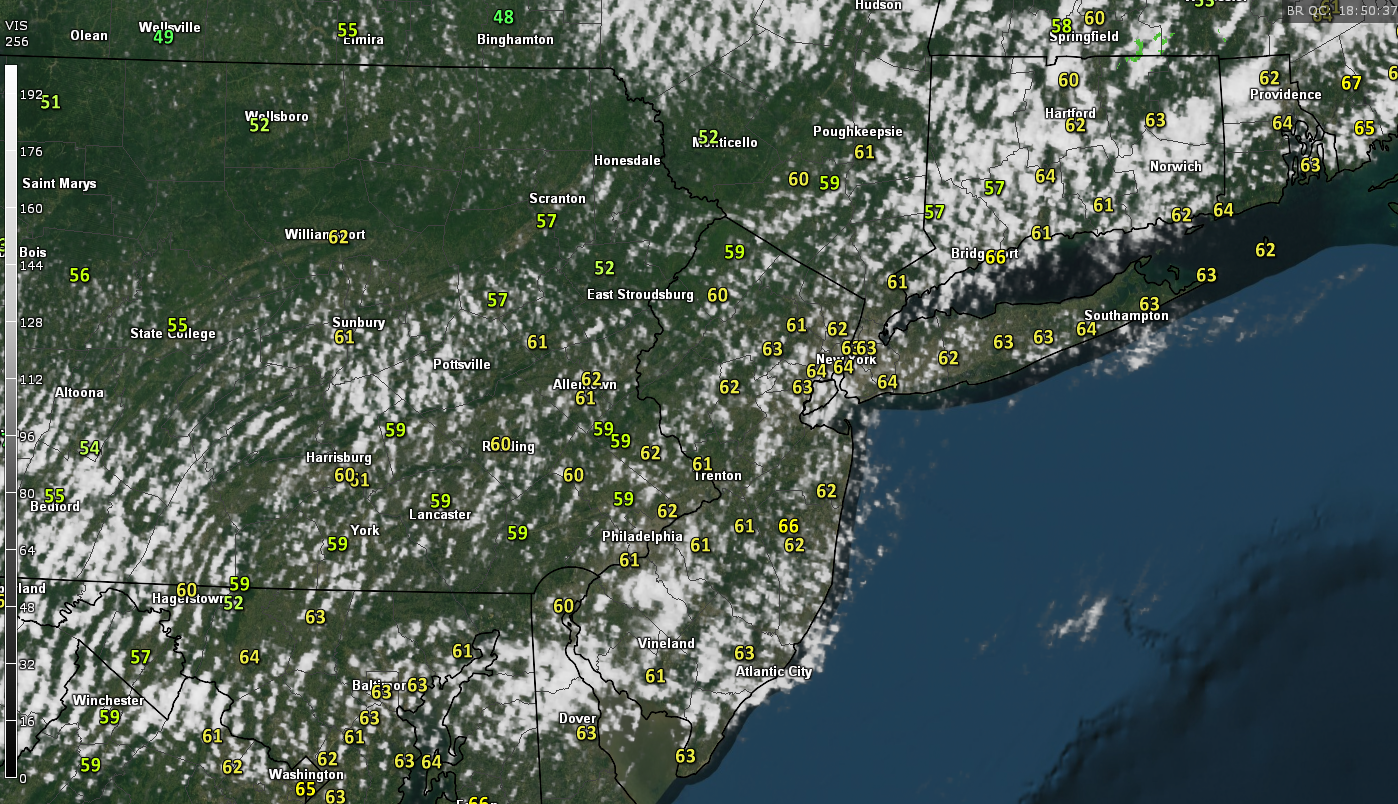
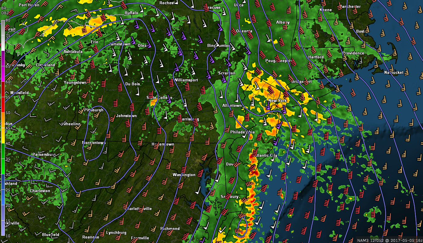
This afternoons high resolution visible satellite imagery, regional radar mosaic, and surface observations showing a relatively calm day to end the work week
Sundays System
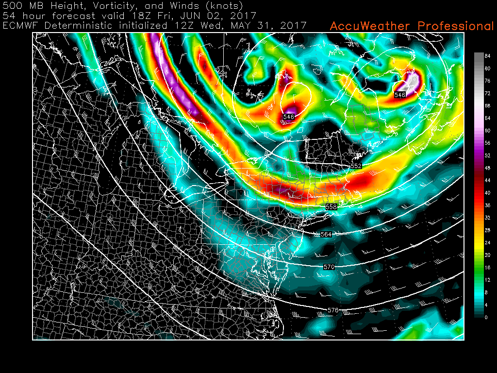
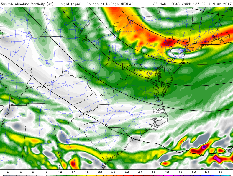
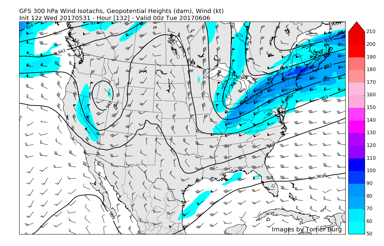
Conditions should begin to deteriorate quite quickly across much of the Northeast on Sunday as the upper level system currently located over the Great Lakes region begins to intensify. As this system intensifies Sunday morning, the rain associated with the original cold front will begin to increase in intensity as well as coverage. Simultaneously, the remnants of a tropical system will be drawn northward into the coast of the Carolinas. As these two features gradually merge over the Mid Atlantic states, a very potent upper level jet streak located tens of thousands of feet above the ground will also intensify with wind speeds of around 190 mph. This intense jet streak will provide excellent upper level divergence and surface convergence for the developing low pressure near the Mid Atlantic states, which should cause the system to intensify quite quickly as we head into the afternoon hours of Sunday.
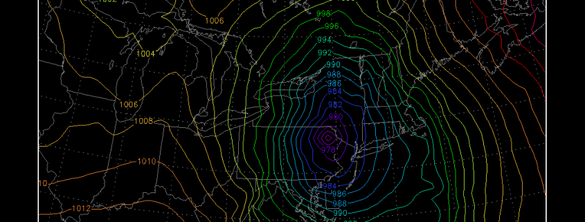
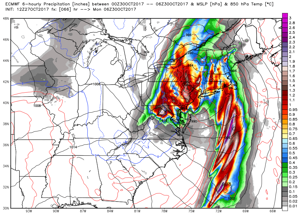
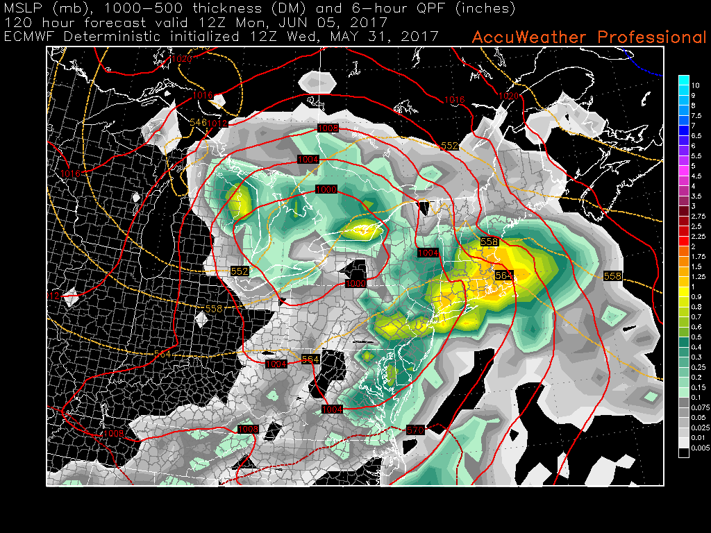
By Sunday evening, the energy in the base of the upper level trough will begin to swing eastward and take on a more negative orientation, which will further promote the development and expansion of precipitation over the Mid Atlantic and Northeast states. This afternoons model guidance has shifted westward and a bit stronger with the overall system, indicating that the low pressure area will be located in the vicinity of Atlantic City, NJ by 8pm Sunday. This scenario would lead to very heavy rainfall rates over the entire Northeast, with strong, gusty winds from the east also increasing through the evening. This afternoons European ensembles, which is a blend of 51 models with different initial conditions shows that the low will then take a track to the NNW into New Jersey, and then Pennsylvania by late Sunday night and into the early morning hours of Monday. The storm would likely be intensifying while still heading inland, with the European model showing pressures in the low 970’s-which is common for an Atlantic hurricane. Widespread heavy rainfall and strong winds will likely continue as the low heads inland over portions over southern New York state and finally begins to weaken into the day on Monday.
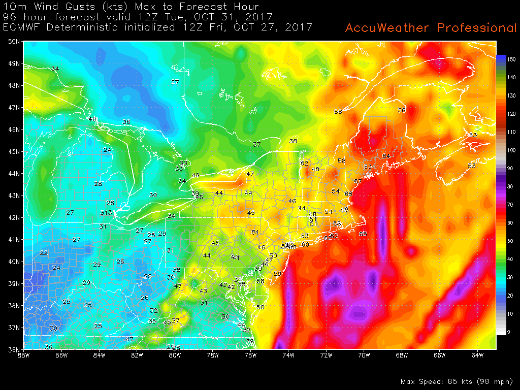
This afternoons European model showing a very strong storm tracking inland over NJ/PA Sunday evening with very heavy rains and damaging winds
Impacts
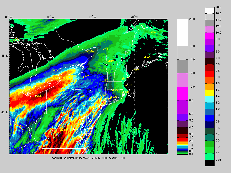
As of this afternoon, it appears that this low pressure system has the potential to bring rainfall in excess of 2-4″ across much of the New York metro area, with locally higher amounts possible over Long Island. With a system like this, usually the heaviest rains will be on the western side of the low pressure track, while the strongest winds will be on the eastern side. With that said, much of New Jersey, New York, Connecticut, and the rest of SNE could see strong wind gusts in the 40-60 mph range. This could be conservative in some locations, where some of the high resolution models have winds nearing hurricane force (around 75 mph+) over portions of Long Island. However, the exact magnitude and extent of the winds will likely be under question until tomorrow afternoon when we get into the prime range for our model guidance and the tropical system down south is better resolved. Regardless, these kinds of winds could easily down small tree limbs, and potentially down a couple trees due to saturated grounds. In addition, the heavy rains will likely cause some small-stream flooding and ponding of water in roadways, but a marginal drought over the region should be able to soak up enough of the storms rain so that widespread flooding is not likely.
Preparedness– Due to the possibilities of strong winds and the time of year, it is recommenced that any Halloween decorations are either taken down, or secured so that do not blow around and cause damage to property. Also, make sure that you do not have any weak, or lose branches near utility lines that may cause lose of power. Make sure to stay up to date with your local NWS office for any potential warnings and updates on the forecast over the next 36 hours. There are still some questions regarding the overall evolution of this system, so make sure to check back to get the latest on this system!
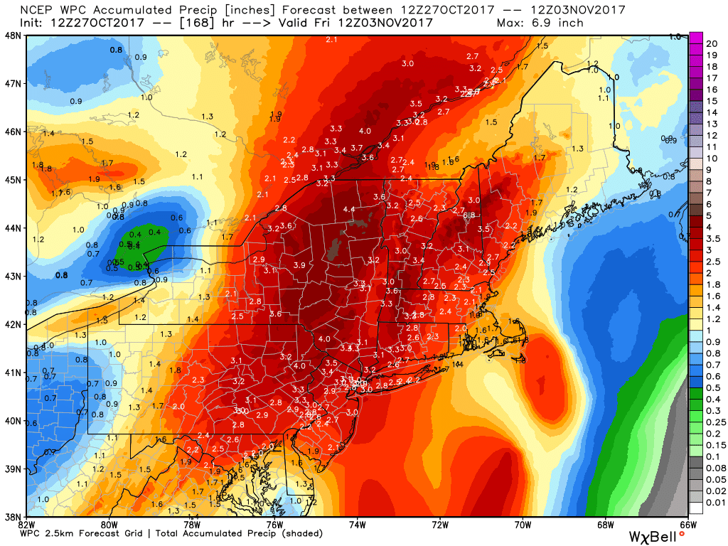
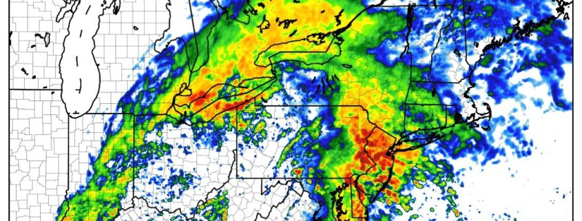
Total rain accumulation from the Weather Prediction Center
For more information and posts like this one, make sure you sign up for Premium Forecasts — where multiple detailed articles, videos, and interactives are posted each day. Also, come interact with our staff and many other weather enthusiasts at 33andrain.com!
Have a great and safe weekend!
Steve Copertino
