Posts

Summer begins with splendid weather

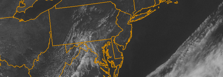
Astronomical summer officially begins at 1:04am on Friday with the summer solstice, but the weather may more resemble early to mid spring. Lower dew points and temperatures in the upper 70’s to low 80’s will be common throughout the area on Friday, making it the third in a string of several days of pleasant weather expected through the weekend. Afternoon high temperatures and humidity will be on the climb by the end of the weekend, however, with an increased chance of storminess expected by early next week. Enjoy the pleasant air while it sticks around!

Today (Friday): Sunny with highs in the upper 70’s to lower 80’s. South winds from 5 to 10 miles per hour. A bit cooler near the shore.

Tonight: Clear, with lows in the 50’s to lower 60’s. As usual, it will be colder outside of the city. South winds 5 to 10 miles per hour.

Saturday: Sunny with highs in the upper 70’s to lower 80’s. South winds from 5 to 10 miles per hour.

Be sure to follow our social media accounts on both Facebook and Twitter for up to the minute information and interaction.


Pleasant weather through the weekend

High pressure, settled in over the Northeast United States, is providing pleasant weather with little clouds and near-average temperatures. Lowered humidity and a lack of rain chances has the weather feeling extra-special, after a week or two of unsettled weather which featured chances of showers and storms each day. Over the next few days, a slow warming trend is expected as a ridge builds into the area aloft. This will bring warmer air into the Northeast US from the west-southwest with time, bringing high temperatures into the 80’s by this weekend.

Early next week, the forecast looks to take a bit of a summery turn with increased heat and humidity as well as chances for organized storms. That’s still fairly far into the forecast, however, so for now try to enjoy the benign and pleasant weather which is in the forecast through this weekend!

Rest of Today (Thursday): Sunny, with highs near 80. South winds around 5 to 10 miles per hour. A gem of a day.

Tonight: Clear and a bit cool, with lows in the upper 50’s to near 60. Cooler inland away from the city. Southwest winds around 10 miles per hour.

Friday: Sunny, with highs near 80. South winds from 5 to 10 miles per hour. Another gem. Summer solstice (official beginning of summer) occurs just after 1am — also the longest day of the year!


PM Update: Wonderful Wednesday on the way

A pleasant Tuesday, which featured lower dew points and comfortable temperatures in the mid 70’s — as well as a light northwest breeze and plenty of sun — will give way to a gorgeous evening and overnight period. Wednesday will be a hint warmer, with calm winds that will quietly shift from northwest to southwest. You’ll be hard pressed to find a more comfortable two day stretch in the first week of June!

Tonight: Clear, with low temperatures in the mid 50’s. A bit cooler near the shore and away from the city. Light north winds between 5 and 10 miles per hour, so crack a window and give the air conditioning a break tonight.

Wednesday: It doesn’t get much better than this. Mostly sunny with highs in the mid to upper 70’s in the city, a hair cooler near the beaches and inland. North winds will flip to south-southwest by afternoon. Just a few clouds after noon.

Tropical moisture may mean a wet weekend: Forecast models have been persistent in showing the potential for widespread clouds, showers and a period of moderate to heavy rain this weekend. A tropical disturbance in the Gulf of Mexico may eventually weaken and head up the East Coast while being scooped up by a progressive trough. The result would be a weak low pressure system tracking near the East Coast. Unsettled weather looks likely from late Thursday into Saturday, but the amount of rain remains in question.

NAM model showing precipitatable water values approaching 2.0 this weekend as tropical moisture surges up the East Coast.

NAM model showing precipitatable water values approaching 2.0 this weekend as tropical moisture surges up the East Coast.

El Reno tornado becomes widest ever recorded: Our article from earlier today detailed the El Reno, Oklahoma tornado which today was upgraded to an EF-5 on the Enhanced Fujita Scale. The tornado featured winds of 296 miles per hour (as measured by mobile doppler radar) and was 2.6 miles wide — a new record.

Be sure to follow our social media accounts on both Facebook and Twitter for up to the minute information and interaction.


Cooler, pleasant weather behind cold front

The warm and humid airmass from this past weekend is a distant memory this afternoon, as cooler air with lower dew points has settled into the area. A refreshing northwest breeze will continue for the remainder of the day with high temperatures around average in the mid 70’s. The trend is expected to continue through the middle of the week, with more sun and slightly warmer temperatures on Wednesday — but not hot or humid at all.

Not all of the news is good, however. The forecast takes a bit of an unsettled turn by late Thursday and Friday and may become quite ugly by the weekend as a tropical moisture feed extends up the East Coast of the United States. Forecast models are showing a trough sinking through the Ohio Valley and Northeast by the weekend, with showers becoming likely with periods of heavy rain also a possibility if a weak surface low pressure system can form offshore.

We’ll keep a close eye on it as the week goes on, but for now enjoy the beautiful weather! Remember to check our social media accounts for frequent updates.