Posts

Evening Zones: Briefly drier, another storm on the way

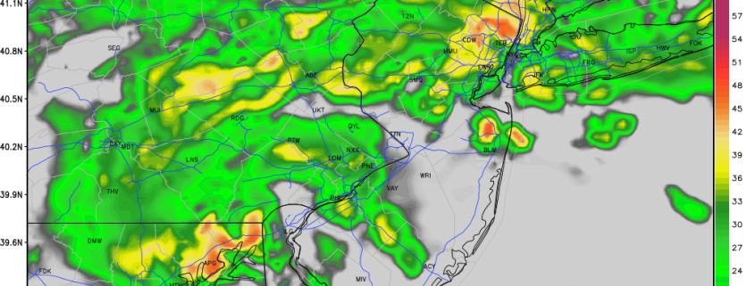
Whew! The active pattern we had been discussing for several days has certainly arrived. Several disturbances and individual storm systems have impacted the area, with widespread rainfall and unsettled conditions. More than anything, really, the weather has been incredibly bleak with widespread fog and drizzle even when the rain wasn’t overly heavy. The atmosphere will finally settle down over the next 24 to 48 hours.

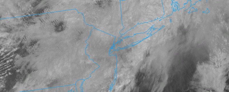
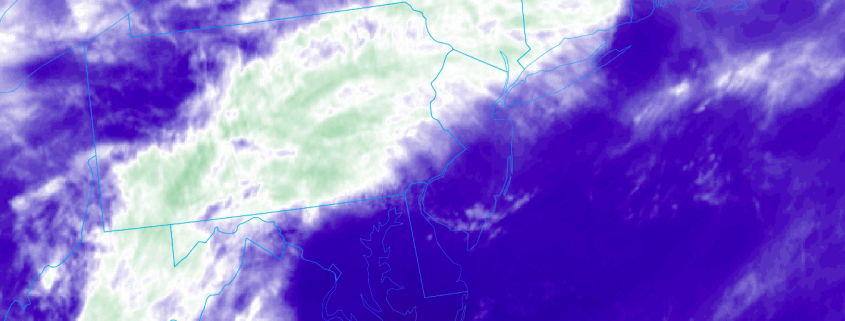
Drier air is nudging into the region already as a low pressure system moves off the coast of the Northeast United States. Rain over the region will shift gradually east through morning, with drier air and high pressure moving into the area. The sun (it still exists!) will return to the friendly skies on Wednesday, with temperatures near average. Most notably, clouds and drizzle will be a memory, for now.

Read more

3/28 All Zones AM Update: Showers & Isolated T-Storms Today, Another Storm System Friday

Happy Tuesday! More unsettled, dreary weather is in store for today. Low pressure will be tracking from the Ohio Valley this morning to just south of Long Island. This will keep a frontal boundary front further south and most of the region underneath a marine airmass with temperatures only in the 40s or 50s with onshore winds and cloudy skies for most of the day. Temperatures might sneak up into 60s over Southern NJ or Southeast PA with the frontal boundary nudging northward as a warm front, later this afternoon.

Read more

3/27 All Zones Early Afternoon Update: Dreary and Unsettled Weather Continues

Happy Monday afternoon! Showers this morning were mainly associated with a shortwave trough. Which is now moving northeast of the region this afternoon. As the warm front slowly lifts northward through the region, skies may begin to brighten or break for sunshine across parts of the area later this afternoon. But it will remain dreary with mostly cloudy skies overall, through early this evening. A few more scattered showers are possible as well. Some areas of patchy fog and drizzle may continue be around this afternoon, especially near the coast. But visibilities should gradually improve.

Read more

3.25 AM Zones: Fleeting warmth as backdoor cold front approaches

Good morning! Warm weather will move into the Mid Atlantic and parts of Southern and Central New Jersey today (it already has) as a warm front slowly creeps northward into New England. It will only be there very briefly, much to the disappointment of those who are hoping for the quick arrival of Spring. Instead a cold front/backdoor cold front hybrid will sink southward from Ontario into New England as the day goes on today.

The cold air to the north and well developed southerly flow with warm air to the south will create quite a thermal gradient as the day goes on today. Unfortunately, for most, this means the return of clouds and showers as the colder airmass will win out over time. The backdoor cold front will sink southward from New Jersey and New York City back into the Mid Atlantic States as the day goes on today.

Read more