The wild roller coaster ride of temperatures that we are currently experiencing has taken another deep plunge-as promised. Though, this wild ride will continue as we make our way back up the tracks to much warmer temperatures by this weekend. The question is, will there be another rapid drop back down to winter-like temperatures? Find out below!
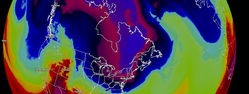
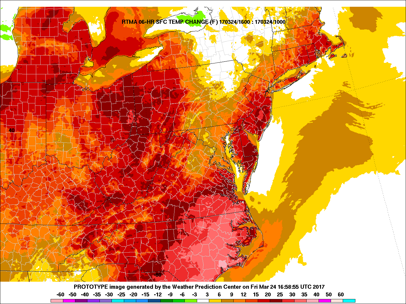
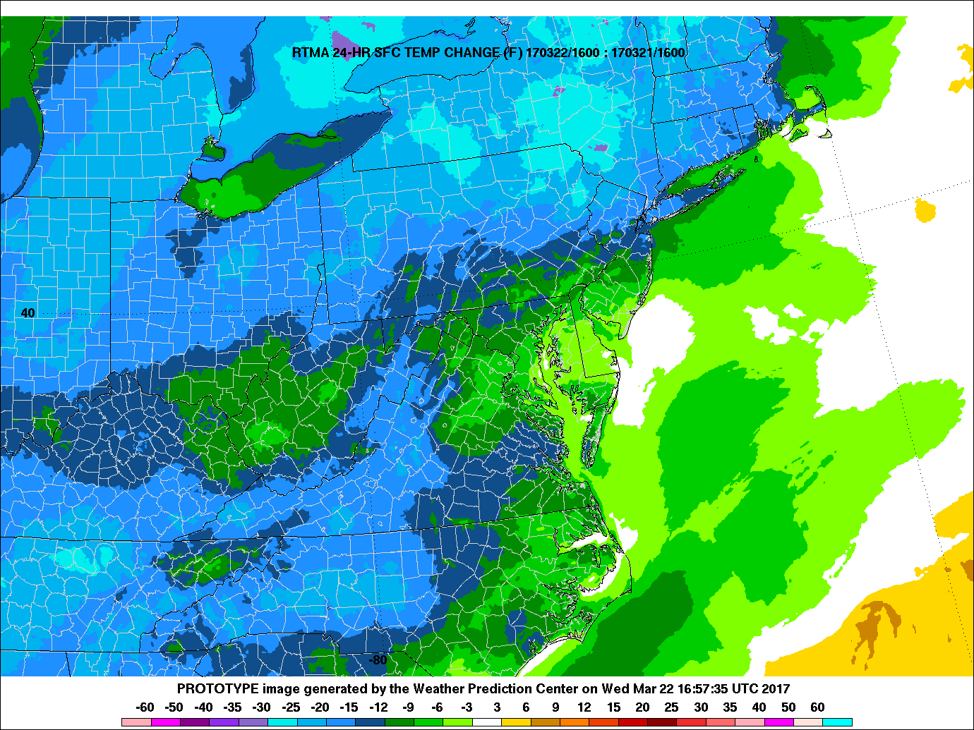
The brief warmer weather we saw earlier this week where temps made it into the 50’s just yesterday, was violently replaced with a fresh injection of Arctic air this morning. This Arctic airmass was ushered in by a strong cold front associated with a large and impressive high pressure system centered over Great Lakes region as of this afternoon. This has caused temps to plummet to the upper 20’s to mid 30’s across much of the area, with some locations in Southern New Jersey in the low 40’s. For the northern sections of the area, this is a good 20-25 degrees colder than it was yesterday. Things become even colder when you factor in the current wind chills across the area, which are ranging from the low 20’s, teens, and even single digits across some of the northern sections!
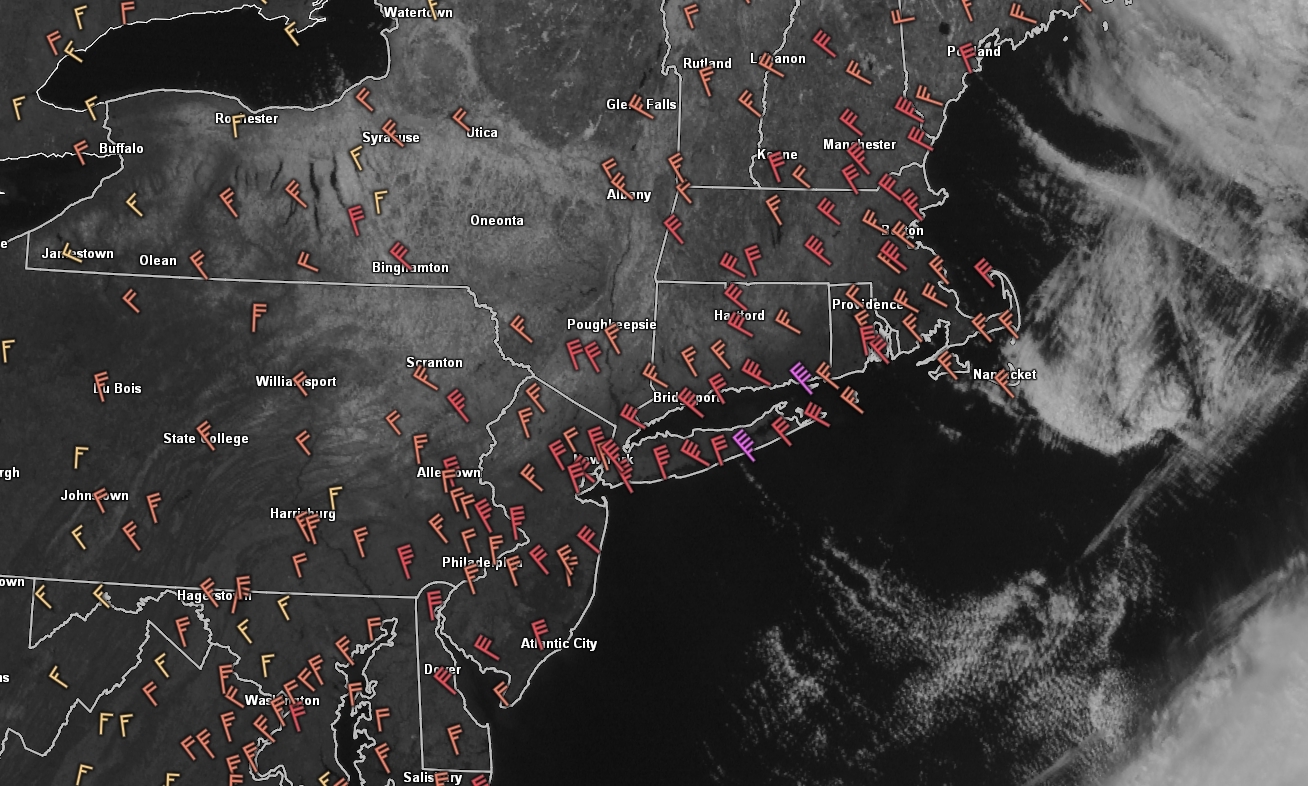
The aforementioned large area of high pressure and a deepening low pressure system over the Canadian maritimes and Nova Scotia are working together to create a tight pressure gradient over the Northeast-which is making for a very gusty afternoon. These gusts have been responsible for numerous reports of downed tree limbs, localized power outages, and even some delays at Newark and La Guardia airports. We anticipate wind gusts to remain in the 40-50 mph range for the rest of the afternoon, with some isolated gusts of up to 60 mph possible (especially along the shores of Long Island and Connecticut where tree and roof damage has been reported) There is currently a Wind Advisory from the NWS in effect for the NYC Metro area until 6pm for the potential for downed tree limbs, some trees, and power lines.
As we continue through the afternoon, only streams of high clouds are expected as the atmosphere remains extremely dry, with the only source of moisture for clouds/precipitation being the Great Lakes. As we get closer to sunset, the winds will begin to settle down as the high pressure system starts to envelope the area. The combination of light winds, very cold upper levels of the atmosphere, and clear skies will lead to near-perfect conditions for what is called “radiational cooling”. Since the water vapor in clouds tend to trap heat quite efficiently, when we remove the clouds and wind, we allow the temperatures to “radiate” back into space since there is no longer a barrier holding them in. This means that tonight is going to be a very cold night for the entire area, with temperatures dropping into the teens and single-digits.
One thing to mention is that those who still have snow cover need to be extremely cautious of black ice tomorrow morning as any water from melted snow will quickly freeze this evening and potentially cause very slippery conditions tomorrow.

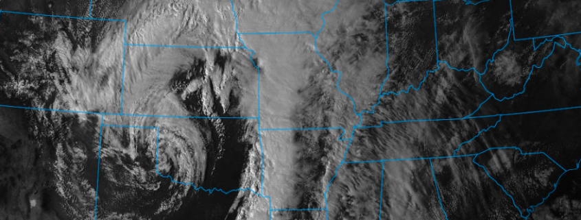
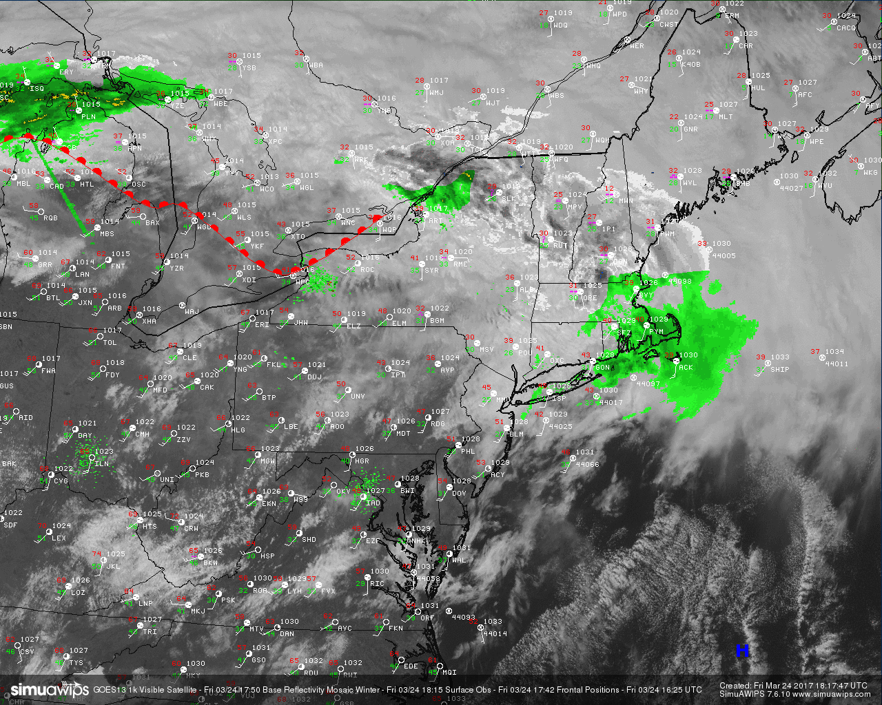
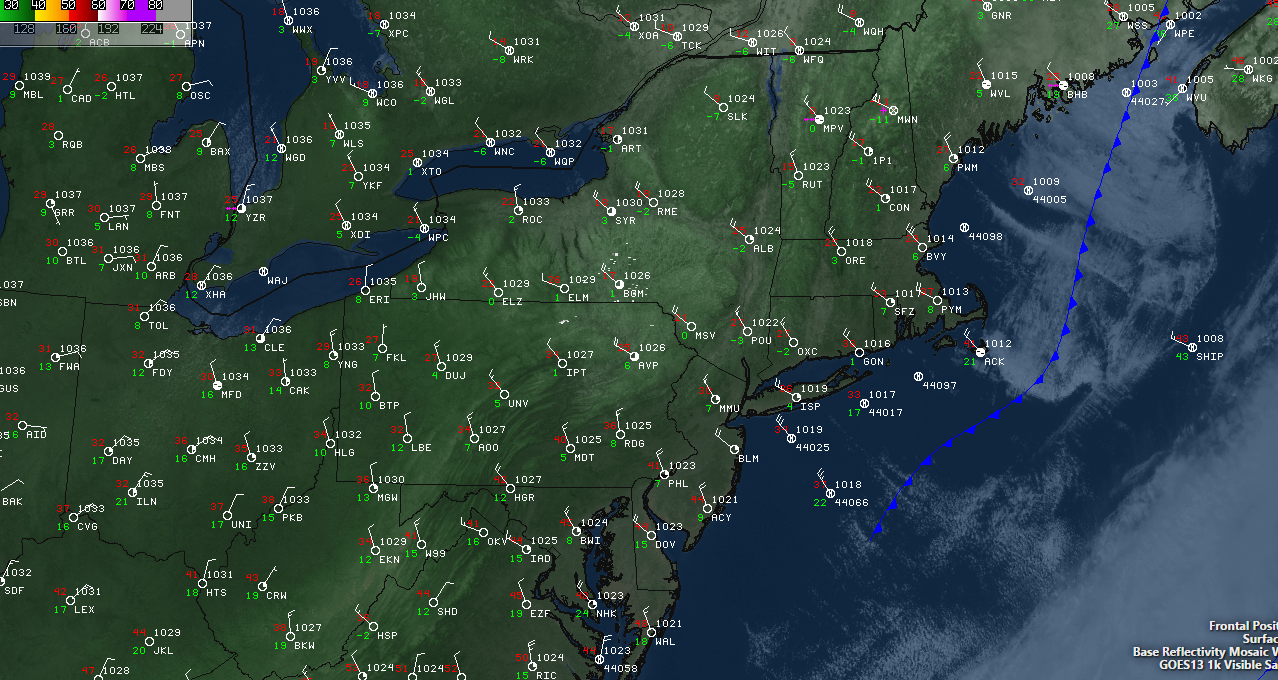
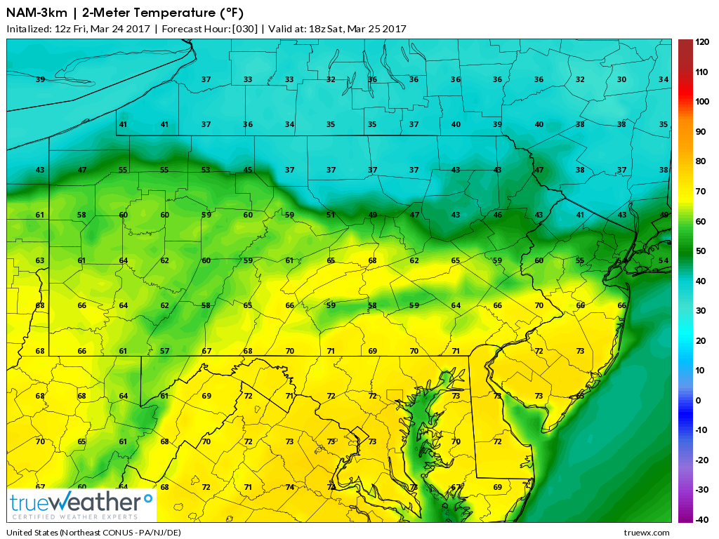
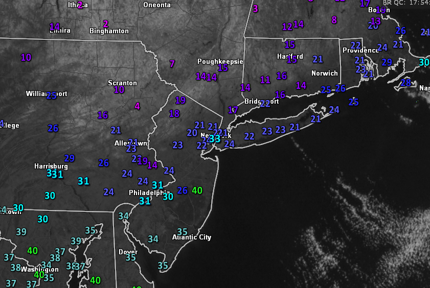
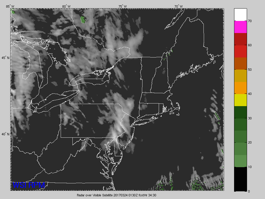
Latest surface observation, radar, visible satellite, and frontal positions over the Northeast this afternoon (Courtesy of Simuawips.com)
As we move into tomorrow, high pressure will be in control of the weather once again. Relatively clear skies and light winds will be likely across the entire area for yet another day. Thursday shouldn’t be as cold as it was today as we should see highs in the upper 30’s and lower 40’s across most of the area just ahead of a building upper-level ridge. Later in the day and into tomorrow evening, some high clouds should begin to move in ahead of a warm front that will be situated over the Ohio Valley. Lows should still be cool Thursday night, with temperatures hanging into the mid to upper 30’s across most of the area.
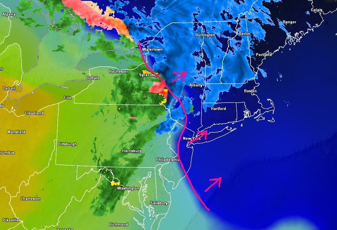
As the ridging that we mentioned earlier begins to build in on Friday, the high pressure that has been in control for today and tomorrow will begin to exit off to the east. Once off the Mid Atlantic coast, this will allow winds from the southwest to move in and usher in a warmer and more moist airmass. Just ahead of this airmass will be a weak warm front that has the potential to bring some light precipitation to the area in the morning hours. There is the possibility that some of the northern locations and higher elevations may possibly see a mix of wintry precipitation in the form of freezing rain and sleet. Otherwise, Friday should be a more seasonable end to the work week as we clear out, and temperatures reach the upper 40’s to mid 50’s by the afternoon hours.
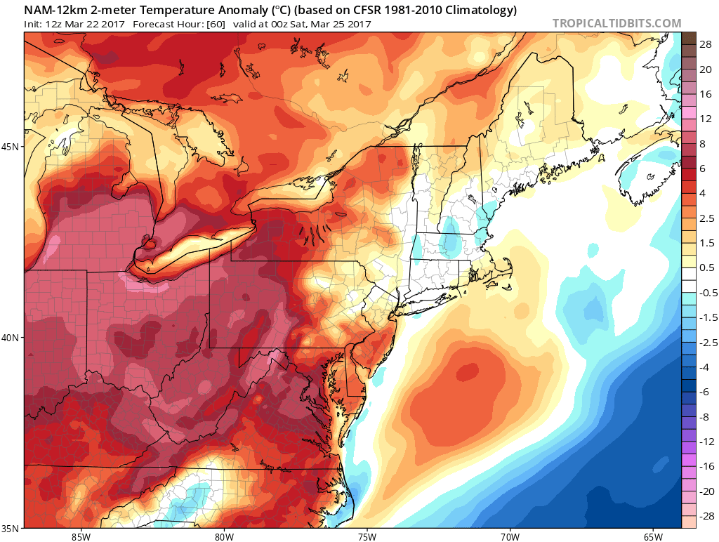
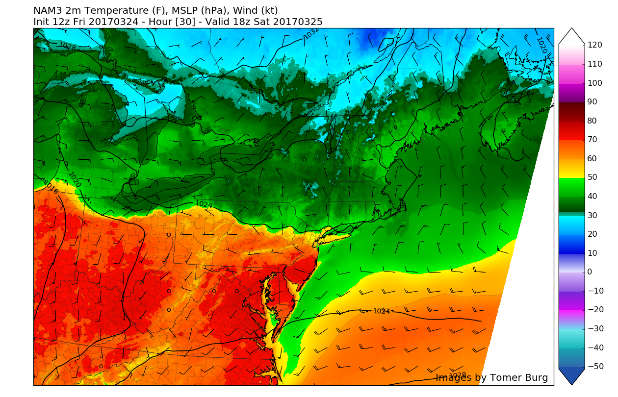
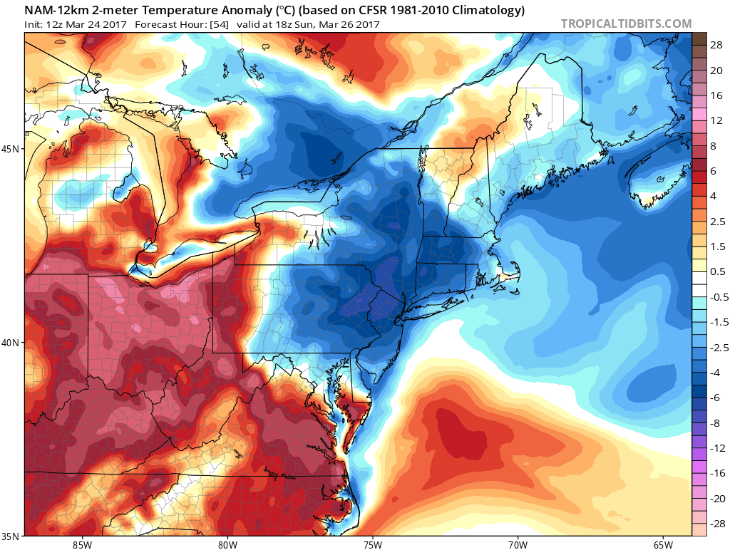
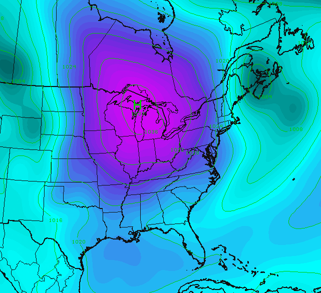
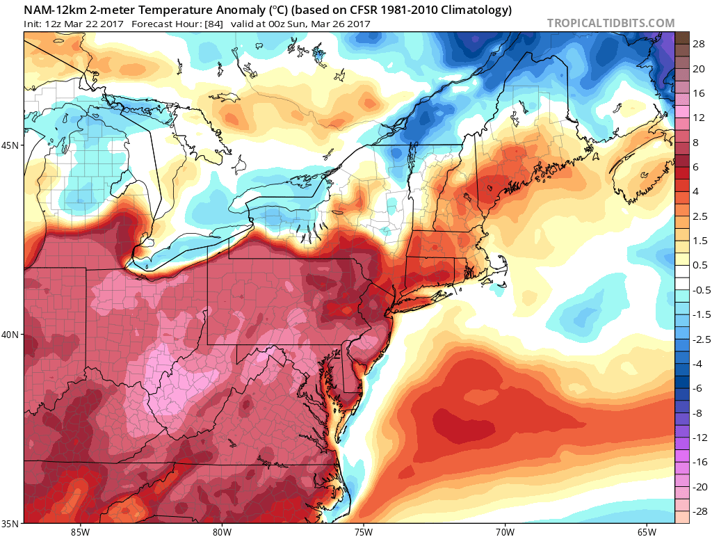
12z NAM 2-meter temperature anomaly showing much more seasonable temperatures across the area by Friday afternoon with warmer air on the way (Valid 8pm Friday)
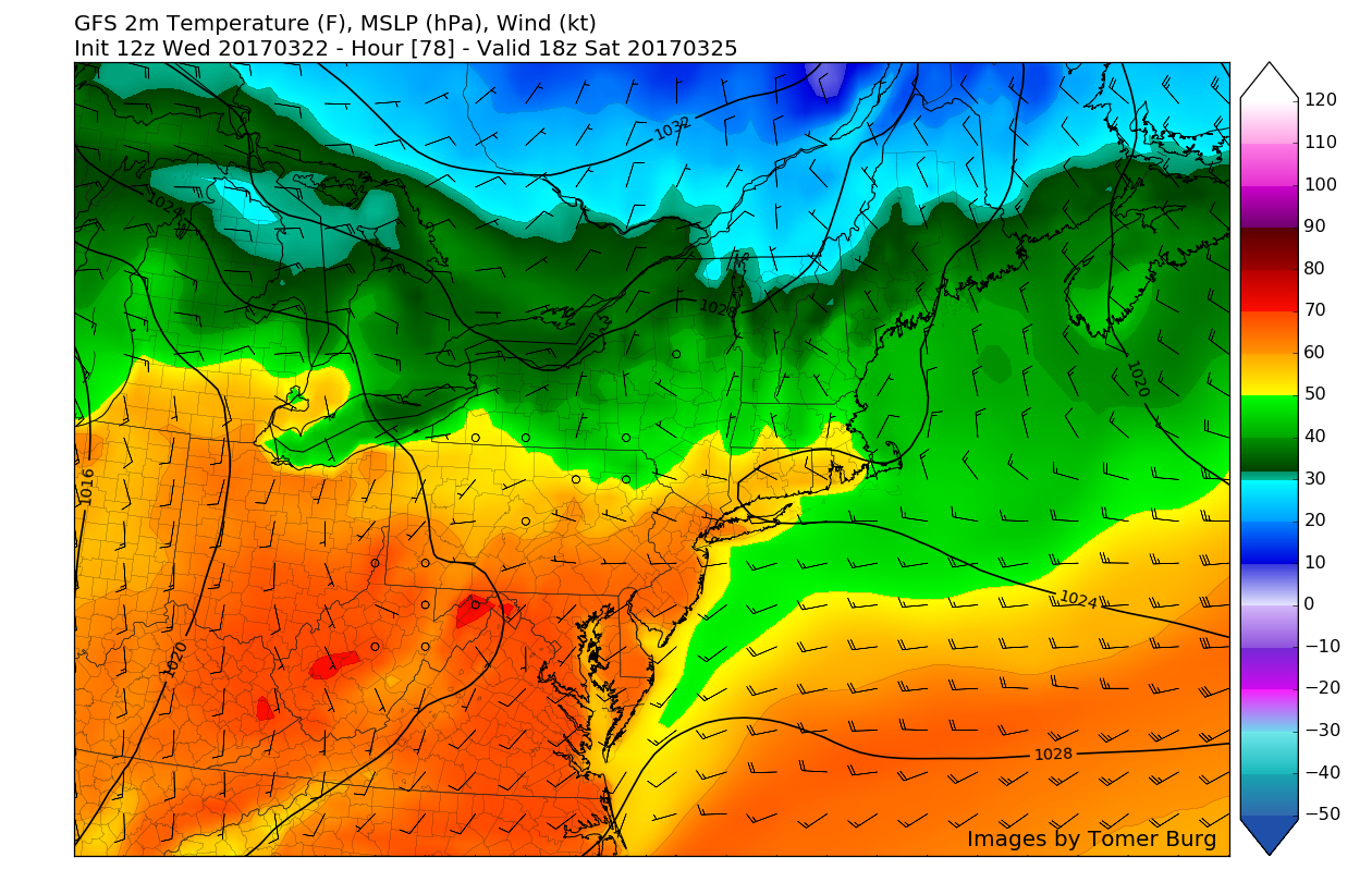
By Saturday much warmer conditions are expected as the warm front begins to lift across our region, with winds from the southwest reinforcing the warm air from the much colder temperatures just to the north. With just a few clouds likely and light winds across the area, highs should have no problem getting into the upper 50’s and middle 60’s-with some locations in Southern and Central NJ possibly seeing temperatures rise into the 70’s! By this time, most locations could see temperatures as much as 12 degrees above normal, which will be an amazing contrast to today (Wednesday)
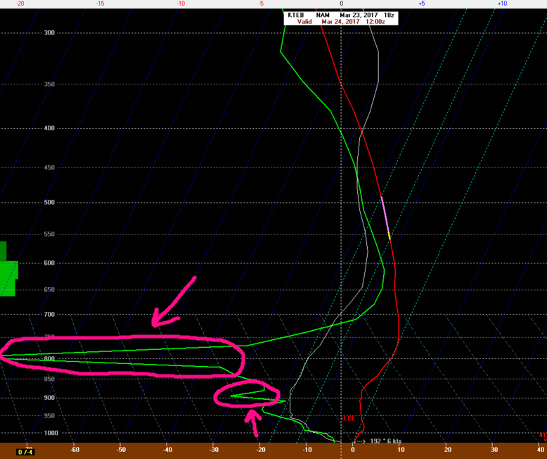
Back on Monday we mentioned the potential for some wintry weather across the area this weekend as a complex situation involving a cutoff low in the Central US, a large upper-level ridge over the East, and another upper-level system in Canada. I mentioned how the upper level system in Canada would have to be able to “press” down hard enough on the ridge over the east coast to create “confluence” that would block the storm system in the Plains from cutting to our west. As of this afternoon, it appears that the upper level system in Canada will not be able to force the confluence far enough south to keep the storm system from cutting to our west through the Ohio Valley on Sunday/Monday. When this low passes to the west of the area, warm air from the mid levels of the atmosphere will surge north and prevent any snow from falling, but with colder air in the lower levels, it is *possible* that some locations in Pennsylvania, Southeast NY, Northern NJ, and New England see some sleet or freezing rain at some point. For now, New York City and points south look to remain all rain. Again, there is still some uncertainty here, so make sure to check back for updates!
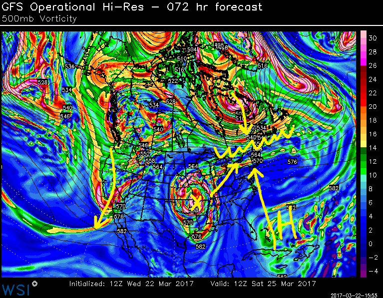
12z GFS 500mb map showing the different pieces that have to come together for a very light wintry event for portions of the Northeast (confluence marked by the wavy line)
This system will exit the region with more clearing expected by Monday night. Temperatures may warm up again later next week if ridging builds into the Northeast US as some models indicate. However an active pacific jet could keep weather conditions more unsettled over the entire region, with the possibility of one or two more cool shots.
We will continue to monitor this system throughout the rest of this week, so make sure to stay tuned for future updates. Again at this time, we do not feel there is support for significant wintry precipitation this weekend, especially closer to the coast.
For more information and posts like this one, make sure you sign up for Zone Forecasts — where multiple detailed articles, videos, and interactives are posted each day. Also, come interact with our staff and many other weather enthusiasts at 33andrain.com!
Have a great day!
Steve Copertino
-2")