-2")
Unseasonably cold and relatively calm conditions have dominated through the first half of this week. Temperatures look to rise only a few degrees through Friday before we have to watch for our next rain threat later on this weekend!
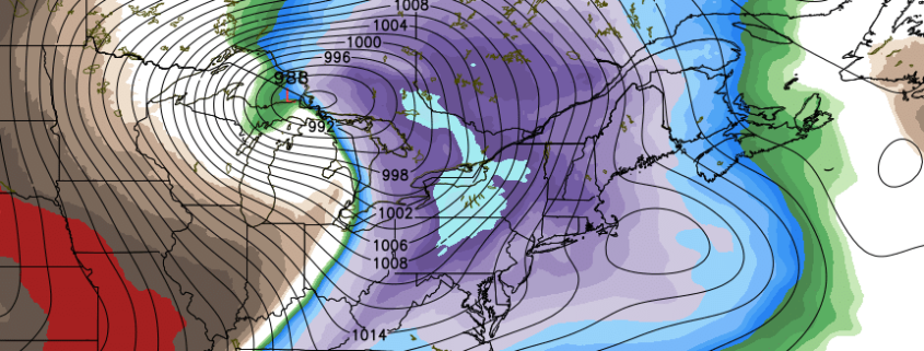
The short-lived, but intense blast of Arctic air last week is now all but a memory as an area of mid-level ridging continues to build over much of the East Coast.

Briefing: A Flash Flood Watch is in effect through tonight. Heavy rain is expected during the evening commute. A colder and active pattern will continue through early December.
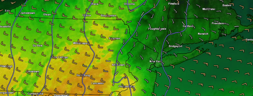
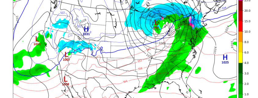
Another round of moderate to heavy rainfall is expected this evening, on the heels of a heavy rainfall event that lead to localized flooding on Saturday evening. This system will approach from the Ohio Valley and Great Lakes today, with a secondary low pressure system forming off the New England coast. While not as intense as Saturday’s storm, it will again feature the potential for moderate to heavy rainfall.
With Flash Flood guidance already low from several weeks of above normal rainfall, the National Weather Service has issued a Flash Flood Watch for a large majority of Northern NJ, NYC, Southeast NY and Long Island for the potential for flash flooding, especially in flood prone/low lying areas. Rain is expected to begin during the early afternoon today, first over Eastern PA and Southern NJ, spreading gradually northward.