Posts

5.18 Late-AM Zones Update: More Heat and Isolated T-Storms Possible into Friday

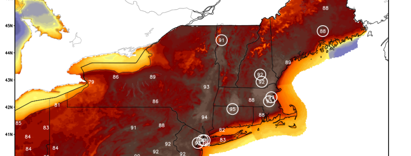
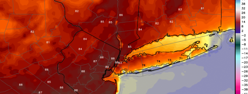
Good morning! More summer-like weather continues today. It will be hotter in many areas, than on Wednesday. 850mb temperatures around 17░C to 19C with southwest winds will support highs in the lower and middle 90s, away from the coast today. More record highs will likely be set again across the region.  Humidity will be higher, but not oppressive. Sea-breezes will keep coastal areas, such as Long Island and NJ shore cooler again today. But even these areas temperatures may reach the 80s, with a stronger southwest flow today.

Read more

5.17 AM Zones Update: Record Heat Possible by Thursday, Cooler Weekend Weather

Happy Wednesday! As we’ve been discussing this week, a strong ridge will be bring very warm, summer-like temperatures over next few days. Today, mostly sunny skies are expected. 850mb temperatures between 16°C to 17°C with light southwest winds, will support temperatures rise into the mid-upper 80s, away from the coast this afternoon. Some typical hotspots like Newark,NJ may reach around 90. Sea-breezes are likely to develop by early this afternoon, along the coast, with only light southwest flow. This will keep much of Long Island, Coastal Connecticut and the New Jersey shore, from rising out the 70s or lower 80s.

Read more

5.15 Midday Zones Update: Summer Warmth Midweek, Cooler Weekend

Happy Monday! Hope you had a lovely weekend! A coastal storm that impacted the region over the weekend, is still east of New England today. Clouds from this low are moving through parts of the region. As the storm slowly moves out further into the Atlantic, clouds will gradually clear for more sunshine. High temperatures this afternoon will be in mid-upper 60s. Overall it will a pretty decent day. But a tight pressure gradient behind this low will cause northwest winds to gust over 30-40mph, through this afternoon.

Read more

5/5 Late-AM Zones Update: Heavy Rain Today, Unsettled Weekend, More Blocking Next Week

Happy Friday! A large, closed low to the southwest, will continue to impact the region today. Rain will continue to be heavy at times, early to mid-afternoon hours, as stronger southerly low-level jet moves across the region. Some embedded thunderstorms are also possible, with weak some instability this afternoon. Rainfall totals of at least 1” to 2” are expected for most areas. But some locally higher totals up 3”or 4” are possible. This could lead some flooding on area roadways and poor drainage areas.

Read more