
T-Minus 7 Days
My parents told me there’d be days like this.
It’s been about four months since we decided to schedule a storm chasing trip during the peak climatological period for supercells in the Plains – comfortably from the end of May into the very early part of June. It is only fitting, then, that forecast model guidance is suggesting one of the most quiet periods of the entire season right smack in the middle of our trip. We’ll get to that later.
The “fun” part of the trip has just gotten in to full swing, as preparations are fully underway. We’re making some of our final preps in regards to the technology and equipment. This includes the big stuff like cameras and cars, and the little stuff like weather radios and power inverters. Side note: It’s been really difficult to find a laptop mount that features an easy install for a rental car. Something to keep in mind for those of you who are planning to do something similar soon.
This year, we rented a Sony RX 10 IV. We touched on this in a previous post, but this thing is an absolute beast. A Zeiss 24-600mm lens comes with it – and that’s just the kit. This thing is a powerhouse and takes some amazing photos while also offering the ability to take video in 4k (which honestly was a big deal for me as we try to capture the essence of this whole thing). Having that here and ready to go has really added to the excitement of everything.
Guys. It’s here. #chase2018 pic.twitter.com/N9rgTMTgKJ
— John Homenuk (@jhomenuk) May 18, 2018
Next, we’re waiting for the radio units to come in and the other power-related accessories to be ready. We’re having those delivered to Minneapolis to make things a bit easier for us. This will give us the ability to hop into the rental car, assemble things fairly quickly, and get on the road. Which it looks increasingly likely we will have to do – that leads us to some discussion regarding the weather pattern.
For some time now, I have been pretty excited about this period in late May. It seemed for quite a while that the tropical forcing and hemispheric stars would align to create an uptick in activity that was further supported by analogs. It hasn’t worked out, at least it hasn’t worked out how I expected it to. As I write this, forecast model guidance remains extremely sporadic with any widespread severe weather activity.
A Pacific Jet retraction is expected to take the mean troughing anomaly westward – perhaps even off the US West Coast for a time – during the week of May 25 – June 1. This will allow room for a large ridge to expand in the Central United States, amplifying the mid level jet stream northward into Canada. Not exactly ideal for storm chasing opportunities (and that’s probably putting it lightly).
Not an ideal storm chasing pattern.
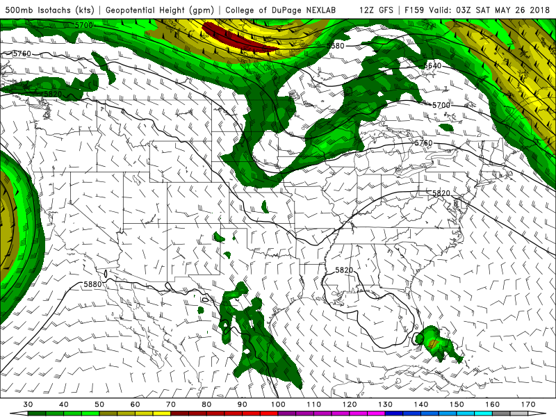
Forecast model guidance, particularly ensembles, had been very unfavorable for any storm development in the medium to long term with the mid level jet displaced well into Canada. However, it is important to consider the degree of ensemble muting that occurs at that time frame. We’re seeing the fruits of this over the past 24-48 hours, as forecast model guidance is coming into better agreement on a small shortwave trough that will traverse the northern fringes of the large Central US Ridge.
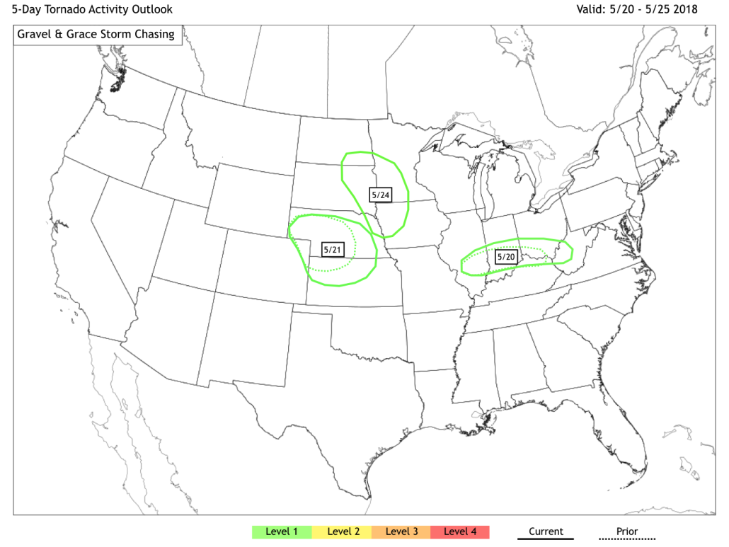
These types of setup can be very favorable for supercell thunderstorm development on the edges of large ridging, with plenty of instability and the potential for moderately favorable mid level winds. The GFS and ECMWF are in good agreement now regarding the track of one of these troughs through the Northern Plains from 5/24 – 5/26. Exactly how this plays out remains to be seen, but it appears probable that the severe weather threat will be heightened during this time frame.
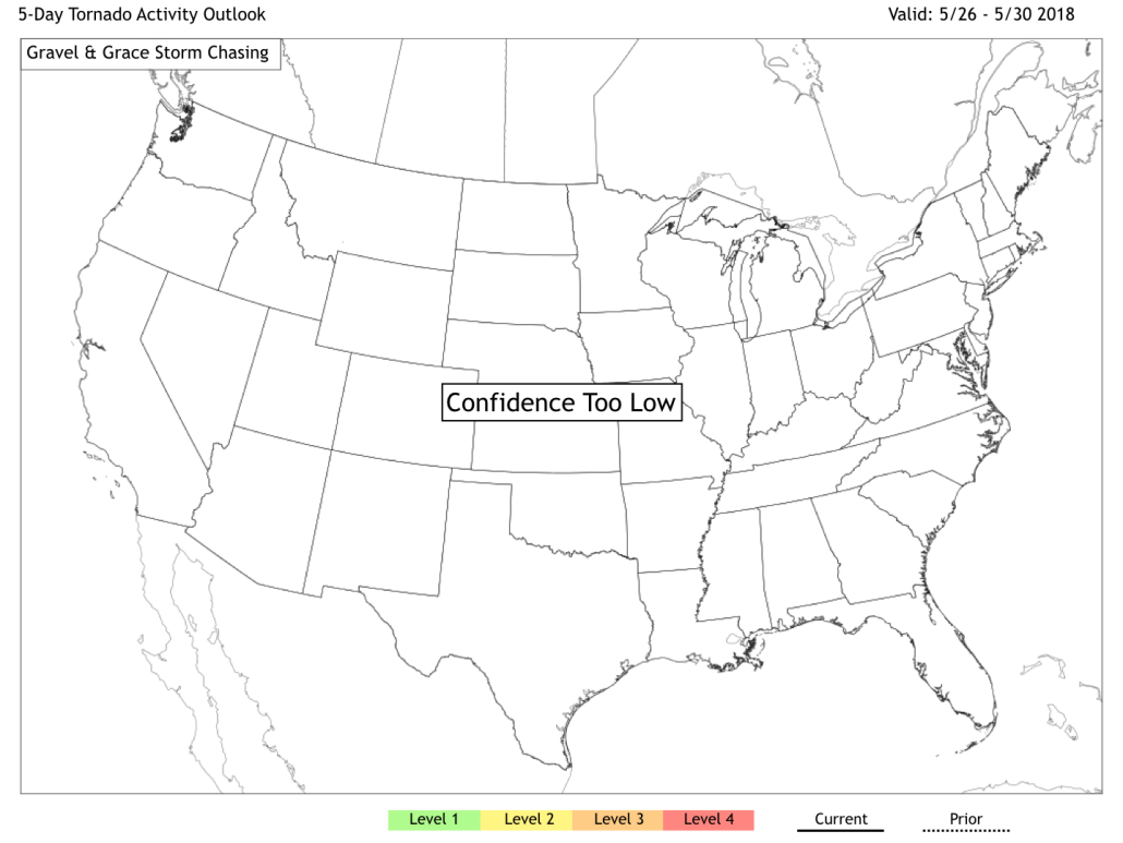
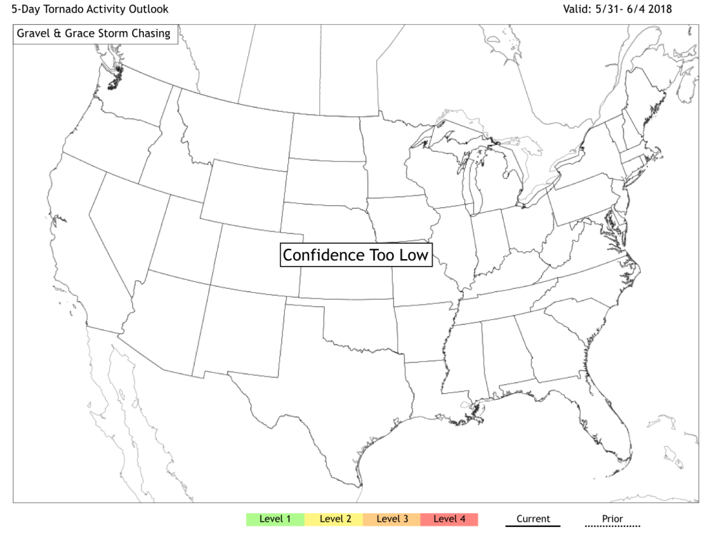
*A brief note regarding these outlooks – they are clearly a beta and are not meant to replace official SPC or NWS outlooks. However, we are really excited about the possibilities with them. Level 1 is meant to delineate the areas where a few tornadoes are possible. Level 2 features more organized activity. Level 3 is a high or unusual concentration of tornadoes, while Level 4 is outbreak or extremely unusual concentration of tornado activity. We’ll build on this list and categories as we go…feedback is encouraged!
Thereafter, the forecast currently appears much more quiet from 5/26 through 6/1 (but again, we’re seeing fundamental changes on most guidance still) before a return to activity around 6/1 as the mid level jet makes a return. Both the ECMWF EPS and GEFS agree that opportunities for severe thunderstorm develop will return to the Western Plains around that time, particularly focusing on the Western Dakotas. Additional support for the return of troughiness and the mid level jet comes via the MJO progression into Phase 2 during this time.
As it currently stands, we anticipate this trip to feature “bookend” periods of heightened activity – both in the days surrounding our arrival and depature. It looks likely to be more quiet in between, but there still will likely be plenty of mesoscale opportunities for severe weather. We’re getting more excited to head out there each day. Stay tuned over the next few days for further updates, photos, and interactives!