-2")
Bouts of heat, multiple MCS threats to end July
The hot weather is here — and as we have mentioned in our posts for the past week or so, it isn’t expected to go anywhere any time soon. While the pattern will remain somewhat transitional this weekend, a tremendous mid level ridge is forecast to build across the Central United States by the middle part of this upcoming week. This ridge will become the dominant feature in the jet stream and weather pattern throughout the Contiguous United States during this time frame.
The core of the ridge, and the center of the big-time heat, is likely to stay well to our west. The ridge center is expected to drift from the Mississippi River Valley westward toward the Plains states during the week ahead. However, the breadth of the ridge is likely to grow during this time frame, with rising mid level heights extending all the way to the Northeast United States.
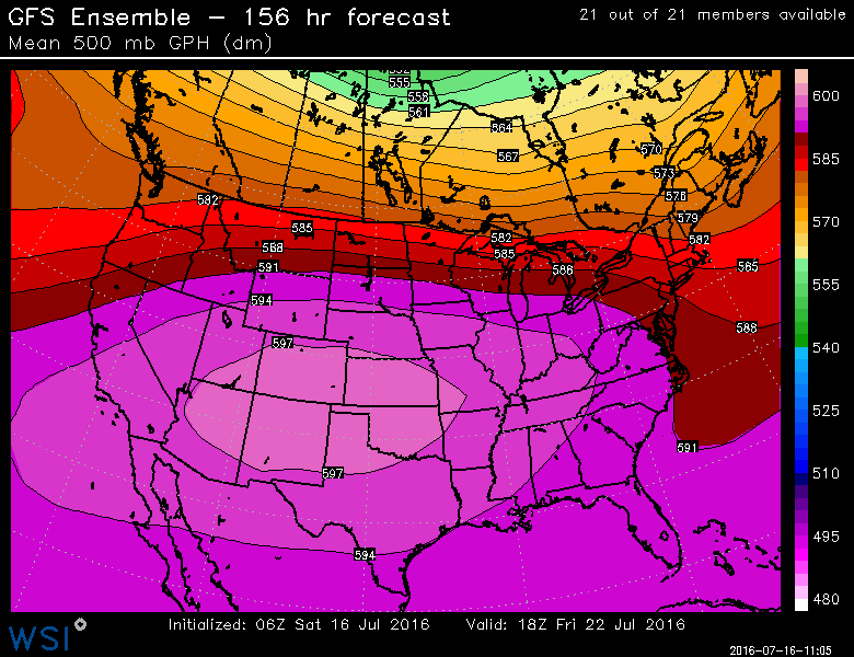
GFS model showing an expansive ridge building throughout the United States next week.
Accordingly, bouts of heat are expected in our area as the ridge flexes its muscles. Temperatures in the 90’s will be common, and depending on the exact timing and location of these bursts of higher heights, a few days with highs nearing 100 F are not out of the question. This will be especially true across interior locations and places further away from the shore.
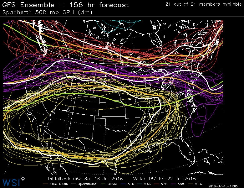
The real story, however, will become the battle between the large, anomalous ridge to our southwest and the continually active pattern over Canada, to our northwest. This will lead to a gradient in the atmosphere, at multiple levels, especially the mid levels and the jet stream. The most impressive energy will be shifted to the north, but will have a tendency to sink southward into the Northeast United States later in the week ahead.
A severe weather threat may rear its head throughout the Northeast US as early as Monday –and perhaps Tuesday — as this mid level ridge builds. The first in a line of passing shortwave troughs over Southeast Canada will run into a marginally unstable environment, likely touching off a few strong and severe thunderstorms. These will be most common throughout the interior locations and possibly New England, but may sink into NJ/NYC Metro on Monday evening and linger into Tuesday as well.
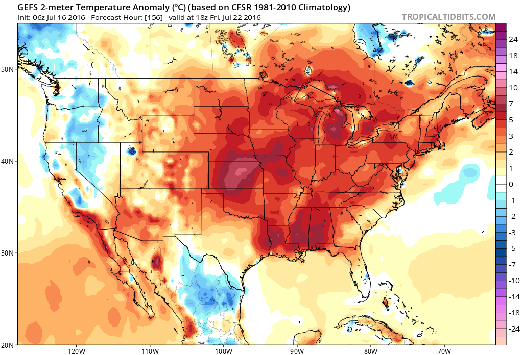
Models suggest a large area of above normal temperatures by the end of this coming week and weekend.
With the ridge axis building to our southwest, instability is expected to build in the atmosphere as the week goes on. As additional disturbances approach the area later in the week, multiple threats for strong and severe thunderstorms are expected in the Northeast US from late next week into the weekend. But, as always, the exact intricacies of the timing and intensity of both the ridge and the disturbances riding along its periphery will determine where the severe weather occurs.
What exactly increases our confidence in this occurring? We call it the “Ring of fire”. When large mid level ridges build, such as the one modeled for next week, atmospheric energy and associated wind fields and shear are pushed along the northern periphery of them. They “ride” the ridge, from its western flank, over its northern edge, and then down its eastern flank, often accelerating as they do so. As this occurs, the disturbances run into the edge of impressive instability which builds underneath the ridge.
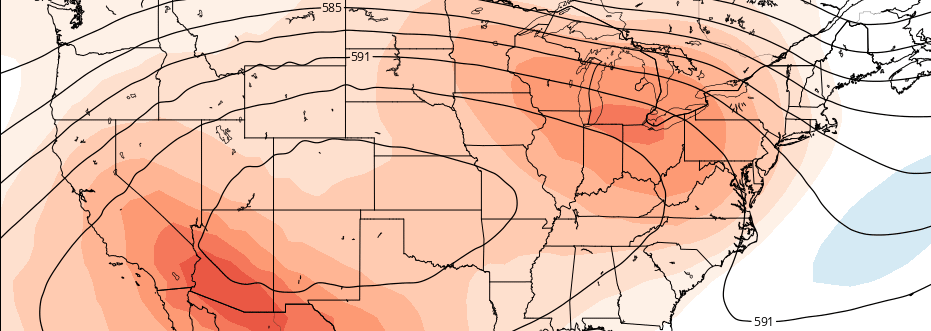
The most common zone for this occurrence, in the mid levels of the atmosphere, is near the 588dm height line at 500mb — or, more broadly, between the 582 and 588 dm height line at the 500mb level. These are the height line where disturbances love to travel — often the gradient between the larger heat ridges and more active patterns to their north. This case is no different, and forecast models agree that our area will lie precariously near the 588dm height line for several days.
GFS model showing high confidence in the 588dm height line (purple) residing near our area late this week and weekend.
To digress a bit, the signal for the potential for multiple severe weather events is strong. But that guarantee much at all. In fact, it mores suggests that multiple threats will be possible, embedded within an active pattern. The timing of such disturbances, and intensity of them during their passage, is still critical to the prospects for severe weather — and will determine whether or not we see widespread severe storms or passing storms overnight.
Over the next few days, stay tuned for updates and information on the evolution of the pattern as we try to pin down dates and times for severe weather opportunities and the more impressive heat bouts during this period of time as well.
Don’t forget, check the Premium Member dashboard throughout the day and make sure you have the latest information and constantly updated discussions and videos from our meteorologists. Have a great Saturday!