-2")

Tornado Outlook: The first few days
The time has come, friends! Packing is well underway, important shipments are on their way to Minneapolis, cameras are charging and ready. We are just a few days away from the beginning of our 2018 Storm Chase, and we could not be more excited to get started. A lot has gone into planning this and making it all come together, and the time has come now to let the atmosphere take over.
By now, most everyone is aware that this has been a quiet severe weather season across the Plains (and entire United States, for that matter). Tornado counts are among the lowest ever for this time of year, and the Storm Prediction Center hasn’t issued a Tornado Watch in the Central United States in sixteen days and counting. The atmosphere simply hasn’t cooperated to produce setups conducive for supercells and severe thunderstorms consistently.
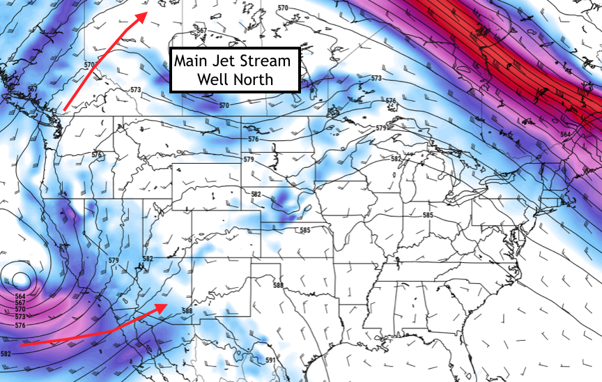
500mb hPa winds and heights on Friday morning. Image courtesy pivotal weather.
Compounding our problem is that we are beginning our trip during an unfavorable mid and upper level atmospheric setup. In fact, it is extremely unfavorable. The mid and upper level jet stream is situated well to the north of the United States, completely displaced into Canada by a poleward reaching Pacific Jet stream and amplified high latitude hemispheric weather pattern. This has led to very infrequent severe weather opportunities across the lower 48 over the past several days and will continue to mitigate chances through about Wednesday.
The pattern, however, is beginning to undergo some changes – and it is worth noting the forecast models did not pick up on these changes in the long term or even medium term forecasts. It was only recently that forecast model guidance began to change the evolution across the Pacific Ocean and downstream across the United States. A mid/upper level trough and associated jet streak is forecast to surge eastward into the Four Corners by the latter half of this week and into the weekend.
Thereafter, model guidance diverges a bit on exactly how it will proceed eastward – but there is a developing consensus among the ECMWF EPS and GEFS that its jet streak will at least make it far enough east to impact the Western Plains states. This will send an area of more favorable mid level winds northward into the Western Plains states – interacting with sufficient moisture and an elevated mixed layer. The potential for severe weather should increase during this time frame.
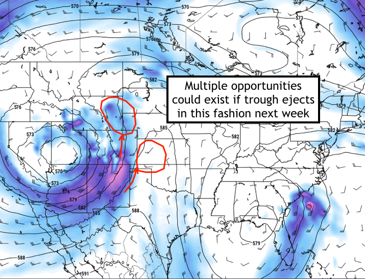
GFS 500hPa winds and height forecast valid Tuesday 5/29. Images via pivotal weather.
The eastward movement and overall intensity of this mid/upper level low and jet streak are an obvious caveat to the setup – while another will be the presence and quality of low level moisture. Forecast models are persistent in indicating a lingering upper level low in the Gulf of Mexico which could impede or mitigate otherwise favorable moisture return. These will both be significant factors in the intensity of any severe weather threat that develops during this time frame.
With that said – a few days of severe weather and tornado potential appear likely to unfold, which we are very excited about. We currently anticipate sitting out Friday’s severe weather threat across the Plains – and then repositioning for Saturday. At this juncture, we anticipate severe weather chances will increase on Sunday, Monday, and Tuesday respectively across the High Plains states.
We’ve highlighted the next week of tornado potential on our map below – something we’re excited to debut. Our hope is to begin with weekly outlooks and target days in advance, and then hone in on them as we get closer. We’ll be updating these over the next few days as we get closer to our arrival!
PS – Don’t forget. Follow us on Instagram and Twitter for the very latest!
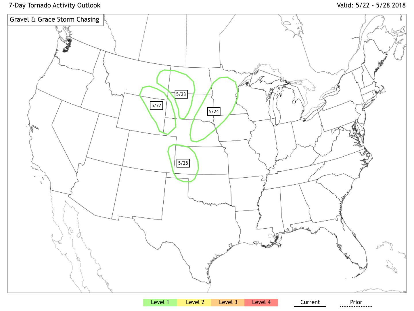
Tornado Outlook for the next several days.