-2")

Day 1: Back home in Minneapolis
I love Minneapolis. I’m so excited to be heading here for our first few days. After spending a year here in 2017, Minneapolis will always feel like home to me. It’s odd, really, knowing that you will end up back somewhere. It’s a weird feeling to be certain of something in your mind – but I am certain that I will end up back in Minneapolis sometime soon. The city is far too welcoming, exciting, and energetic for me to leave it behind. Nevertheless, enough about me – there are other exciting things to discuss!
The long awaited, discussed and debated 2018 Storm Chasing trip is finally here. On Friday morning, we will boarding a 7:00am flight out of JFK en route to Minneapolis. The weather is going to cooperate. Temperatures there are likely to be in the 90’s, which all but certainly will set the tone for the trip ahead. After careful analysis of the weather pattern, we’ve decided not to chase storms for the first two days.
The time has come y’all. #stormchase2018 pic.twitter.com/bBbsIS4vO8
— John Homenuk (@jhomenuk) May 24, 2018
The weather pattern has evolved significantly since our last post – and from here forward, since we’ll be posting each day, you’ll be able to track that evolution with us. Right off the bat, forecast models have trended more organized with the mid and upper level jet streak moving into the Western Plains during the middle of the week. This is a very good thing. Plenty of moisture and instability will be present, and now it appears that mid level winds will at least be marginally favorable for storm organization.
The target areas each day will vary significantly – and that does present a bit of a challenge. As much as we love storms and are willing to maneuver, we can’t be everywhere. So we will need to choose our target positions carefully and wisely. Forecast models, best used as guidance, have given us plenty of hints, but ultimately it will be up to us to pick where we end up at the critical moment.
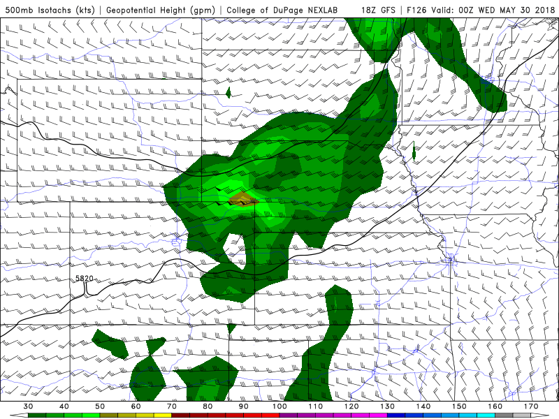
GFS model showing a favorable mid level jet during the week ahead over the Plains states.
Our new tornado outlook for the 7 days ahead, pictured below, gives a visual display of the areas that we are targeting. Things kick off for us on Sunday – and likely will be most prevalent in the high plains from Wyoming into the Dakotas. The mid level jet streak surges northward through Colorado and along the fringes of the Western Plains states. This should present an opportunity for thunderstorm initiation in the foothills of Wyoming and Colorado, but it will be interesting to see whether the Dakotas offer a similar and less risky opportunity.
Thereafter, chances look to transition into the Central Plains. The GFS and ECMWF both indicate the 500hPa jet streak will surge northeastward, with 30-50knots of mid level winds situated over Kansas and parts of Nebraska on Monday and Tuesday. Mesoscale details will ultimately determine exactly where the best potential sets up, but it appears probable that both days will feature ample opportunities for supercells and perhaps tornadoes.
Things look to pick up again towards the end of the week, but uncertainty remains high in terms of exactly how it occurs. The GFS and ECMWF are both indicating even more favorable mid level winds on Thursday and Friday, which could offer the opportunity for a more significant severe weather episode, but the location of such an event is currently extremely uncertain.
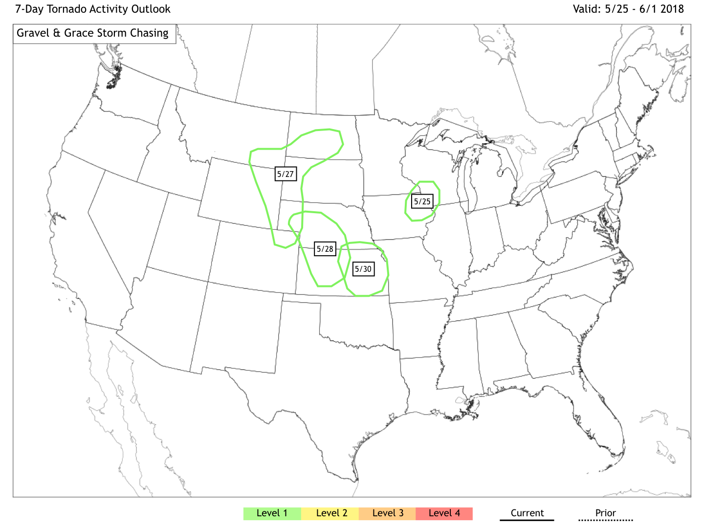
Tornado Outlook for the next 7 Days
Nevertheless, it appears the week ahead will be filled with multiple opportunities for severe weather and tornadoes – and for that, we couldn’t be happier. Check back later today for more details and be sure to follow our social media accounts for the very latest!
Twitter: @gravelandgrace | Instagram: @gravelgrace