-2")

First Chase Day
It really does feel like Christmas morning! The first chase day of 2018 is upon us. We’re in Nebraska, heading westward towards the Nebraska Panhandle later this morning. Forecast models are in good agreement on the overall setup later today, but the setup itself presents a tremendous amount of complications and subtleties (when does it not?) that will make it a very difficult chase. The first chase usually is the toughest and today does not look to be any different.
The synoptics of the setup features favorable moisture return into the upslope regions of Colorado and Wyoming with favorably positioned instability developing amid a swath of notable mid level winds. This mid level wind maxima shifts eastward into Colorado later today with 500hPa wind speeds exceeding 55kts by 21z. The NAM and HRRR as well as other convective allowing models are in good agreement on this.
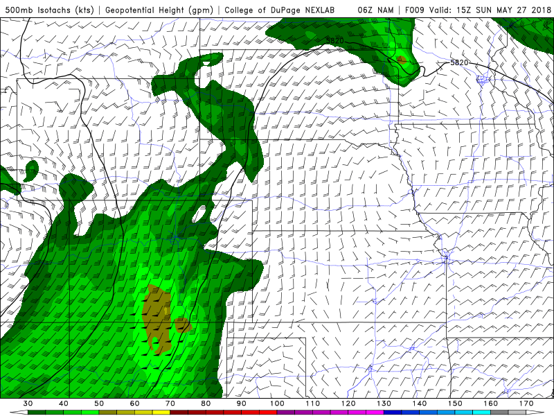
The NAM model showing a very favorable 500hPa jet streak into WY/CO and the Western Plains on Sunday.
Meanwhile, cyclone development begins to occur back to the west. This will be further enhanced by the developing mesoscale Denver cyclone and a La Junta low developing in Colorado – while more pure cyclone development occurs in Wyoming that is further aided by the Cheyenne Ridge convergence zone. Forecast models have picked up the Cheyenne Ridge specifically as a region where supercellular convective development could occur.
The forecast creates problems because there are two distinct areas of convective potential – both with caveats. The convective development off the Cheyenne Ridge convergence could be more intense and likely supercellular in nature given the enhanced low level turning and helicity, but the dew point spreads are not as favorable – perhaps the potential exists for high based supercells in this region, but northerly winds prior to the arrival of moisture late in the day present some concerns. This area is also slightly removed from the best mid level winds.
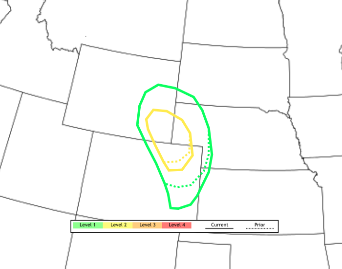
Relative zoom into our latest tornado outlook for Today, Sunday May 27th, 2018.
In Colorado, moisture return is more favorable in Eastern parts of the state, and closer to the mid level wind max. But hodographs and general mid and low level profiles suggest that a multi-cellular storm mode could quickly become dominant despite the more favorable kinematics overall.
This presents a challenge in terms of picking a location. While my mind currently favors Southeast Wyoming for overall structure and tornado potential, we’re going to have to check back in this afternoon to make a final decision. We’re heading West to Ogallala, NE for our first position and will be taking it from there – either Northwest or Southwest.
We’re also stoked to let you know that Doug has joined us for the trip! It was a last minute decision but we’re glad to have him along. He’ll be contributing to our photos, videos and stories. More to come later today, check back soon!