-2")
Day 2: Chasing Reverie
Okay, lets just start by saying this about yesterday: WHAT A DAY! After much deliberation and thought, we made the decision to chase in Southeastern Wyoming. There were many factors (logistics, landscape, meteorology, etc) but we were comfortable with our decision throughout the majority of the day. Until an isolated supercell formed in Colorado and produced a wall cloud. I would be lying if I said I didn’t consider shooting south to catch this discrete storm.
In chaser lore, this would have been known as the “decoy storm”. And it was. The updraft that had been rooted near an upslope boundary in Wyoming began to strengthen again as inflow into the storm system increased. We positioned ourselves just to the east/southeast of the storm and began observing increasing rotation. Just around that time, the storm itself separated from the upslope and began shifting east – it was now on its own.
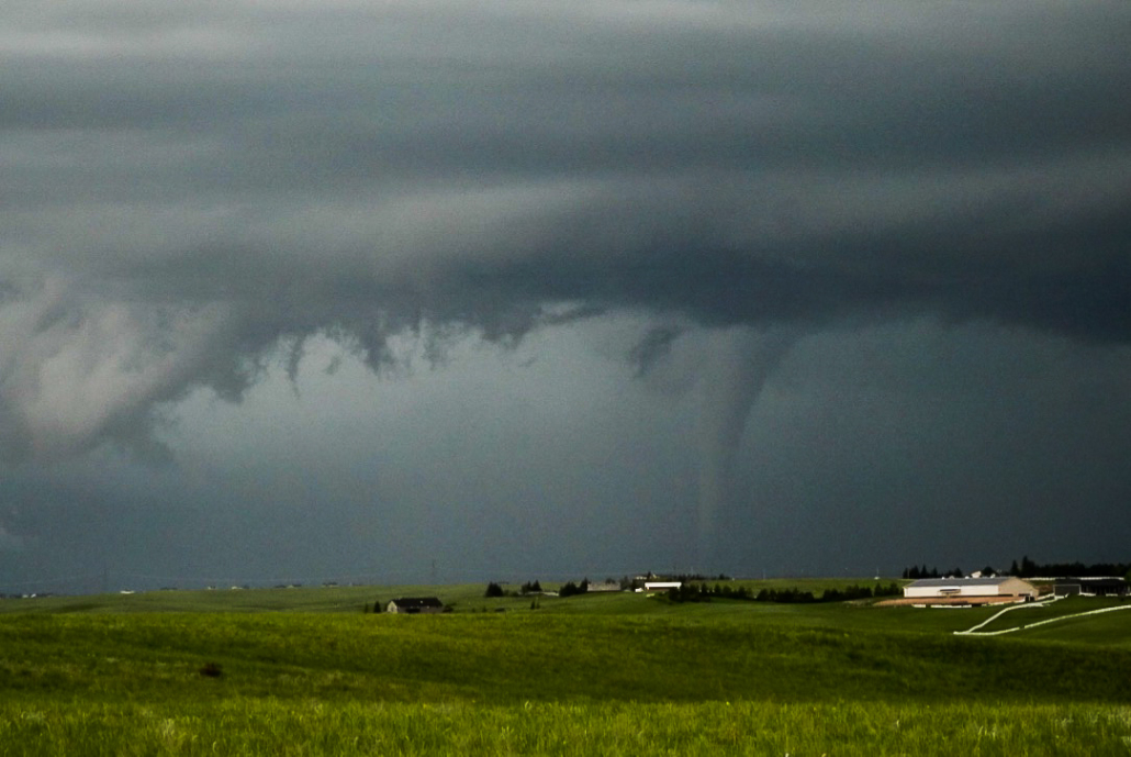
Rotation strengthened rapidly and the system became a bit of a monster. Low precipitation in nature at first, it very quickly began the transition. We observed multiple tornadoes, the first two of which were rope-type tornadoes. A quick stovepipe-type tornado also developed. Thereafter, the transition to a precipitation supercell totally obscured the tornadoes structure as the storm developed to the Northeast. At one point we decided to stop pursuing it.
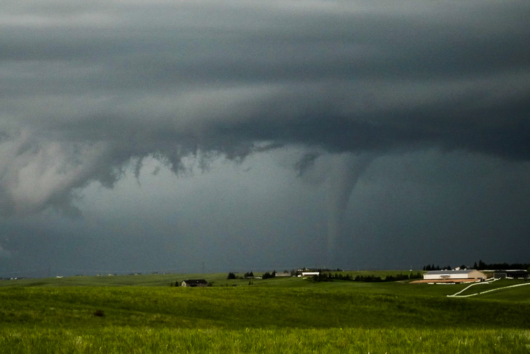
A tornado near Horse Creek, WY on May 27th, 2018.
We were able to see a tornado and some incredible structure on our first day chasing – more than we ever could have asked for! Our attention now turns to Monday (today) and the potential for more significant severe weather. A mid level trough will continue ejecting northeastward towards Colorado and the Western Plains. Forecast models are in good agreement that a favorable mid level jet streak will develop into Colorado later today with 500hPa winds 50+kts by 00z Tuesday.
Impressive moisture return and instability is forecast by later today across the same area, as well as over Western Kansas and Nebraska. There are two areas of potential today – over the Western Plains near the Dryline and in Northeastern Colorado. Again, after much internal debate, we’re going to target Northeast Colorado closest to the Palmer Divide in hopes of storm formation and strengthening in a favorable environment.
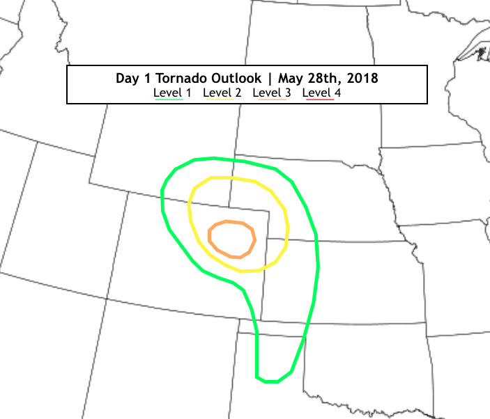
Todays tornado outlook!
Utilizing the HREF and latest CAM’s, our confidence increases in the development of discrete supercells in this region. The low level environment could be supportive of tornadoes as the storm(s) track Northeastward later today. While there is also the potential for tornadoes in the Western Plains, our current thinking is that messy storm modes will preclude a good chase day there.
Stay tuned later today for further updates and details as we move along!!