-2")
Long Range Dashboard
Weekly Breakdown
Video Discussion
Weekly Discussion
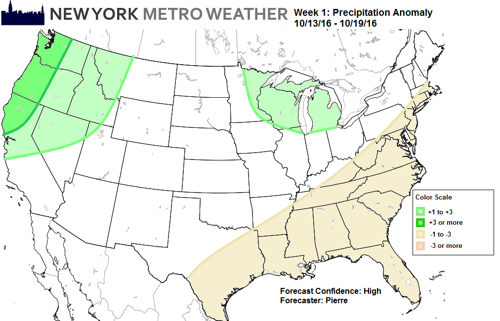
October 13th to October 19th
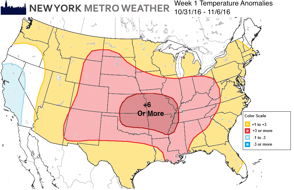
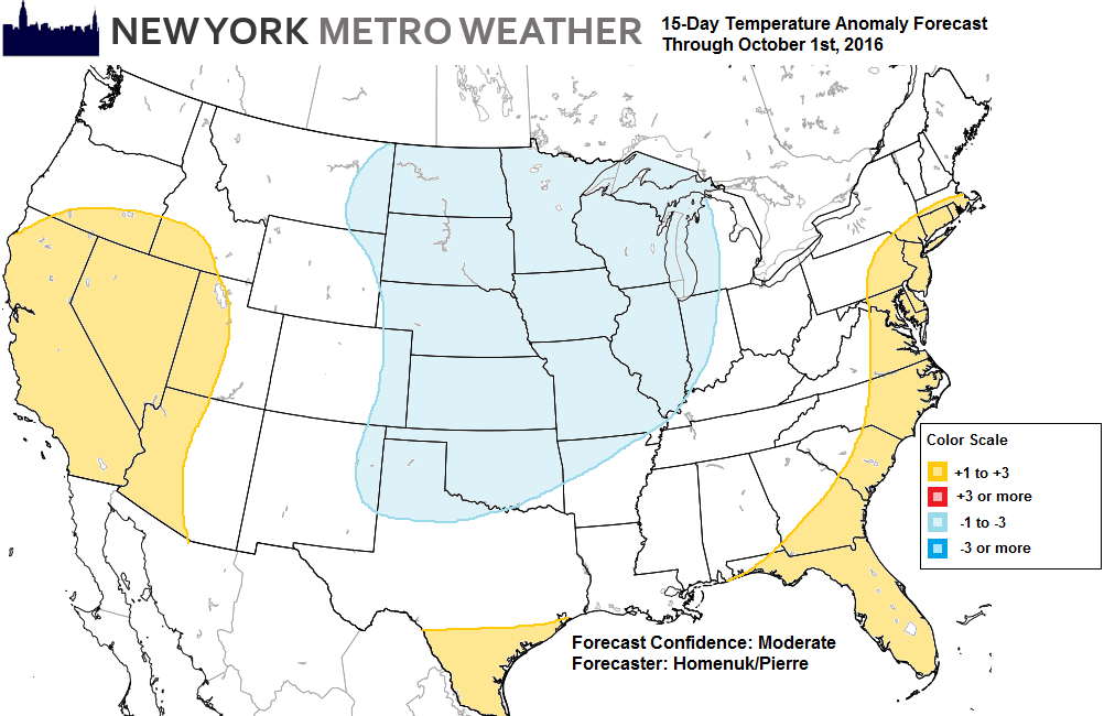
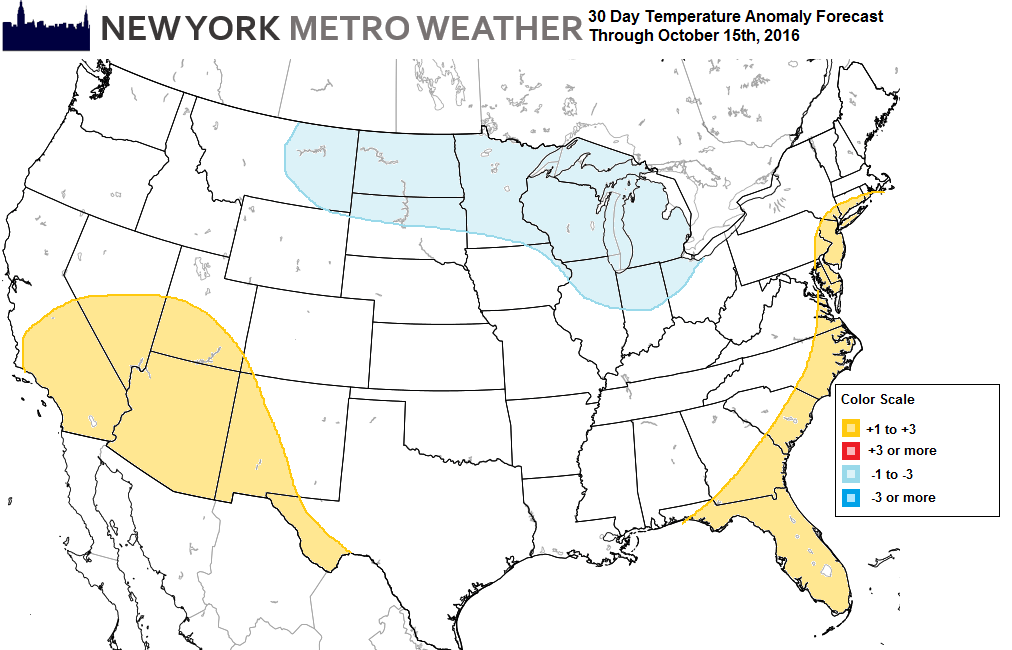
The pattern over the next few weeks, will resemble a weak negative ENSO/La Nina conditions with the MJO/tropical forcing over Western Hemisphere, during the Autumn. A large area of troughiness extending from a vortex over Alaska, to much Northeast Pacific, and Western US, will support more ridging during this period with above normal temperatures from the Eastern Rockies to the East Coast. Temperatures likely average most above normal over much of the Corn Belt, Central and Southern Plains, where the ridge most profound. While the East coast starts with temperatures closer to normal, early in the period. Along the west coast, the Pacific system embedded within troughiness, will supporting below normal temperatures.
The ridge will support precipitation drier than normal over from South New England back to South Texas. Models and ensemble have show deepening low moving to the Midwest next week. A strong southerly low-level jet with higher than normal precipitable water values, will support above normal rainfall over the Western Great Lakes region. A stronger system coming out of Pacific, will be bring above normal precipitation into Northwest United States, as well. Mostly in the form heavy rainfall. But the high elevations, may some of Northern Rockies may see some snowfall.
-MP