-2")
Unsettled conditions and temperature swings last into next week
Good evening and happy Friday!
Unfortunately the mild and clear conditions that were present just 24 hours ago have quickly faded. A few more rain chances will be possible over the next week with continued temperature swings!
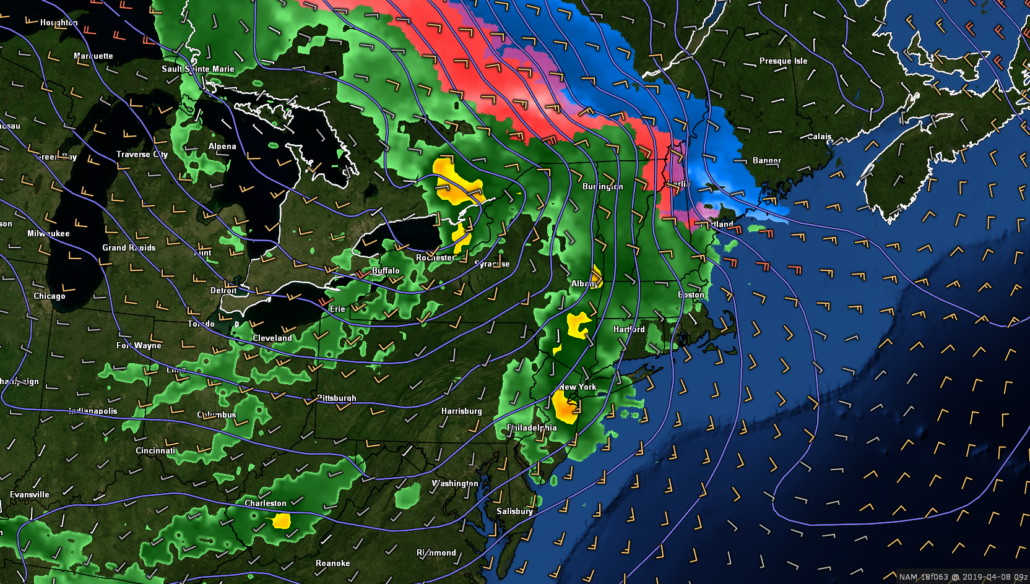
Today has been quite the dreary and dismal “Spring” day as a weak frontal system moved through the area. Light rain has been ongoing since the early morning hours, with some spots of sleet mixed in as well. Stubborn mid/low-level cold has remained entrenched over portions of the Northeast. This has allowed more sleet to mix in with the rain over the immediate New York City area than originally thought. Given the time of year and the overall light nature of the precip, the sleet has not been able to cause any significant impacts to travel. The combination of cool mid/lower temps and significant cloud cover really brought temperatures down since yesterday. Highs struggled to break into the lower 40’s across the NYC metro, with middle to upper 30’s elsewhere.
Conditions will continue to be rather raw and wet as we continue into the evening and overnight hours. Light to occasionally moderate rain is expected to last until after midnight, with a good chance of some sleet mixing in–especially for elevated locations off to the north and west of the immediate NYC area. Continued overcast and cool temperatures will keep lows tonight below normal. Expect lows to remain in the middle to upper 30’s across the entire area.
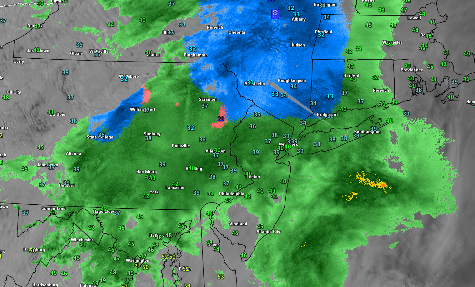
This evening’s latest regional radar/satellite/surface temp summary showing a rather cool and dreary day across the metro area
Conditions briefly improve just in time for the weekend
Things will likely start off at least partly cloudy with a stray shower or two early tomorrow morning (Saturday) as the weak frontal system exits off to our east. Conditions will then gradually improve towards the late morning and afternoon hours, giving way to mostly clear skies. Temperatures will also make a nice rebound tomorrow afternoon, with highs expected to reach into the lower to middle 60’s for the vast majority of the New York City Metro area. Calm and relatively mild conditions will continue into the late afternoon and evening hours, making for a much-improved day overall. Clear skies and dry conditions look to dominate the overnight hours, providing decent conditions for radiational cooling to occur. Expect lows tomorrow night to drop back down into the lower to middle 40’s for the entire area-which will be a few degrees below normal.
Sunday is shaping up to be another exceptional day with sunny and calm conditions right off the bat. High pressure will be located overhead during the day, with a mid level ridge positioned just off to the west. This mid level ridge will provide a period of southwesterly flow into the region, causing warmer temperatures to work into the Northeast. Highs will likely rise into the middle to upper 60’s across the entire NYC metro area, with some lower 70’s possible over portions of NE NJ and SE NY. Mostly sunny skies, warm temperatures, and light winds will make for another exceptional day over the area, so make sure to head outside and enjoy the day!
Clouds will then increase late in the day on Sunday and into the overnight hours as another frontal system works its way into the region. Some spotty showers will be possible, but these will likely hold off until after midnight.
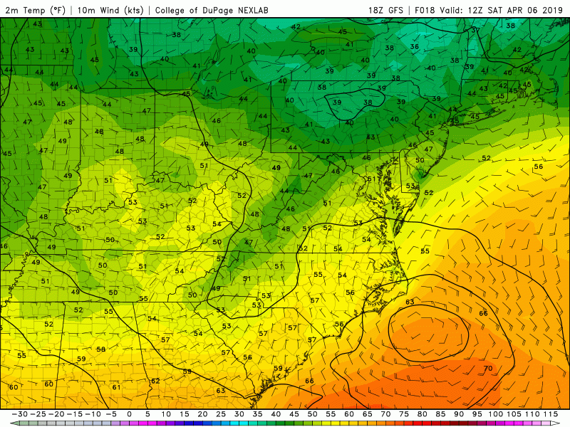
This evening’s GFS model showing a rather substantial rebound in temperatures later this weekend across the East
At least two more rain threats next week as temperatures continue to fluctuate
Periods of rain look likely during the first half of Monday as another frontal system moves through the Northeast. Temperatures may be able to quickly rebound as the front clears off to the east on Monday afternoon and westerly flow aloft takes hold. At this time it appears likely that highs will be able to get into the lower to middle 70’s, but there is a chance temperatures could rise into the middle to upper 70’s depending on the exact timing of the frontal system. Regardless, mild temperatures look likely through at least Tuesday. This cool shot will be accompanied by another chance at some showers late in the day on Tuesday and into the morning hours of Wednesday.
Computer model guidance has been locked in on another area of low pressure developing over the Plains during the middle of next week and slowly moving towards our area. While its way too early to be worried about the exact details, yet another period of rain appears possible Thursday/Friday with this system. Temperatures look to stay at or slightly below the climatological norm through the end of next week as an active storm track sets up over the Central/Eastern US.
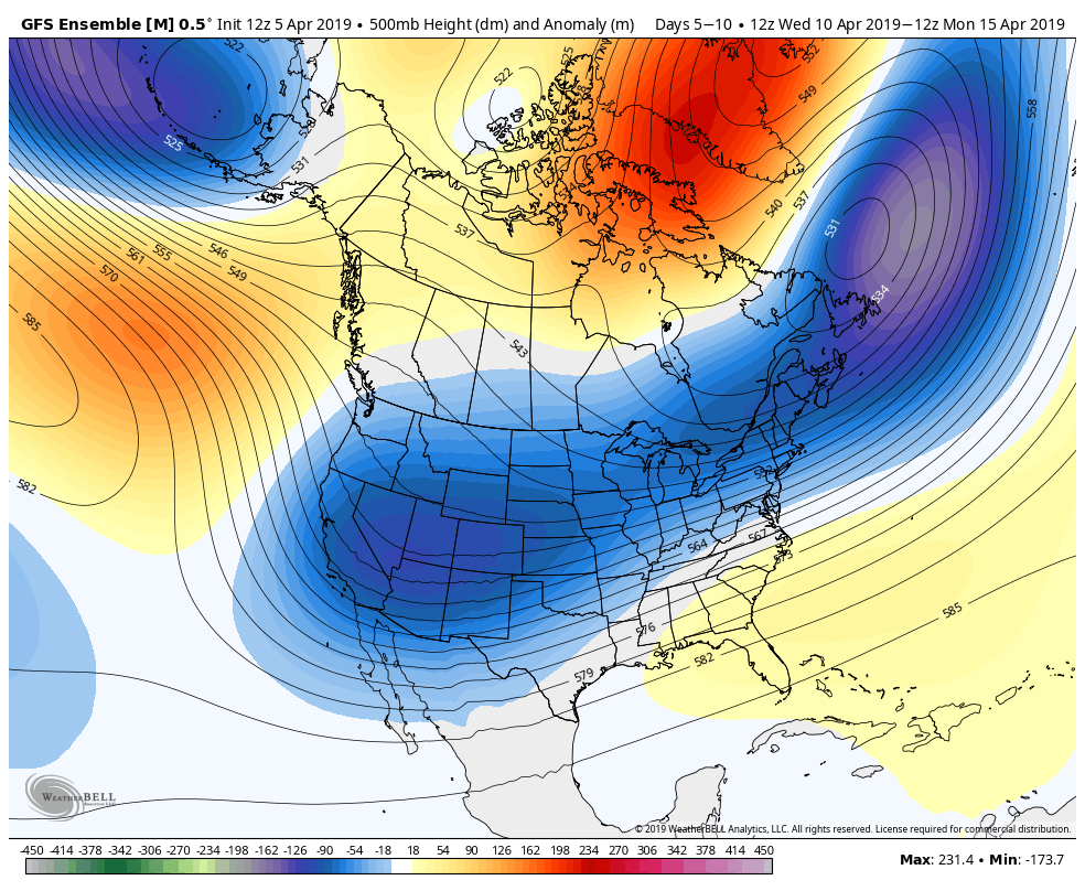
This afternoon’s GFS ensembles showing an upper level pattern favorable for continued unsettled conditions through the next week or so.
Thanks for reading and have a great weekend! We’ll have an update early next week!
-Steve Copertino
Leave a Reply
Want to join the discussion?Feel free to contribute!