-2")
Premium Blogroll
Forecast Discussions
Weekly Overview: Transitional weather, interior winter storm possible late week
It was dreary today with lots of cloud cover and spotty light rain and drizzle in some areas. High pressure is now moving out into the Atlantic, while low pressure from the Midwest tracks into Southeast Canada. This will allow for a warm front to lift further northward through the Northeast states this evening, with winds […]
Late week winter storm possible in interior New England
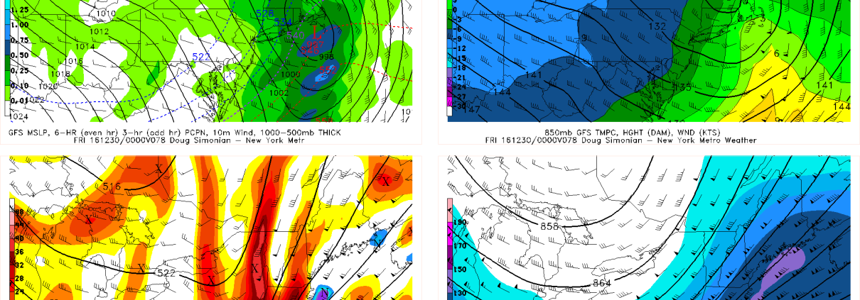
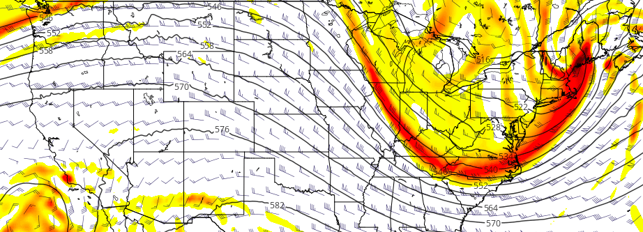
Amid a changing hemispheric pattern and active jet stream pattern, forecast models have begun to hone in on the potential for a late-week winter storm across New England, particularly interior locations. Despite the presence of a warm antecedent airmass and a relatively progressive-natured pattern (both of which will be discussed as mitigating factors below), the potential […]
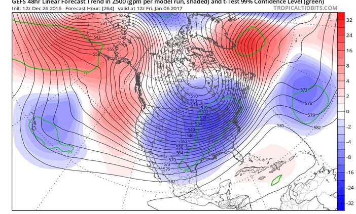
High latitude ridging, and the return of a colder pattern
Just a week ago, we spent time in our Public Threat Analysis speaking of about the return of a Southeast Ridge towards the end of December. Just 7 days later, we’ll be discussing the return of a colder, more active weather pattern as we move forward through the next 10 days and into early and […]
Local Observations


