-2")
Premium Blogroll
Forecast Discussions
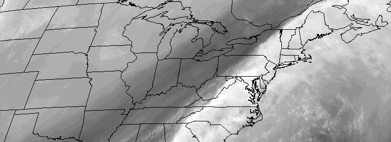
Premium: Friday AM snow potential hazards analysis
Forecast models have trended farther northwest — and stronger — with a low pressure system, which is forecast to develop on a frontal boundary off the East Coast from late Thursday into Friday. This is the same frontal boundary which is crossing the area this evening, and its eventual positioning offshore will have significant impacts […]
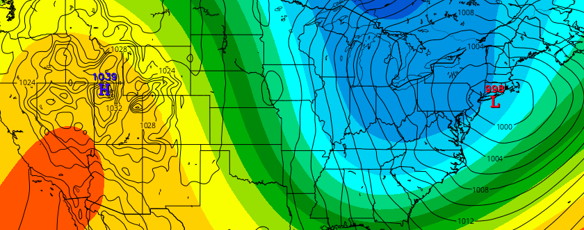
Winter returns with multiple threats next week
Temperatures will soar into the 50’s and 60’s during the day on Wednesday, as a strong low pressure system drives into the Great Lakes and eventually Southeast Canada. This will, undoubtedly, leave many wondering if winter has taken its one and only stand with the blizzard at the end of January. Unbeknownst to most, however, is […]
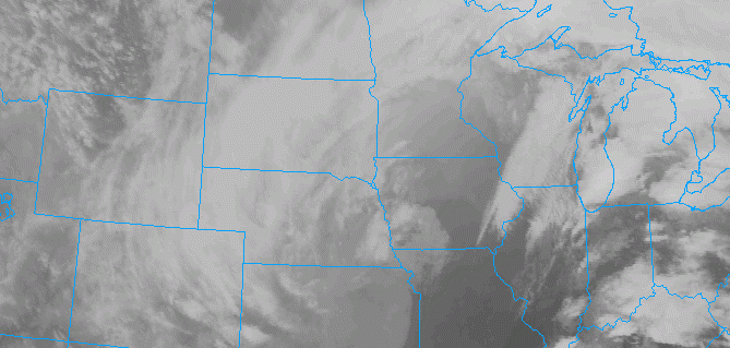
Heavy Showers and Localized Flooding Possible Wednesday
A deep low is producing blizzard conditions over the Northern Plains and severe weather over the Lower Mississippi River Valley today. This low will track into the Great Lakes and send a frontal system through the area on Wednesday, bringing the potential for heavy rainfall and some flooding in the local region. A warm front […]
Local Observations


