-2")
Heavy Showers and Localized Flooding Possible Wednesday
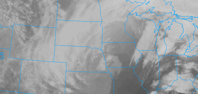
A deep low is producing blizzard conditions over the Northern Plains and severe weather over the Lower Mississippi River Valley today. This low will track into the Great Lakes and send a frontal system through the area on Wednesday, bringing the potential for heavy rainfall and some flooding in the local region.
A warm front will push slowly northward through the region during the day tomorrow. This will cause clouds to increase and areas of fog and drizzle to develop late tonight. Some scattered showers are possible early tomorrow morning and the midday hours tomorrow, especially northwest of New York City. Showers will likely become more numerous and widespread over the region later tomorrow afternoon and evening, via a strong cold front approaching the region. Some elevated instability may even support an isolated thunderstorm.
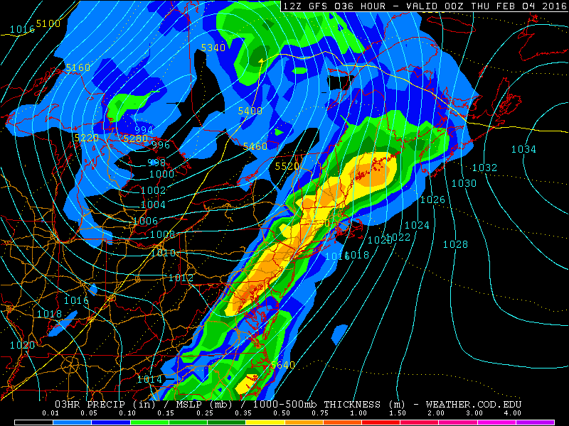
The GFS model showing heavy showers and possible thunderstorms spreading over region tomorrow evening (NEXLAB).
Showers or an isolated thunderstorm could contain heavy downpours, especially during the late afternoon and evening hours Wednesday. Precipitable water values reaching between 1.40″ to 1.70″ could support rainfall totals of 1″-2″ in parts of the region. This rainfall combined with snow melt could cause localized flooding in low-lying or poor drainage areas. There is also the potential for some small streams or rivers to exceed their banks. A flash flood watch has been issued by the National Weather Service for Central and Southwest New Jersey.
High winds will also be a threat with a strengthening southerly low-level jet over the region. Winds at 925mb (2500 ft) will between 60kt to 70kts ahead of a cold front late tomorrow afternoon and evening. A stout low-level inversion on model soundings is forecast to prevent much of these winds from mixing down to surface. However, an isolated strong wind gust over 40mph is possible with heavier showers or convection, as these can sometimes override inversions.
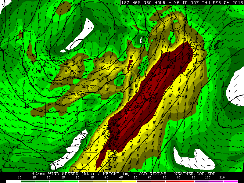
The NAM showing winds 60-70kt at 925mb (2500 ft) tomorrow evening over NYC metro area (NEXLAB).
Despite cloudcover, the strong southerly jet will help temperatures reach at least the middle to upper 50s on Wednesday. Temperatures 60 degrees or higher are possible, especially over Central and Southern New Jersey. Record high temperatures tomorrow are in the middle 60s.
Showers will taper off later, and skies will clear later tomorrow night as the cold front shifts east of the region. A wave of low pressure developing along this front will stay mostly south of the region. Temperatures will be near seasonable levels with fair weather for the rest of week.