-2")
Late afternoon temperature surge today, 90s tomorrow, thunderstorms Thursday
Good afternoon! As I write this article, most of the region is under mostly cloudy skies with humid conditions, as dewpoints have surged to around 70 degrees. Temperatures are primarily in the upper 70s to around 80. However, over the next few hours, temperatures should rapidly surge into the mid and upper 80s. An isolated hot spot could even hit 90.
Currently, there are showers moving through Connecticut, associated with a warm front that surged to our north. This warm frontal passage is what has brought us warmer temperatures with increasing humidity. As that system moves off the coast, skies will begin to clear from southwest to northeast. Considering how warm our 850mb temperatures are, the sunshine will allow for mixing through the surface, which leads to compression and warmth.
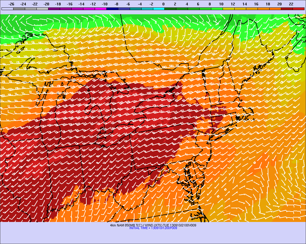
850mb temperatures are expected to spike to between 16-18 Celsius later this afternoon. This could yield surface temperatures in the upper 80s.
Above is a map of the projected 850mb temperatures, valid for 4 p.m. this afternoon. The warm front helped to spike them up to between 16-18 Celsius. On a sunny day, it is typical to add between 13 and 15 Celsius during the summer months to the 850mb temperature, to predict the high temperature at the surface. For example, if the current 850mb temperature is 17 Celsius, and enough sunshine has occurred, or is expected to occur, then adding 15 Celsius to that yields 32 Celsius — translating to 89.6 degrees Fahrenheit at the surface. The basic explanation for doing this is that if you have enough sunshine, an air parcel at 850mb can be mixed with the surface, and compress and warm dry adiabatically — through “sinking” to the surface. Without sunshine and mixing, these parcels cannot “sink” to the surface, and thus will not warm via compression. But with sunshine later this afternoon, many areas can expect mid to upper 80s, with perhaps an isolated spot hitting 90 degrees!