Coastal storm could spoil pleasant weather week

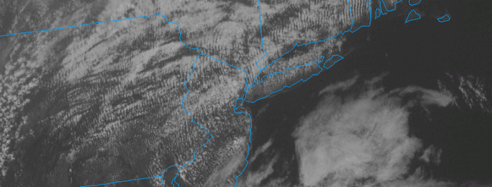
In a post yesterday, we touched on the fact that a few forecast models were honing in on the potential development of a coastal storm later this week. Those models continue to harp on that idea — and others have hopped on the bandwagon over the last 12 hours. The storm looks to develop as a result of a mid level disturbance, which will be shifting eastward amid a generally quiet mid level pattern — as a ridge builds over the Eastern United States. But the disturbance has a mind of its own, and it will shift from the Tennessee Valley to a position off the East Coast on Thursday.

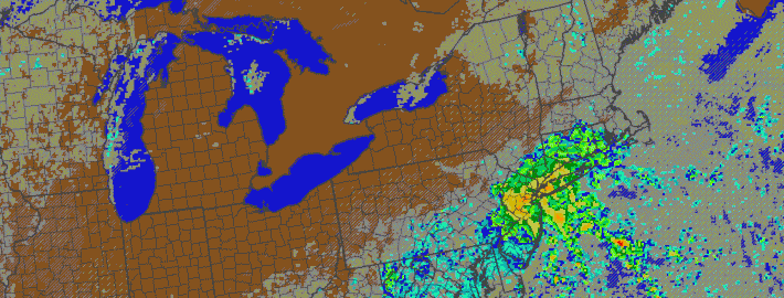
A surface low pressure is expected to develop from Wednesday into Thursday — all forecast models agree on that. The exact track will obviously have big impacts on our forecast. Newer forecast models have continued the trend of strengthening the storm, and tracking the center of low pressure very close to the Mid-Atlantic coast. With a slug of moisture surging northward near the coast, this would mean increasing potential for moderate to heavy rain in our area on Thursday.

Read more

PM Update: Beautiful weather continues, autumn arrives

Monday was one of the most beautiful weather-days in recent memory and, fittingly, autumn will officially arrive tonight at 10:30pm. Temperatures on Monday reached only into the upper 60’s (lower 70’s in some spots) and the low humidity kept things very comfortable. There was even a bit of a chill in the air at times, as a dry west-northwesterly breeze blew during the afternoon. Autumn will arrive officially tonight just shortly after 10:30pm Eastern.

Sunset tonight will be due west — as the autumnal equinox occurs. Tonight, the sun can be seen a “zenith” before its rays shift into the southern hemisphere for the rest of the year. That means that starting tomorrow, until the middle of winter, the sun will continue to set farther and farther to the south on the horizon. And yes, it also means we’ll be losing much more daylight each day moving forward. In fact, by this time next month, we will have lost a full two hours of daylight at a pace of 2 minutes and 40 seconds lost per day.

Read more

76 years ago, Category 3 hurricane slammed Long Island

For anybody who lives on Long Island or in New England, the Great Hurricane of 1938 will forever be remembered as the “worst of the worst”. Killing hundreds of people, destroying 57,000 homes and totaling $306 million in damages (~40B in 2014), the storm was the strongest and costliest storm to ever strike Long Island and New England. Damage from the storm, on trees and buildings, was still visible in the early to mid 1950’s, almost 20 years after the storm made landfall.

The storm’s origins can be tracked back to ship data from the Eastern Atlantic ocean, where the storm was first observed near the Cape Verde Islands on September 9th, 1938. The storm then, presumably, tracked west-northwestward while organizing. Data is sparse, but not incomplete — the storm reemerges in more dense data near the Bahamas on September 20th, 1938. At this point, the storm is estimated to have attained Category 5 status — with maximum sustained winds over 140 miles per hour. But it was here that the trouble began, for those in the Northeastern United States. The storm would never actually strike the Bahamas. Instead, it would begin veering to the north, on the periphery of a trough to its east.

Read more

Large high pressure may bring prolonged pleasant weather

The pattern over the past few weeks has been, without doubt, a progressive and active one. There haven’t been any dominant areas of high or low pressure in our area, but instead the pattern has kept moving with intermittent periods of troughing and ridging as well as multiple cold fronts. If medium range forecast models are reasonably accurate, that’s about to change.

Models are in good agreement that a massive trough will develop over the Western United States during the mid to latter part of the  next work week. With the mid level jet stream recessed into Northern Canada and no real high latitude blocking to speak of over the Atlantic,  a ridge of high pressure will build over the East. Some forecast models even suggest the high pressure could get as strong as 1035mb — totally dominating the pattern over the Northeast.

What does this mean for us? Well, first, we’ll be in a transition period. The ridge will develop eventually, as long as model guidance isn’t totally out to lunch with the pattern progression. But first, we’ll deal with a cold front late Sunday into Monday and a few mid level perturbations early next week. Afterward, it means that we’ll likely enter a period of prolonged pleasant weather.

Read more