Strong storms possible with big cold front Thursday

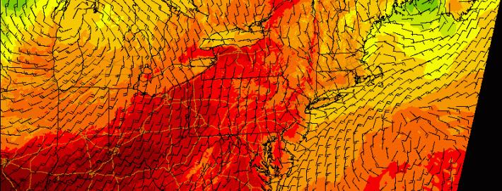
A significant cold front moving through the Central United States will approach the region late on Thursday evening, bringing a wind shift and drop in temperatures both aloft and at the surface. The cold front is associated with a major mid level disturbance, which will shift from the North Central US into Southeastern Canada. As the front shifts through our region, moderate instability and favorable wind fields could support the development of strong/severe thunderstorms.

The Storm Prediction Center has placed parts of the area in a Slight Risk for severe thunderstorms on Thursday afternoon and evening, citing a risk for strong winds. In addition to the winds, unseasonably high precipitable water could support heavy rain and flooding in any storms that shift through the area Thursday evening. But the severe weather threat isn’t as straightforward as it may seem.

Read more

Morning roundup: More sun, a bit warmer today

Onshore winds and cooler temperatures made Tuesday a bit of a dreary day, especially in the evening. Although a developing coastal storm remained offshore, some bands from the system rotated inland and brought drizzle and sprinkles to the coastal areas of New Jersey and New York Tuesday Night. Decreasing moisture in multiple levels of the atmosphere on Wednesday will lead to improving conditions in much of the area, although clouds and a shower cannot be ruled out. Warmer temperatures are expected, in general, with highs in the 80’s.

A developing storm system in the Central United States will bring changing weather to our area by Thursday. Winds will shift from east/northeast to southerly by Thursday afternoon, ushering in much warmer air and allowing for an increase in humidity. A strong cold front eventually will approach the area by Thursday evening.

Read more

PM Update: Dreary, coastal storm passes by

Rounds of clouds with sprinkles and showers will rotate inland from the Western Atlantic ocean this afternoon and evening, as a coastal storm system passes off the shores of the Mid Atlantic and Northeast states. Ultimately, the coastal storm will be shunted off to the north and east, and the westward extent of the precipitation shield limited by westward mid and upper level winds. Still, enough showers and sprinkles will rotate inland tonight to keep things dreary and cool. It’ll be a little less dreary inland — and more dreary near the coast. With a not-so-great evening on the way (weather wise, at least) here are some highlights on our weather and links from around the world of meteorology today:

  • The onshore flow will continue tonight. Along with the aforementioned showers and drizzle, clouds with gusty winds (especially near the shores) are expected. Surf will be rough as well. If you’re headed out on the waters, be careful.
  • A major change in the weather is expected by Thursday, as a significant system organizes in the Central US and moves into Canada. This will bring the return of southerly winds to our area by Thursday — and warmer temperatures.
  • As a major cold front approaches our area on Thursday evening, showers and storms are expected — some may be strong or severe. The SPC has placed our area in a 5% risk for severe storms. The highest threat currently looks likely to be west of NYC.
  • The iPhone 6 was announced today — and it will include a barometer! This means we can all launch our phones up on weather balloons now, and drop them into Hurricanes for data!

Have an awesome Tuesday evening. Image courtesy Dave Dicello.

Morning roundup: Unsettled, coastal storm slips by

Temperatures in the 50’s and 60’s made this Tuesday morning feel extra Autumn-like, despite easterly winds and an onshore flow. Clouds were more prevalent over southern/eastern areas of New Jersey and Long Island. The marine air will continue pushing westward today, and the gusty winds and higher surf will return to the area shores once again. The clouds and showers won’t necessarily be widespread, but they’ll certainly put a bit of a damper on the day.

A developing coastal storm, owing to a mid level disturbance passing near the East Coast, will bring a period of rain very close to the New Jersey and Long Island coasts on Tuesday morning and afternoon. But westerly winds pressing on the system aloft will keep the precipitation from spreading inland. Instead, breaks in the clouds will be just as common as scattered showers throughout the area — and so while Tuesday won’t be sunny and bright, it won’t necessarily be a washout either.

Read more