-2")
November 2015 Outlook: Above Average Temperatures Likely
It’s that time of Autumn again, where weather enthusiasts start looking into the longer range forecasts for telleconnections, pattern changes, and the first chance of snowfall; while everyone else who dreads winter will start shopping for new coats, boots and shovels. For now, it’s snow haters rejoice: It appears there will be very little wintry weather through most, if not all, of November.
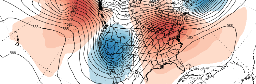
Currently the medium-range and long-range guidance shows a significant pattern change that will support prolonged above average temperatures for the Eastern United States to begin November. The Arctic Oscillation (AO) will be turning strongly positive next week, with the polar vortex reorganizing over the Arctic circle. The Pacific North American Oscillation (PNA) will be trending negative with a trough digging into Western US, which will pump a ridge over the ridge over the Eastern US. Downsteam, this will cause a southwest flow with temperatures reaching the 60s and 70s again in the local area next week.
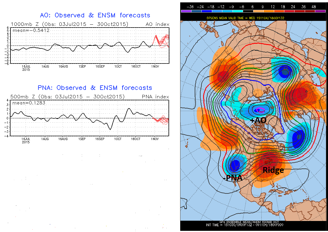
NCEP/GFS ensemble mean forecasts show -AO and -PNA patterns support the ridge over Eastern US for the first week of November
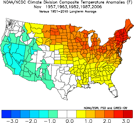
Model guidance has significant synoptic support through the atmospheric pattern evolution. As you might already be aware, strong El Nino conditions are present in the tropical Pacific. The Quasi-Biennial Oscillation (QBO) is also in a westerly phase (+QBO). These are equatorial zonal winds in the stratosphere that oscillate between easterly to westerly in a quasi-period averaging between 12 to 25 months. The easterly phase (-QBO) tends to transport more warm air from tropics moving towards the North Pole, causing weakening to the Stratospheric Polar Vortex. The westerly phase (+QBO) doesn’t often have this transport of warm air and supports a Stronger Stratospheric Polar Vortex. Below is a mean composite of temperature anomalies during the past moderate-strong El Nino years and a moderate +QBO in November. The composite shows well above average temperatures for Northern Plains, Northeast and Mid-Atlantic. It also shows below average temperatures in the West — particularly the Southwest — which matches the above GFS ensemble forecast quite well.
Past El Nino Novembers with a moderately +QBO:
1957: +10.11
1963: +8.87
1982: +9.51
1987: +9.23
2006: +10.10
In addition, model forecasts show a rapidly strengthening stratospheric polar vortex through November. This makes it difficult for above normal heights or a ridge to build back over the north pole region — which would cause the AO to fall into a more negative phase. 10 hPa temperatures are currently below average and forecast to remain below average into the first 8-10 days of November. Zonal winds are westerly in highest latitudes and running above average at 10 hPa. For a sudden stratospheric warming event, you want see the opposite trend–more warming and easterly zonal winds at 10 hPa. It is natural and common for the polar vortex to strengthen as we head towards the winter solstice. But with the QBO winds in a westerly phase, a significant stratospheric warming event is less likely to occur this early in the season.
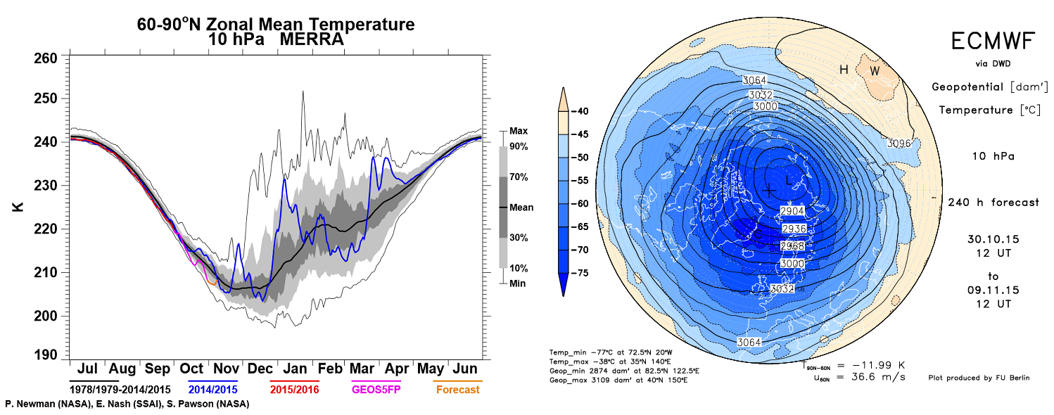
The left image shows 10hpa temps forecast to remain below average. The right image, is the ECMWF forecast showing a strong 10 hPa polar vortex on November 9th
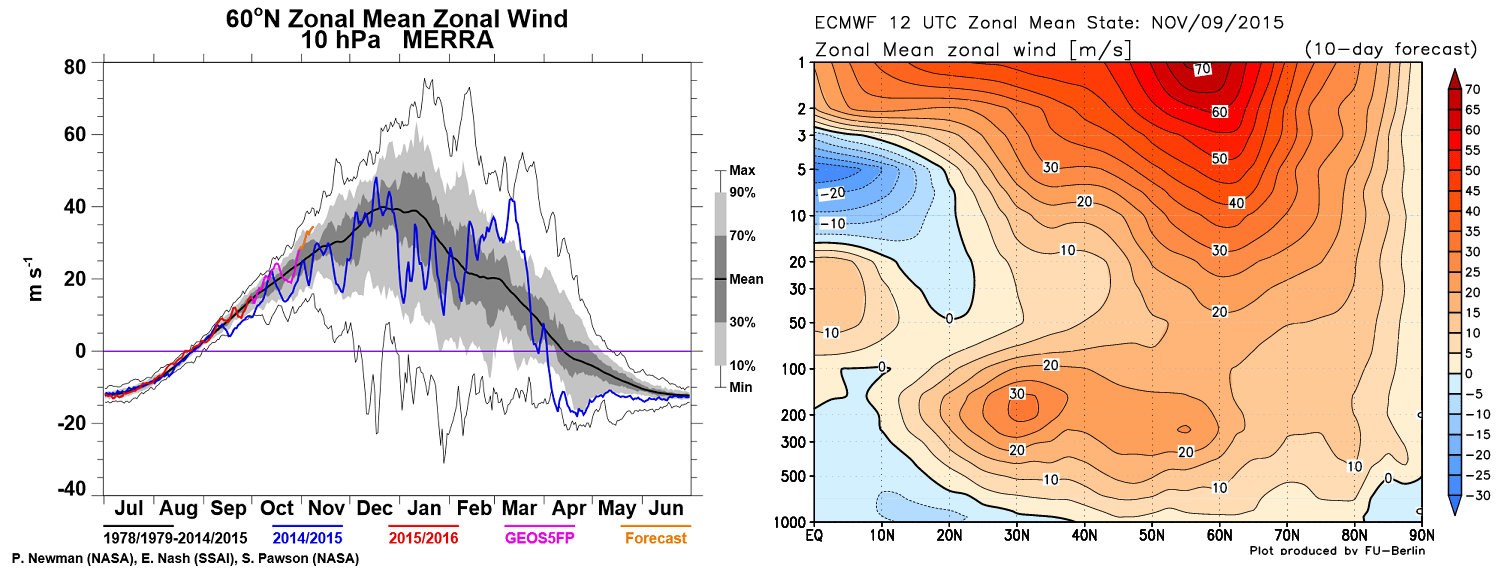
The left image shows 10 hPa zonal winds shows strengthening westerly winds, above average. The right image, is the ECMWF model forecast showing a strong westerly winds in high latitudes on November 9th
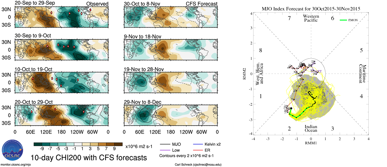
Finally, the Madden Julian Oscillation (MJO). This is a wave associated with deep convection that propagates eastward in the tropics, from the Indian Ocean through the Pacific into the shores of Peru. This will likely have a major influence on the weather pattern over North America next month. Strong tropical forcing in the upper-levels is forecast will be over the Indian Ocean for the first two weeks of November. The MJO wave is likely to propagate slowly into phase 3. The three monthly composites for the MJO in both those phases below show above average temperatures with November in the center.
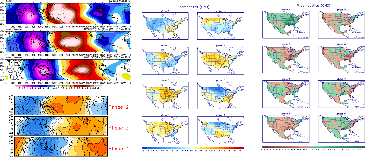
On the Roundy forecast top left 200mb Velocity Potential (tropical forcing) for weeks 1 and 2. Bottom left composite shows anomalies for each MJO phase. Right composites show temperature and precipitation anomalies for each MJO phase.
As we get into the long range, the forecast becomes foggier, as usual. However, the latest weekly ensemble guidance today, shows a continuation of above average temperatures with similar pattern into the second half of November. The CFS and Euro weeklies that go out to 30-45 days, suggest the tropical forcing will still be in the Indian Ocean, somewhere between phases 2 and 3 by the end November or early December. If the MJO is in phase 2, it could help temperatures drop closer to average late in the month.
Currently, we believe November will likely feature above average to perhaps well above average temperatures with a positive AO and negative PNA pattern, for the majority of month. We are more confident that the first half of November will feature prolonged mild temperatures, while temperatures could trend closer to average in the second half of the month, but even then are still likely to be above average.
What does this mean for all this upcoming winter? Stay tuned for our winter forecast coming out on Tuesday!