-2")
Long Range: Winter is Coming…January Pattern Change Details
So far this winter has been mild here with historic warmth. We released a previous premium article stating the reasons why. This is still in much dismay of snow-lovers, while a blessing to many others. But we’ve been discussing a pattern change here for January for a while, and now it appears that some parts of that pattern change are coming together a little sooner than we thought. Some of the climate patterns we discussed are going through major changes.
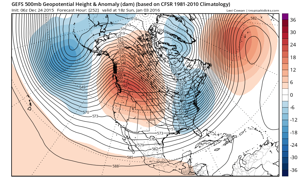
The pattern change will begin with the development of a large ridge over Scandinavia next week. This ridge builds into a very strong, anomalous ridge over the Barents/Kara Sea next weekend. Meanwhile a deep low/trough near the Aleutians causes another large ridge develop over Western Canada. Both ridges cause the polar vortex over the high-latitudes to begin elongating or splitting, from northwest to southeast. These changes will cause the AO to fall into the negative phase and the PNA to rise into the positive phase. This process results in a large trough with seasonably cold temperatures over the Eastern US shortly after New Year’s Day.
The GEFS showing a very strong, anomalous ridge near Barents/Kara Sea, another large ridge over Western Canada, and a deep trough over the Eastern US for Jan 2nd (PSU E-Wall).
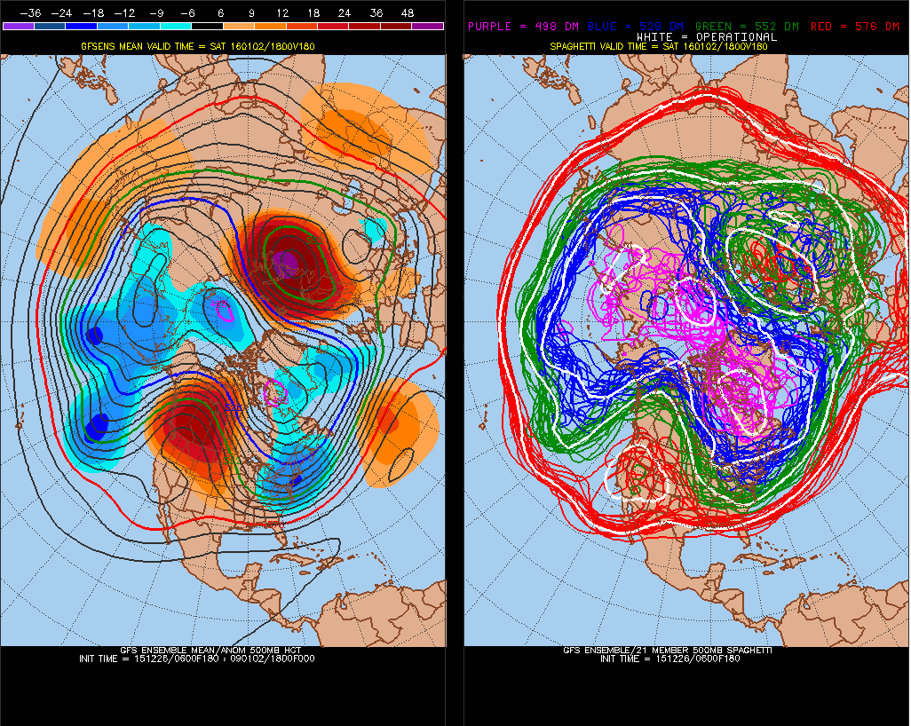
Longer-range guidance shows more high-latitude blocking developing towards the middle of January, with positive 500mb height anomalies from both aforementioned ridges building over the North Pole, Alaska, and Greenland. This will cause the EPO and/or NAO to fall into the negative phase and the polar vortex at 500mb to drop south into the Hudson Bay. If correct, this pattern will be more conducive to producing more sustained below normal temperatures and significant snowstorms for the Eastern United States.
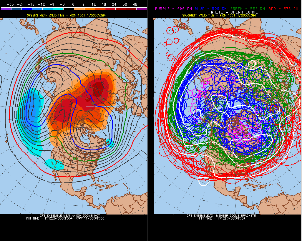
The GEFS showing high-lattitude blocking towards mid-January, increasing the potential for sustained cold and winter storms over the Eastern United States (PSU E-Wall).
More support for the sustained cold and winter storms in January will be the MJO propagating into phase 7, then weakening in phase 8 . Tropical forcing will be more concentrated near the International Dateline. Previously, it was spread over the Indian Ocean and the Eastern Pacific for much of November and December. During El Nino winters, these phases typically support a low or trough around the Aleutian Islands and a ridge to build over the West Coast of North America and high-latitude blocking. The subtropical jet also typically becomes more active during these phases.
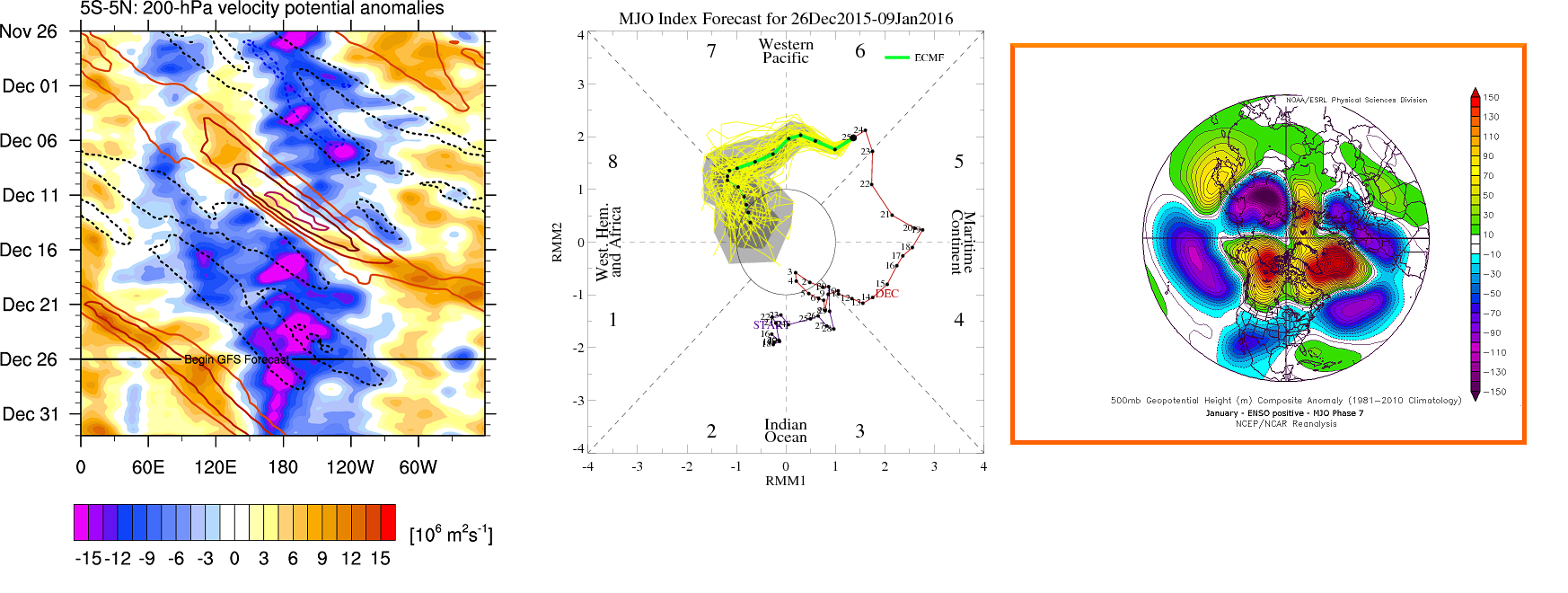
Left image: GFS forecast 200mb Velocity Potential Anomalies. Middle Image: ECMWF ensemble MJO forecast in phase 7. Right Image: 500mb mean anomaly composite for MJO phase 7 in January, during positive ENSO (Image Credits: Micheal J. Ventrice, PhD, CPC, MeteoNetwork)
The model and ensemble guidance has also been showing the stratospheric polar vortex weakening, splitting or being displaced at various levels. Strong ridging over the Barents/Kara Sea and tropical forcing centered near the Dateline causes waves to propagate upward from the troposphere into stratosphere. These type of polar vortex disruptions or changes in tropospheric pattern commonly precede a Sudden Stratospheric Warming event, which we still anticipate will occur later in January. But there will be pattern changes to colder weather long before it.
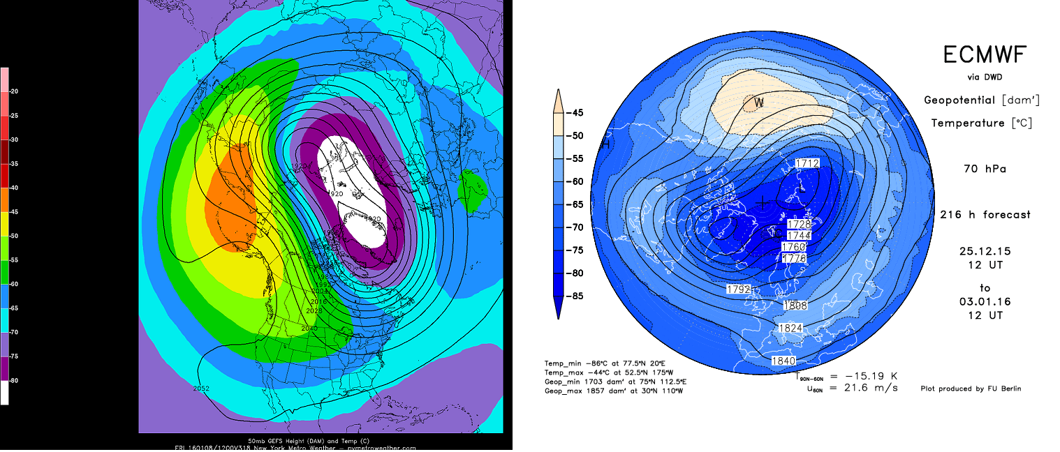
The GEFS and ECMWF showing 50mb and 70mb PV partial splits and displacement in January
In conclusion, the pattern that has supported well-above average and record high temperatures is changing for January. Winter is coming this season and it might be with a vengeance. While El Nino remains very strong, there are enough changes occurring with the stratospheric polar vortex and tropical forcing in the Pacific to support major changes to the Northern Hemispheric Pattern.
At this time, we expect at least more seasonably wintry weather to be the rule next month. The first week to ten days of January may be a transition period with only light snow events possible, before the pattern becomes more conducive for sustained cold and bigger snow threats — the cold and snow could be even more prevalent in February with El Nino and +QBO influences likely to weaken somewhat. However, if the high-latitude blocking continues to develop by the middle of January as some of the latest ensemble guidance suggests, there could be more severe winter weather impacts in store for the second half this winter.