-2")
Colder air is on the way, but how about the snow?
Winter has finally arrived. Despite potentially record breaking warmth for one day this weekend (Sunday), and the return of rain this weekend as well, we will continue to transition into a colder pattern with an arctic frontal passage on Monday. The atmospheric global circulation pattern is trending much more favorably for winter weather lovers — with teleconnections favoring cold being dislodged into the Northern 1/3 of the United States. With high latitude blocking also in the forecast on all medium range models — the question now becomes: What about the snow?
We’re entering a classic — and sustained — Negative NAO period
A traditional negative NAO (North Atlantic Oscillation) seems very likely to develop by the middle of January. This is a feature we haven’t observed with much frequency or intensity over the past few winters. Instead, the past two seasons, we’ve seen -EPO and -AO patterns, with blocking over the Western part of North America and Arctic. Often times, in the past two years, a ridge over Alaska and Canada would team up with another ridge over Scandinavia (often referred to as a “Ridge Bridge” over the North Pole). This would force the polar vortex to be dislodged farther south over Hudson Bay and Southeast Canada at times, with a very cold weather pattern.
However, medium range models are in good agreement that the middle of this January will feature a classic -NAO pattern. This features a large ridge on top of Greenland, westward toward the Davis Straight and sometimes the Arctic Circle. Why is this important? This ridging often helps to move the polar vortex into Eastern Canada, but also allows troughs to slow down and amplify near the east coast.
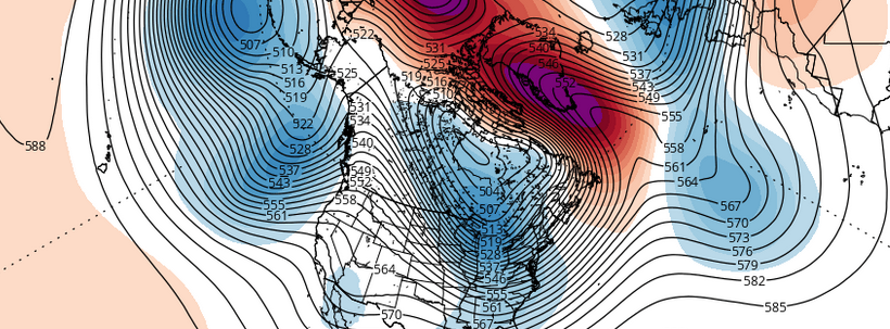
The GEFS showing classic -NAO developing in the medium-range (January 12-14th ) with 500mb mean heights and highly positive anomalies building west into Greenland with the Polar Vortex to south, over Hudson Bay and Southeast Canada and trough going negative over the Northeast. Some model runs have suggest an Alberta clipper or a coastal storm developing for this time frame.
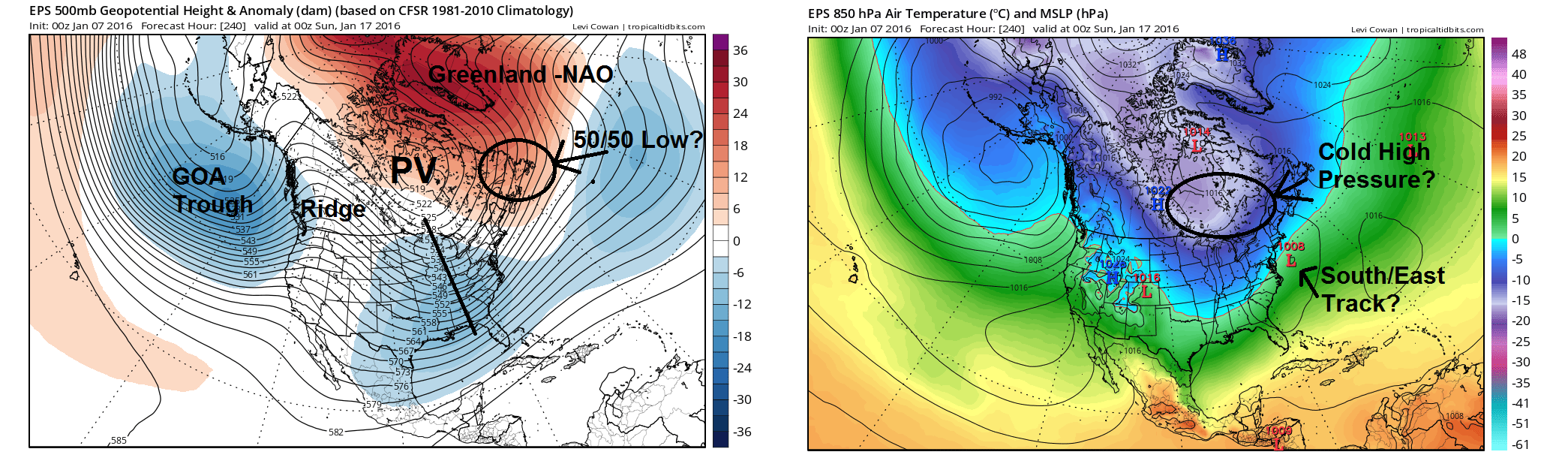
A polar vortex moving into Canada…but where?
Medium range forecast model guidance — including ensembles — agree that the polar vortex will be dislodged toward a vicinity from Hudson Bay or Southeast Canada. In general, this supports a confluence zone over the Great Lakes and Northern New England. Exactly how this polar vortex is positioned and oriented will be critical during the next few weeks. Not surprisingly, forecast model guidance is very inconsistent with its behavior.
If the polar vortex is oriented more north to south over Hudson’s Bay, that would support a deep trough axis over the Mississippi River Valley and the confluence zone would lift northwest into Southeast Canada. This will result in the antecedent cold airmass quickly modifying — in other words, any storm system moving our way would likely take a more amplified track or hug the coastal plain. This scenario typically supports more liquid than frozen precipitation for the coastal plain and major cites along the I-95 corridor.
However, if the polar vortex is more elongated west to east over Southeast Canada or splits into another upper-level low near Newfoundland, otherwise known as a 50/50 low, this would support the confluence zone to remain longer over the Northeast, before a winter storm arrives. This scenario typically supports more significant snowfall for the I-95 corridor and coastal plain. Most of our major or historic snowstorms of the past featured an upper-level low or trough over Southeast Canada, and cold high pressure over centered over Ontario or Southern Quebec.
The Euro Ensemble Mean showing a potential winter storm for the January 16th-20th period. Several favorable features are on the map. Biggest uncertainty is the presence of a 50/50 low, a cold high over Southeast Canada, and the exact low track. These factors will likely play a large role in determining whether we see major snowstorm, during this time frame, especially for the I-95 corridor.
West Coast Ridge and Split Flow?
Juxtaposed with all of these other hemispheric features, ensembles guidance shows a large ridge over Western Canada and an active subtropical jetstream. This what we call a “split flow” and is very typical of El Nino winter. This pattern can be favorable for major winter storms over Eastern United States, but the amplitude and placement of the ridge just prior to a storm threat will be important.
Medium range guidance indicates the mean trough over Gulf of Alaska will remain far enough west to maintain a strong ridge over Western Canada in the 500mb height field. However, the timing of Pacific storm systems and the West Coast ridge placement is subject to large changes as we get closer — so confidence in these features will have to be gained as we approach any event.
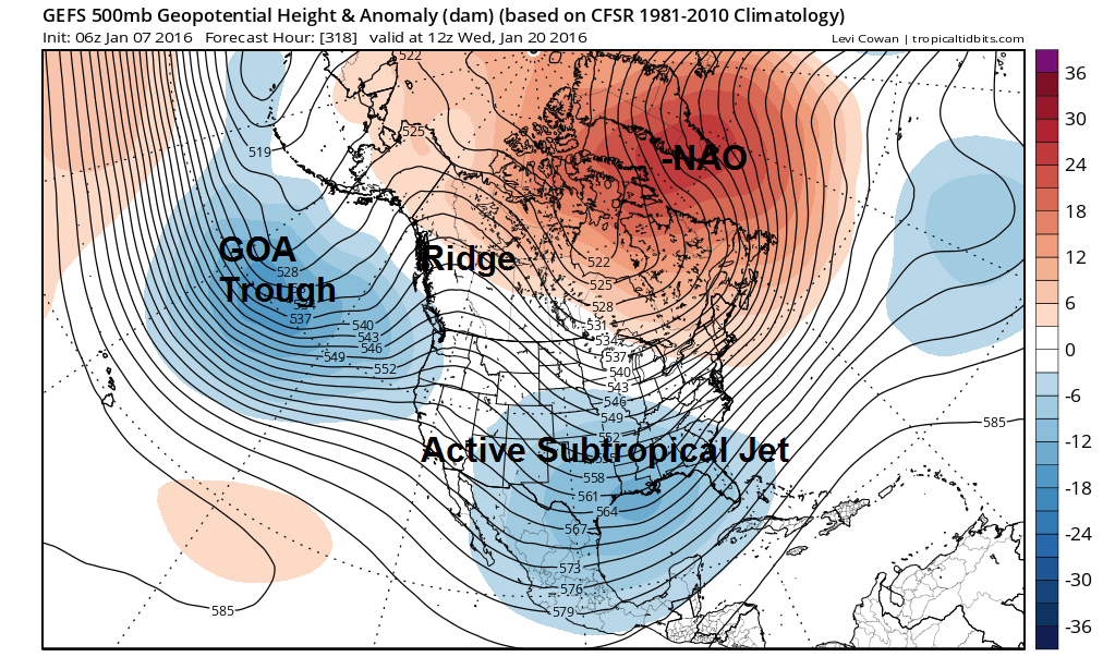
The GEFS showing a split flow with a ridge over Alaska/Western Canada and active subtropical jet and polar jet running across. If correct, this could support more winter storm threats after January 20th
The bottom line of it
Here’s the deal: It is becoming increasingly apparent that the atmospheric pattern will become much more conducive for both cold and snow over the next few weeks than it has been at any point this winter. Hemispherically, many of the pieces we “search for” when trying to scope out cold and snowy periods in our area seem to be there. The combination of a -NAO ridge, Arctic Blocking, a ridge on the west coast, and a subtropical jetstream to supply moisture can produce some very large snowstorms in the Northeast United States.
That being said, uncertainty is still extremely high. The period which is expected to be favorable for cold and snow is still a week or more away, and individual threats are still extremely “blurry” on forecast models. As it stands, ensembles are focusing in on a period between January 16th and 20th for our first “potential”, but watching how this evolves over the next several days will be most important.
Article written and edited by Miguel Pierre and John Homenuk.