-2")
Premium: Warmer than normal temperatures by late May
The news many have awaited for several weeks is finally here: We are forecasting the return of above average temperatures by the end of May. For the past few weeks, the hemispheric pattern has been stuck in a bit of a rut. High latitude blocking has maintained its control over the pattern, on both the Pacific and the Atlantic sides, forcing the development of anomalous cutoff lows and troughs into the Northern 1/3 of the United States. Colder than normal air with unsettled weather has been the dominant sensible weather in our area.
The transition out of this pattern is already underway. While high latitude blocking on the Pacific side (a -EPO) will again flex its muscles late this week, it will be more of a parting shot than anything else. An upper level low will form, as a response to the -EPO ridging, and push into the Great Lakes. But its presence will be mainly progressive, as a front swings through our area and the upper level trough elongates and moves to our northeast.
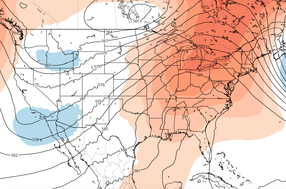
GFS model showing a developing ridge in the Eastern US with toughness over the West Coast.
The hemispheric pattern then begins to undergo more significant changes. Ridging from the Western USA coast into British Columbia, which had been partially responsible for our unsettled weather (as mentioned earlier) is very likely to be replaced by troughiness as a pattern reversal and wave-break occurs. This is more affectionately known as a -PNA pattern, with a broad overall trough on the Western USA coast toward the Rockies.
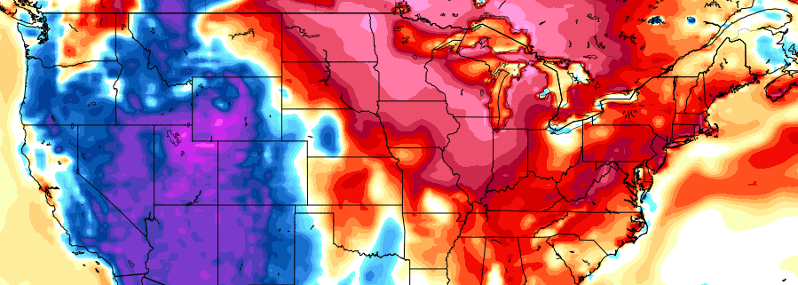
These troughs on the Western USA coast are, more often than not, associated with building ridges to their east, from the Central Plains toward the Ohio Valley and Eastern United States. Above normal temperatures often surge eastward as well, with a more southwesterly flow developing in the aforementioned areas. Forecast model and ensemble guidance, not surprisingly, have begun to hint at the warmup by the tail end of the month of May.
The ECMWF and GFS, most notably, have trended toward increasingly notable height anomalies at the 500mb level, with a slowly developing response at the surface. Temperatures are likely to average above normal by the final week in May as this ridging develops toward the Central and Eastern United States.
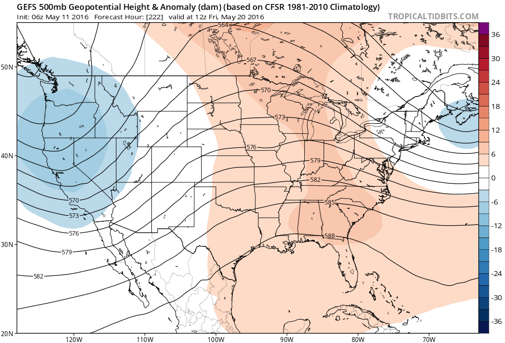
Some forecast models also show the development of roughing over the Northwest Atlantic, which could be a wild card in the duration and intensity of the warmup.
A potential wild card in the warmup — as is often the case — is the development of toughness in the Northwest Atlantic Ocean. This could lead to frequent backdoor cold fronts and cooler marine air infiltrating New England and, occasionally, our area — especially coastal locations. There are subtle hints of this development on some ensemble guidance as well. With energy from the Western USA trough coming over the top of a Central US ridge, toughness developing in the Northwest Atlantic could be an unsettled wild card in the pattern.
Over the next several days, our forecasters will continue to monitor the more intricate details of the warmup as we head toward the end of May. For now, the chances of above normal temperatures, at the very least look to be increasing. Stay tuned.