-2")
Heat, storms increasingly likely the next two weeks
A large and anomalous heat ridge is forecast by most mid-range operational and ensemble model guidance to build over the Central United States. The process will actually begin by early next week, as heights in the mid and upper levels of the atmosphere rapidly increase over the Central United States. Troughing over the Northwest United States will act to enhance this ridging, with mid and upper level heights approaching anomalous levels by the middle to end of next week.
Medium range ensemble support, at this range, is actually quite remarkable. Both the GFS and ECMWF ensemble means (the averages of multiple-member ensemble runs) show a tremendous ridge over the Central US, pulsing and expanding northeastward toward the Great Lakes and Northeast. While the brunt of the unbearable heat will likely miss our area to the south and west, the heat will still be felt. More notably, however, is the fact that our area will likely lie along the periphery of this ridge, in the path of multiple atmospheric disturbances.
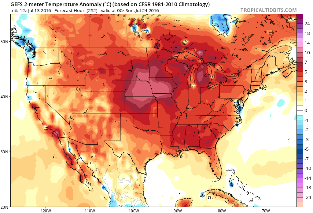
GFS Ensemble showing support for above average temperatures next week.
The heat and humidity, in fact, will build over the next few days. Highs in the middle to upper 90’s are expected away from the shores on both Thursday and Friday, with hot temperatures lingering through the weekend. Heat index values are likely to approach the lower 100’s. This will only be a predecessor to the main show, however, as mid level heights this week pale in comparison to what modeling indicates for the several days that follow.
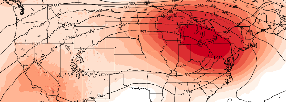
Both the GFS and ECMWF ensembles show mid level (500mb) heights increasing well above 590dm throughout a large portion of the Central United States, sprawling warm and humid air towards our area from the southwest. Despite the building ridge during the early week, the real “effects” of the heat and humidity aren’t likely to arrive until the latter half of next week — about 7 days from now.
Thereafter, the forecast gets hotter and more stormy. Ensembles are in good agreement on mid level heights exceeding 594dm for a fair period of time — most likely from next Thursday into next weekend. In addition, a northwest to southeast oriented height gradient near our area, in conjunction with an active pattern of disturbances over Canada, suggests the potential for complexes of strong and severe storms.
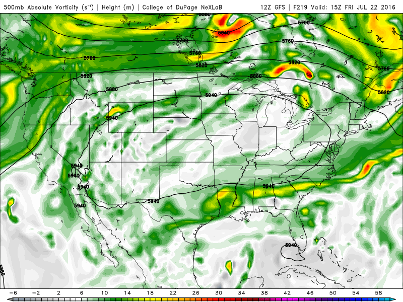
GFS model showing a large ridge over the Central US, with disturbances riding along its periphery toward our area next week.
Essentially, disturbances like to ride the northern periphery of these large ridges like a “highway” of sorts. The disturbances often track along the northern edge of the ridge, and then drop southeastward as they move toward the eastern flank. Better atmospheric shear can often shift southward along the ridges edge with the storms as well.
Individual nuances such as the hottest days or best chances for strong/severe storms won’t be ironed out for several days. The signal, however, continues to grow stronger for an increasingly hot and active pattern during this time frame.