-2")
Heat returns to East, but active pattern awaits
The remnants of Hermine are still hanging around, off the coast of New Jersey and south of Long Island this afternoon. The system, in fact, has drifted farther south today than it has been all week — much to the ire of meteorologists and forecasters up and down the East Coast. Nevertheless, the storm will begin to have a lessening impact on our areas weather as the days of this week go on. The system is vertically stacked, at all levels of the atmosphere, meaning it’s cut off from moisture and lift sources.
Accordingly, the storm will fade out slowly over the next 24 to 48 hours, with only momentum carrying its circulation. As it does so, a large mid level ridge will build across the East Coast and Western Atlantic, as we have seen several times already this summer. This pattern looks to remain in place through the weekend, when temperatures will again approach the 90’s in many areas.
Temperature anomalies will, notably, return to much above normal levels. But there are clues within the pattern as to where changes are occurring, and much of them lie west of the Corn Belt in the Northern Plains. An active pattern has settled into those areas, with multiple disturbances dropping southward from Canada bringing below normal temperature anomalies. Over time, these disturbances have become more intense.
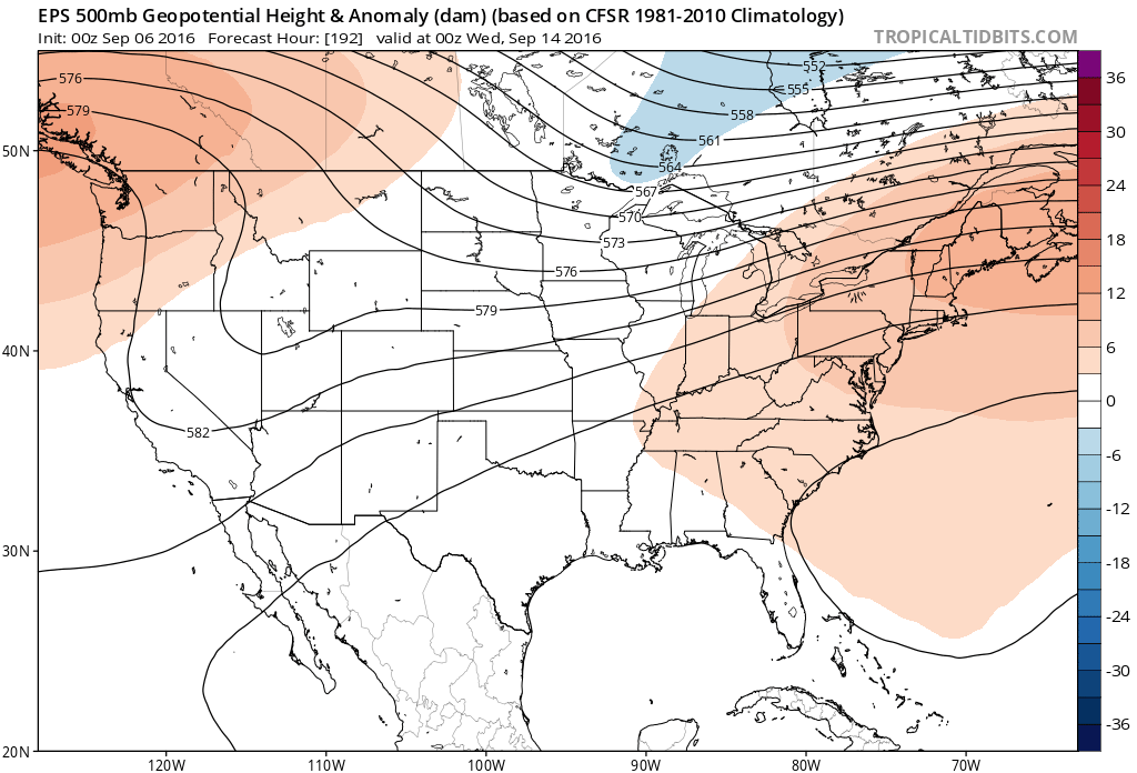
European model ensembles showing above normal heights in the East, with a cooler pattern over the Plains states, through Mid September.
Forecast models are in good agreement that a developing – EPO (Eastern Pacific Oscillation) will aid in the development of more intense troughs swinging southward through the Plains states, with below normal temperatures and an active precipitation pattern in those areas through September. While this may temporarily enhance our warmth on the East Coast, it signals a more active pattern and the propensity for disturbances to begin dropping farther southeast.
With changing wavelengths in the Autumn season, northern stream disturbances will start to dig further south toward the Great Lakes and even Northeast — and the active pattern over the Northern Plains signals the more active pattern which will eventually sink toward the Mississippi River Valley, Ohio Valley, and Northeast. Exactly when this occurs, though, is up for debate.
Forecast models have jumped back and forth with the idea of a larger scale pattern change occurring by Week 3 — with a large ridge amplifying on the West Coast of the US. This would allow a deeper trough to form east of the Plains states to the East Coast. But the Western Atlantic Ridge amplification, supported by tropical forcing the next few weeks, looks likely to put up a fight for quite some time.
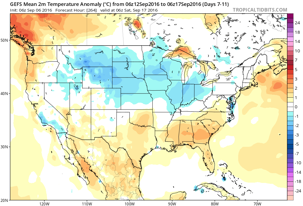
5 Day Temperature anomalies over the United States on the GEFS through the middle of September, showing a cooler than average pattern over much of the Northern 1/3 of the US.
What does all of this add up to? A gradually changing, and gradually more active weather pattern. It appears plausible that while the warmth hangs on in the East, a more active northern stream pattern into the Great Lakes aids in the development of a gradient near the Mississippi River Valley — and above normal precipitation may become a legitimate feature in the forecast over those areas by the end of September.
P.S – Premium Members, be on the lookout for an email later today with information and initial signups for a very special new feature.