-2")
Premium: Active pattern to begin December, but uncertainties remain
The hemispheric pattern will continue to undergo changes as the month of December approaches, and this comes as no surprise to those who have been following our long range forecasts for the past few weeks. The main changes in the pattern are unfolding throughout the Pacific Ocean, where a large vortex in the Gulf of Alaska is being gradually replaced by a propensity for ridging. This causes a domino effect downstream towards the United States.
However, questions still remain in regards to the results of this change in terms of sensible weather. The source of cold air, speed of the pattern, and strength of individual storm systems are the main concerns; most stemming from the uncertainties in regards to the pattern in the higher latitudes from Canada towards the North Pole.
Exactly how the pattern behaves throughout those regions is of critical importance for the United States. Essentially, while changes in the Pacific Ocean are a big deal — the source and quality of cold air, significantly responsible for winter weather potential, depends a lot on the presence and intensity of the higher latitude weather pattern.
Forecast models haven’t offered all that much help.
The GFS and ECMWF suites, as of this evening, do suggest the potential for some high latitude blocking to develop, specifically in the “NAO” regions of the North Atlantic and Greenland. In essence, a blocking ridge of high pressure over these areas can help to displace cold air farther south into the United States. This leads to more wintry precipitation events on average across the Northern 1/3 of the Central and Eastern US.
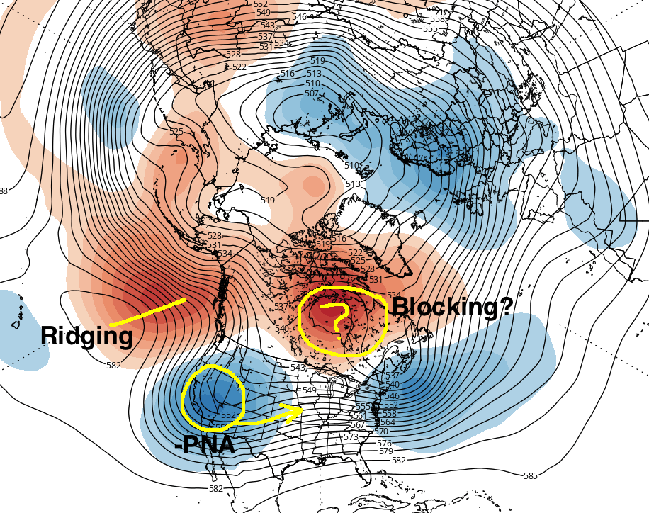
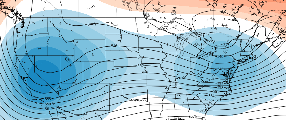
Still, the pattern across the United States itself can offer us some clues. Models are in good agreement that a “-PNA” pattern will develop by the first week of December. The PNA, or Pacific North American index, is generally positive when a large ridge exists on the Western USA coast, and negative when a trough exists there.
With a trough in the Western US, storm systems typically eject farther west into the Central United States instead of farther east towards the Appalachians. High latitude blocking can force storms farther south — if said blocking is strong enough. And that is what is leading to so much uncertainty moving forward.
So, to summarize:
Agreement on the development of a -PNA pattern, owing to changes in the Pacific, is strengthening among mid range model guidance and ensembles. With ridging developing into Alaska, cold air and disturbances should move southward supporting the potential for multiple storms in the Central US, Great Lakes, and Ohio Valley.
The degree of wintry weather that occurs will depend highly on the strength and positioning of high latitude blocking — which will also have significant implications on the pattern throughout the Northeast US. While forecasters continue to monitor the latest trends, we will have a new post out on Wednesday detailing what other sources we can use to give us an idea of if, when, and where the high latitude blocking will form.