-2")
Midday AG Update: Retrogression Theme Remains
Happy Tuesday! We’re going to dive straight into the latest model guidance today and detail some of the latest available information. Fortunately, there has not been much of a change in last night’s and this morning’s guidance — a good signal that the retrogression ideas discussed in yesterday’s AG update are in fact holding true. You always want to see the signal persist and move up in time on model guidance when trying to verify sensible weather changes taking place, and that is indeed what we are seeing.
For a frame of reference, we are going to use this morning’s GEFS model. The conditions right now reveal an amplified pattern in the United States with some deep troughs present (blues) and a large blocking pattern in Canada (reds). This has helped to keep a good chunk of the Eastern two thirds of the US below average in temperatures, as well as active in terms of precipitation.
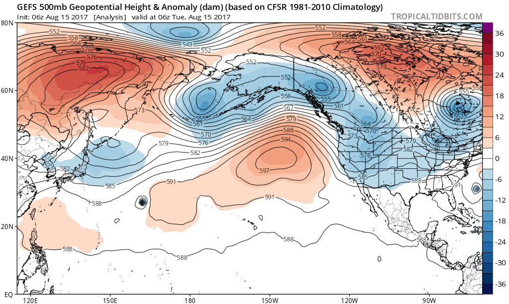
Current 500mb analysis shows a ridge in the Eastern Pacific and a blocking pattern in Canada. These ridges will retrograde west, supporting some big changes (Tropical Tidbits).
Blocking patterns are slow to break down, so this general theme may remain in place through the rest of this week. But next week is when we will start to see this classic retrogression, where large scale ridges move from east to west (rather than west to east) and “collide” with other ridges that are moving in the typical west to east direction. This helps to form even bigger ridges further west in the Pacific, which then becomes the new pattern driver.
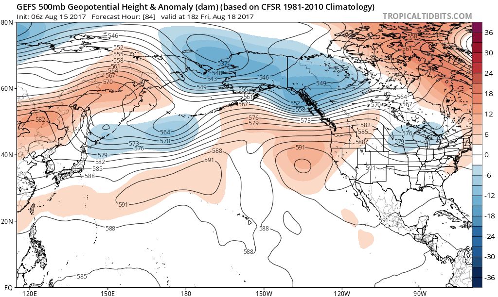
This morning’s GEFS model valid from August 18th through August 26th shows a classic retrogression pattern. This allows a large ridge in the NW Pacific to be the new pattern driver, rather than the blocking in Canada (Tropical Tidbits).
While the detailed downstream effects and individual nuances to the pattern are still subject to change, this is an obvious large-scale signal with very apparent effects. At a somewhat basic level, this large ridge in the NW Pacific favors a trough in the NE Pacific, but there’s still some ridging just beneath this trough. Thus, this trough does not have any below average height anomalies — an indicator that cool air is getting cut off from the Arctic and bottled up there. This means not only will ridging be forming downstream of this trough in a large chunk of the US, but also that the ridge will be large and expansive, due to cool air being bottled up in the Arctic. This means that a much warmer pattern will be developing in the US as we get to the latter part of August.
However, it’s still a bit tricky with the core of the ridging remaining in Canada. SE Canada is on the downstream side of this ridging, and thus some surface high pressure may form there. This could keep winds somewhat northerly in parts of the Great Lakes and Northeast, and thus big heat still may not be a major part of the forecast. But with the source region in the Plains becoming warmer, any westerly downsloping flow could result in some transient heat periods making it to the Great Lakes and Northeast.
As far as wet periods are concerned, we need to watch the pattern’s transition — from the last blocking induced trough swinging through to the ridging building behind it. These transition periods are often where precipitation can be focused.
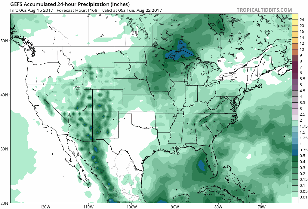
This morning’s GEFS has a strong signal for above average precipitation in the Northern Plains and Great Lakes next week, as the retrogression and transition takes place (Tropical Tidbits).
If we were to compare the precipitation signal with the 500mb anomalies in the same 168 through 222 hour period, we would see that this very much correlates with that last trough breaking off beneath the block as the retrogression takes place. While this exact location is subject to change, the idea of a strong precipitation signal in that general period certainly is there.
As far as hurricane activity in the US is concerned, this pattern can portend impacts. This is because the retrogression is removing large troughs from the US which normally send tropical systems out to sea — such as Hurricane/Tropical Storm Gert. So any tropical activity over the next couple of weeks will need to be very closely watched.