-2")
October Outlook: Why anomalous warmth could return
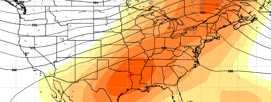
Several daily temperature records were broken over the past several days throughout the Eastern United States, particularly this weekend when temperatures reached into the upper 80’s and lower 90’s. Much of this warmth was aided and enhanced by the development of a large, sprawling mid and upper level atmospheric ridge. This ridge acted to enhance the flow of a warm, southwesterly flow, which effectively advected warmth into the agriculture regions and eventually into the Northeast as well.
In the near future, a potent cold front is expected to gradually shift east/southeastward into the Great Lakes, eventually making headway towards the Eastern United States. This front will provide some temporary relief in terms of temperature for harvesting in the near future, and will have many thinking that fall weather is finally on the way — but not so fast. There is more to the forecast, suggesting that anomalous warmth could return very soon.
Why is the cold front bringing cooler air in the first place?
Frontal boundaries this time of year often feature cooler air with a Canadian airmass source. But this front in particular has some extra help. Thousands of miles away, all the way in the Kara Sea and the Arctic regions, a large blocking ridge of high pressure has developed. These ridges have often been affiliated with some of the colder snaps and larger winter storms in our area – the are often predecessors to the movement of the polar vortex in the winter.
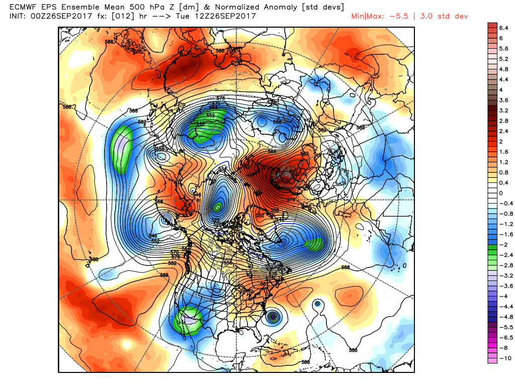
Forecast models and ensembles show a large blocking ridge in the Kara Sea today (top/center of image)
This time around, blocking will allow cooler air to surge into the Northern 1/3 of the United States as the frontal boundary shifts southward. Temporarily cooler, stable, autumn-like weather is expected across a large portion of growing regions into the Eastern United States as September ends and we move towards the first week of October.
These blocks work in funny, complicated ways – but think about it this way: They disrupt the normal circulation of air in the arctic. This allows the air which normally flows in those regions to maneuver more easily into regions it typically does not. In this case, it will push colder than normal air southward into the United States.
Five-day temperature anomalies may actually run below normal across a large part of the mentioned regions during this time.
What happens thereafter?
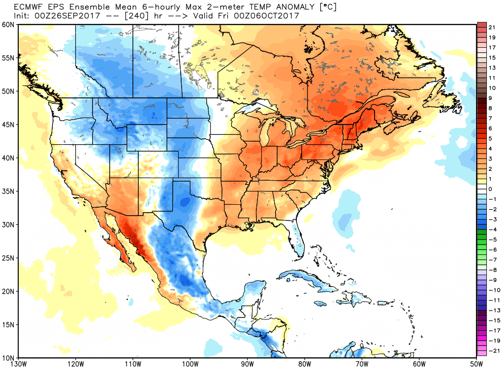
ECMWF EPS forecasting temperatures well above normal in growing regions and East in October.
As atmospheric angular momentum rapidly decreases and the tropical pacific begins to have a larger effect on global circulations, the hemispheric pattern will undergo a “snap back” reaction. Troughiness is again expected to build into the West/Southwestern United States during the early days of October. This will gradually allow another large, sprawling ridge to build into the Central and Eastern US.
It looks, again, like very warm temperatures will surge into the agriculture regions and eventually the East Coast. This will obviously have a major impact on Harvest and — as it currently stands — it appears that these above normal temperatures could last more than several days, into Mid-October, with the months temperature anomaly/departure from normal running solidly above average for many locations by 10/15.
While a transition towards more moderated weather appears likely towards the months end, the anomalous warmth appears very likely to start October.
Articled compiled by John Homenuk with thoughts from Doug Simonian and Miguel Pierre