-2")
Cooler risks increasing, volatile pattern on horizon
Happy Tuesday! For the past several days, discussions have turned from the presence of abnormal and anomalous warmth towards winds of change, which are signaling the return of cooler air and a volatile weather pattern. Overnight forecast models continue to supplement these ideas, with further confirmation that the pattern is set to undergo wholesale changes across the large majority of North America.
As we have discussed, most of these changes are being driven by the Tropical Pacific and the MJO, where global circulations are being affected heavily by its progression over the next few days. While La Niña’s base state has become entrenched in the atmosphere (30-day moving SOI now up to +11.3), the progression of the MJO will allow for a wave-pattern realignments by Days 5-7.
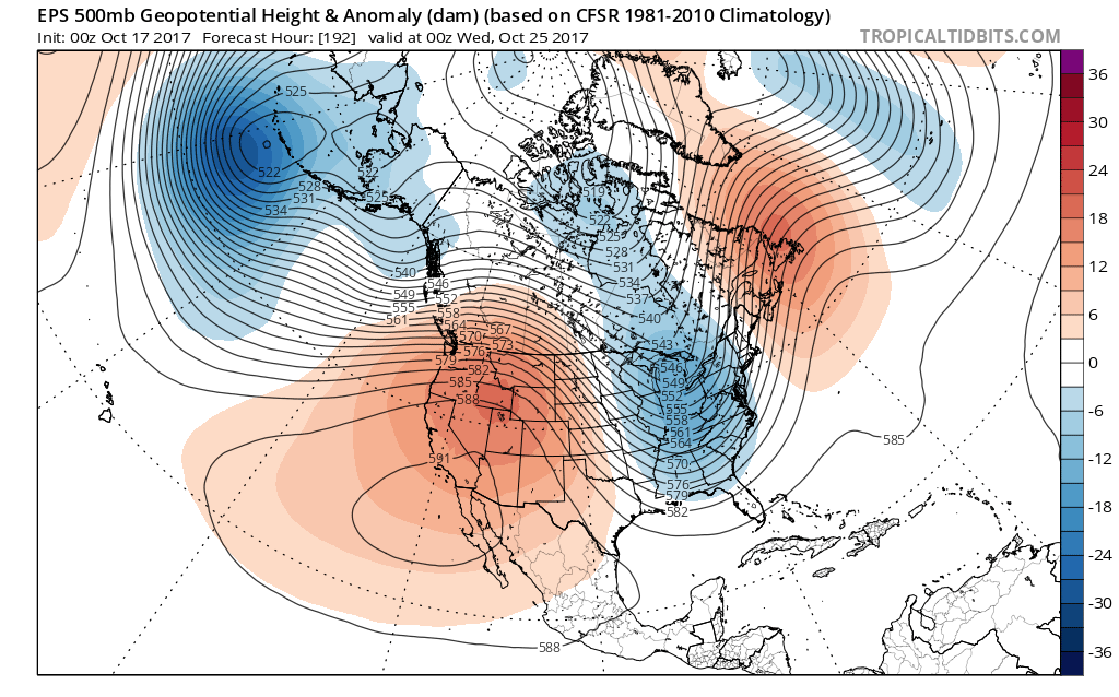
In the Northern Pacific Ocean, a large trough over the Gulf of Alaska is forecast to retrograde westward, pulling back to a position near or West of the Aleutian Islands. This will promote ridging along the Western USA shores. Colder air over Canada will be forced southward into the Central United States as the mid level height pattern becomes more amplified.
This brings us to the convoluted part of the forecast, and ultimately what will heavily modulate storm chances and the longevity of colder air: blocking in the higher latitudes of North America on the Atlantic side. It is important to remember that for a large majority of the United States, the Pacific and Atlantic Ocean weather patterns (especially in the higher latitudes) often work in tandem – and when they are out of sync, the pattern evolves much differently.
Think of it this way: While the Pacific pattern may promote a large ridge on the Western USA coast, and a trough in the Central and Eastern US, all atmospheric forces are fluid. So these features will inherently begin moving and progressing eastward over time. If there is no high latitude blocking in the Atlantic Oceans side of the weather pattern, the ridge over the West Coast often simply “rolls over” into the USA, producing a quick temperature moderation.
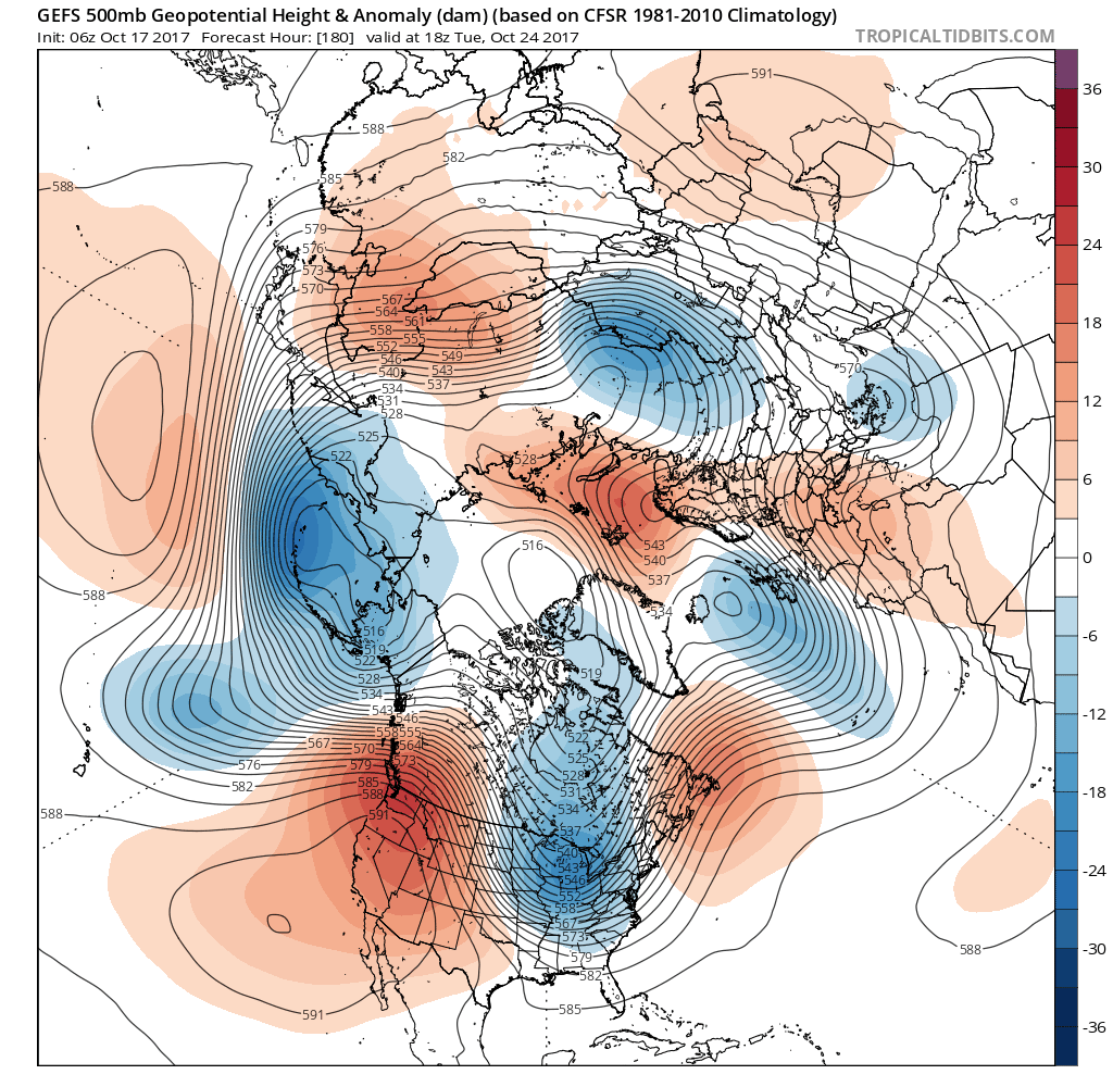
The GEFS shows an Aleutian low and strong ridge over the West Coast, that results in a large, deeper trough with some cooler than normal temperatures over Eastern US late next week. However, a lack of high-latitude blocking over Greenland/Davis Strait allows the faster pacific jet and trough to lift out of the Eastern US after a few days. The airmass over is moderating and potential for storminess over Eastern US decreases.
As you may imagine, our eyes are rightfully peeled and watching medium and long range guidance for Atlantic blocking. These blocking ridges, which form near Greenland and often push into Canada towards the Davis Straight region, can not only allow for longer duration cold, they are often harbingers of more significant storms east of the Mississippi as they act to amplify and slow down the weather pattern in the atmosphere upper levels.
Forecast model and ensemble guidance has displayed some early signals of storm potential with the presence of ridging near Greenland and a deep trough near the Mississippi River in about 7-10 days. The signal remains quite muted given model variances on handling shortwave energy embedded with the deep trough, at this juncture. The potential also exists for blocking to be more transient in nature, with limited effects on the pattern. As always, we will continue to closely monitor this general time frame as we get closer.
Meanwhile, confidence continues to increase that the weather pattern will become increasingly volatile. Cooler risks are likely by days 5-7 from the Plains eastward to the Mississippi, and further eastward towards the coastal plain thereafter. The magnitude and duration of these cooler airmasses and the potential for storminess closer to the East Coast largely remains to be seen. Stay tuned for more updates on the long range pattern later today and this week.