-2")
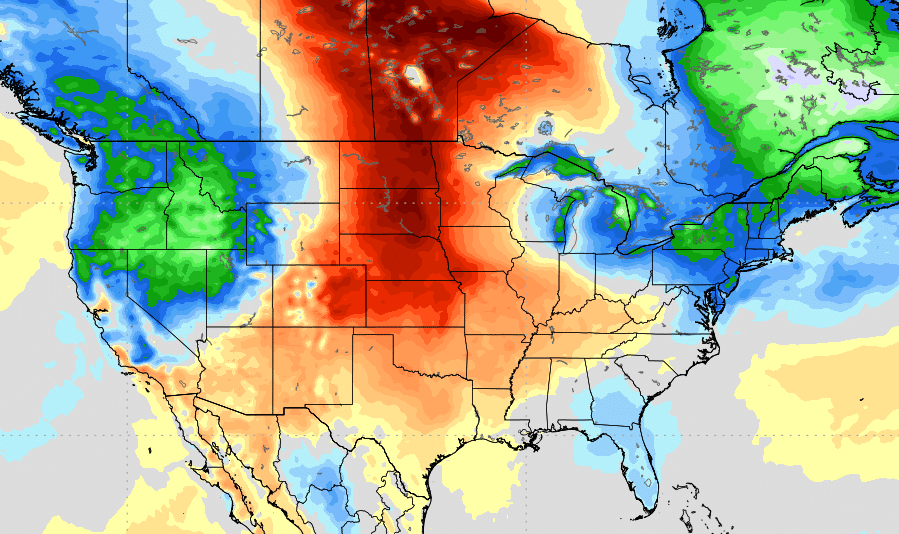
Heat Builds in the Plains, Cooler Weather Persists in the Northeast
While it’s been very warm and muggy at times, during the May and into beginning of this month, more periods of some cooler and some wetter weather have domnated over the Northeast US. Unfortunately, we don’t expect this general theme to be changing very much over next week or two. In fact, this summer isn’t looking to be very hot one for Northeast, based on our summer forecast research into analog years that feature similar pattern for the Spring months, (March to May) and current trends with a more neutral ENSO. But there might a be few changes for awhile during the middle to later part of this month.
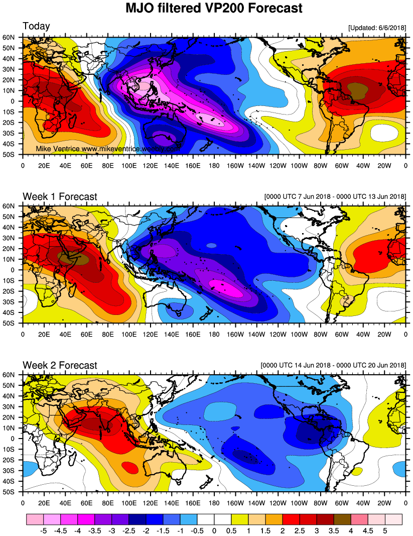
First, a strong ridge will build over the Western and Central parts of United States over during this week. To storm chasers this ridge, is commonly known during the summer months, as a death ridge. This ridge allow more heat and dry conditions to build over much of West/Central US, effectively shutting down severe weather and tornado season for storm chasers. This death ridge showed up on analogs for summer forecast, especially in June. The only areas that will more severe weather will be over Northern most Plains states. The MJO/tropical forcing largely in Maritime Continent over the next week, will also support continue to support the ridge out West and over the Northeast US.
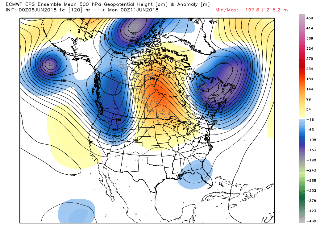
ECMWF EPS showing a high-amplitude ridge over the Midwest and Central Canada this weekend. An upper-level trough or low on either side over British Columbia and Quebec indicates an omega block in the higher latitudes.
For the Northeast, this atmospheric pattern over will mean that no prolonged, extreme heat is likely for the foreseeable future. At times this ridge will extend into the high-latitude areas of Northern Canada and connect some transient ridging near Greenland. This high-latitude blocking will result in a more active pattern with multiple troughs or disturbances digging on the downside of the Central US ridge into Northeast US, over next 6-10 days. Some showers and thunderstorms will also be possible with these troughs, starting this weekend with stronger forcing and sub-tropical moisture involved. Precipitation may be above normal over the Northeast US with more convective rainfall occurring.
That being said, every now and then, the ridge will probably expand further east, of ahead of these troughs and with lack of high-latitude blocking. So some heat and humidity for a couple days is still possible. Especially over parts of the Northern Mid-Atlantic and Southern New England regions, where mid-level heights are likely to rise more. However, we anticipate majority of days with feature temperatures either just below seasonal normals and some more unsettled or wetter weather, in much of the Northeast.
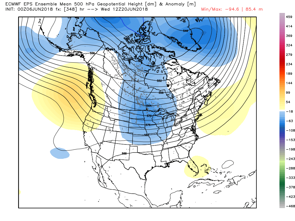
ECMWF EPS retrogrades the Plains ridge into North Pacific towards June 20. This support more troughiness over the the Plains and the Western Atlantic ridge build towards the June 20th
Beyond this time frame, there are signs the MJO will begin weakening, as propagates out of the Martime Continent. Thus the GFS and ECMWF ensembles show some retrogression of the ridge into the North Pacific and more troughiness with some cooler temperatures returning to the Central Plains. This may support the Western Atlantic ridge build again and some warmer than normal temperatures return to Northeast US again by the third week of June. But we anticipate more cold fronts will likely comes out from troughiness over Central US with more convective events are possible in the Northeast. Thus prolonged heat is still not anticipated yet for the Northeast US.
So to summarize, heat will likely continue over the Plains and some cooler weather in Northeast, over next 7 days. Then some changes to pattern may occur during the middle on the month, that may result in some relief to the heat over the Plains and more decent summer-like weather in Northeast for awhile. But keep in mind, the long-range ensemble guidance still has lower skill and with the MJO forecasts, especially beyond 10 days. Therefore stay tuned for more updates, as we will likely be reanalyzing potential pattern changes over the Plains and Northeast, over the next few weeks!