-2")
Seasonably warm for now, cooler air on the horizon
Warm conditions are expected to persist this weekend, with a chance of showers and thunderstorms each afternoon. The good news will be the absence of heat, which had been a consistent feature over the past two weeks. Temperatures will average in the middle to upper 80’s through Sunday. Saturday may be the most active day, with afternoon showers and storms anticipated.
Our area will lie in a transitional zone of the jet stream over the next week. This will keep the weather seasonably warm and bring the opportunity for showers and storms every few days. The longer range forecast, however, offers the opportunity for change. Forecast model guidance suggests that a large trough of cooler air could sink southward from Canada by the end of next week.
Here are the highlights for the weekend and beyond:
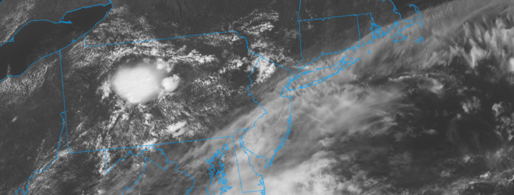
- A few showers and storms are likely this afternoon, mainly across Pennsylvania and New Jersey. These aren’t expected to be severe, but could bring localized heavy rainfall and some blustery winds
- Additional showers and storms are expected on Saturday. After a calm start to the day, expect storms to fire up throughout the area. Again, no widespread severe weather threat is anticipated but storms will pose a threat for heavy rain and gusty winds
- The weather improves on Sunday, with temperatures in the mid to upper 80’s and plenty of sunshine
- Calm weather will continue into the early part of next week, with high pressure temporarily in control
- The pattern takes an unsettled and cooler turn by the end of next week. Model guidance suggests a large trough may sink southward from Canada – and if it does, expect cooler temperatures and plenty of opportunities for rain
We’ll be closely monitoring the weather over the weekend (as we always do, since that’s our job). Stay tuned for further updates.
Have a great Friday!
Leave a Reply
Want to join the discussion?Feel free to contribute!