-2")
Dorian tracking northwest, future remains uncertain
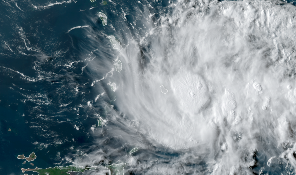
Tropical Storm Dorian continued her northwestward trek today, marching toward the Lesser Antilles in the Tropical Atlantic. The system has maximum sustained winds of 60 miles per hour, a solid Tropical Storm. The National Hurricane Center forecasts the storm to reach Hurricane status by 8pm on Tuesday.
Currently, Dorian is battling dry air which is surrounding the system from all angles. Thunderstorm activity within Dorian has been fluctuating, and recently has perked back up again near the storms center. While this suggests a battle between the moist tropical system and dry air around it, it also does suggest that the storm could have some staying power as it moves into a more favorable environment in the coming days.
Forecast model guidance is in good agreement that the system will continue a steady northwest track and gradual strengthening. This will bring Dorian near or just southwest of Puerto Rico by midweek, likely as a weak Hurricane. The National Hurricane Center has issued a Tropical Storm Watch for Puerto Rico with their latest advisory.
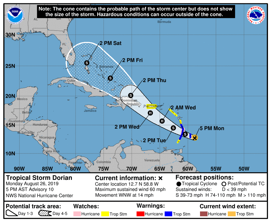
Beyond this point, the systems interaction with the Dominican Republic and Haiti will be an important component to the forecast. Recent forecast model guidance has shifted the track northward, suggesting Dorian may pass far enough northeast of the islands to avoid destruction of the storms core.
Such a track would open up the possibility of Dorian entering the warm waters of the Bahamas as a Tropical Storm or Hurricane. Still, intensity and track forecasts at this range are difficult. There will be hurdles along the way for Dorian’s development including wind shear, land, and dry air.
Nevertheless, the latest discussion from the National Hurricane Center does nod to the storms recent resiliency to its environment and likelihood of strengthening:
The risk of direct impact from wind & rainfall has increased for Puerto Rico and Hispaniola
National Hurricane Center
Ultimately, there is still much to be determined in regards to Dorian’s future. The next few days will be critical to the systems future, as we track and monitor its movement toward Puerto Rico and its eventual maneuvering toward the Dominican Republic.
Depending on the storms eventual track, impacts along the US Mainland are possible. Still, the storm remains 5 to 7 days away from any potential impacts in those areas, and confidence in regards to its track or impacts will remain low for a few days to come.
If you live along the Southeast US coast, take basic early tropical storm preparation steps and pay attention to the forecast in the coming days.
Leave a Reply
Want to join the discussion?Feel free to contribute!