-2")
Dorian strengthens, expected to approach Florida as a powerful hurricane
Update 2:00pm: The National Hurricane Center has confirmed that Dorian strengthened to a Category 1 Hurricane this afternoon. Maximum sustained winds are now near 75mph as the storm passes near St Thomas.
Additional strengthening is forecast late this week as the storm moves into the Bahamas. The National Hurricane Center is forecasting Dorian to be a Major Hurricane as it approaches the Florida Coast this weekend.
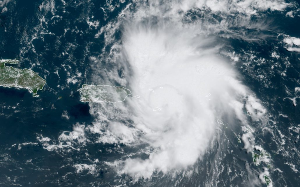
So far today, Dorian has continued a northwestward movement. Dorian is now expected to only skirt Puerto Rico to the northeast later today, thanks to a trend northward in the systems track.
A northward adjustment in the storms track occurred over the past 24 hours, when the center of circulation reformed as the storm passed the Lesser Antilles. Forecast model guidance missed this reformation and struggled after it occurred. As a result, guidance has been too far south until today.

Puerto Rico may avoid direct hit today
The northward adjustment in Dorians track has taken the storms center of circulation further northeast than initially anticipated. As a result, the official forecast track from the National Hurricane Center now takes the center of Dorian to the northeast of Puerto Rico.
Still, 30 to 50 mile per hour winds and torrential rainfall are likely. Mudslides will be possible in rain-stricken areas and flooding may occur throughout Puerto Rico. The islands to the east – Culebra and Vieques – are at risk for a direct hit from Dorian later today.
Puerto Rico is still dealing with a damaged infrastructure from Hurricane Maria, which slammed the island in 2017. While Dorian is expected to be much weaker, the impacts of rain and wind from the Tropical Storm could cause significant impacts to the recovering island.
If you live in Puerto Rico, continue tropical storm preparation and emergency preparedness. While the track shifting to the east reduces the likelihood of direct impact, significant impacts are still likely and will cause a threat to life and property.
Powerful hurricane could approach Southeast US this weekend
As Dorian emerges into the Bahamas later this week, the storm is expected to encounter an environment favorable for strengthening. Lower wind shear and very warm sea surface temperatures will fuel the storms organization. The National Hurricane Center forecasts Dorian to become a Category 2 Hurricane quickly as it emerges into the Bahamas on Thursday and Friday.

Thereafter, steering currents in the atmosphere (mainly a large ridge of high pressure to Dorian’s north) are expected to direct the storm westward. Exactly where and how quickly this happens will be a critical component to the forecast. With the storm riding on the northern periphery of forecasts so far, confidence is unusually low in regards to where Dorian will track over the next 5 days.
Forecast model guidance and ensemble data suggests a wide range of possible solutions, from landfall near Miami to a recurving storm that moves near Georgia and the Carolinas. The National Hurricane Center is currently forecasting Dorian to strengthen to Major Hurricane status and approach the East Coast of Florida – near Dayton Beach – by Sunday.

Residents on the Atlantic Coast of Florida should begin hurricane preparations now. All residents of the Southeast US Coast – including Georgia and the Carolinas – should review hurricane and tropical storm preparedness steps, while carefully monitoring the latest updates on the storm.
Stay tuned for further updates and information throughout the coming days. The next comprehensive update from the National Hurricane Center is scheduled for 5:00pm Eastern time today.
Trackbacks & Pingbacks
1antiquarian
Leave a Reply
Want to join the discussion?Feel free to contribute!