-2")

Wednesday Briefing: Showers return today, Erin forms offshore
Tropical Storm Erin formed off the East Coast late on Tuesday evening. The storm is expected to track northeastward, posing no threat to land. It is expected to bring some rough surf and swells along parts of the Northeast US coast through the end of the week.
Closer to home, showers will return to the forecast today as a frontal boundary approaches the area. Moisture will increase – you may have noticed that it’s much more humid outside (how exciting) – and as the front approaches later this morning, the development of showers is likely.
One positive to take away from today? There is very little instability in the atmosphere. This means that thunderstorms should have trouble developing and organizing, with very little threat for severe weather. Still, showers could produce heavy downpours in some areas through the evening.
Tropical Storm Dorian is still churning this morning as well, and will emerge into the Bahamas later this week after impacting Puerto Rico today. Winds have increased to 60mph and the storm is now expected to strengthen – possibly significantly – as it moves into the Bahamas later this week.
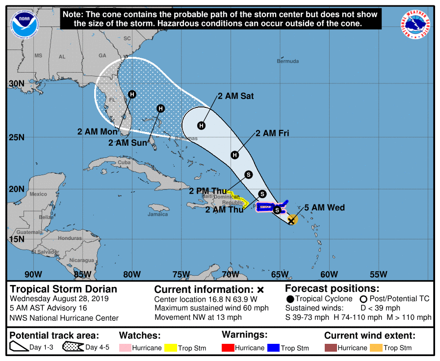
Residents in the Southeast US, particularly from the Eastern coast of Florida into Georgia, should begin early tropical preparation steps. Review emergency plans and be ready to put them into action in the next 24-36 hours if confidence continues to increase that Dorian will approach.
Here are your daily briefing highlights and links:
- Showers and some isolated storms are likely today, mostly from late morning through the afternoon. Bring an umbrella with you.
- Conditions are likely to improve by Thursday morning as the front swings through, with dew points lowering once again and pleasant weather expected this weekend.
- Tropical Storm Erin formed offshore last night, but the storm will head out to sea and won’t impact land. Rough surf and rip currents are expected along the coast.
- Tropical Storm Dorian may be a more notable United States threat once it emerges back into the Bahamas later this week, perhaps strengthening significantly on approach to Florida or the Southeast US Coast.
- We wrapped up meteorological summer in our post on Tuesday. It will end with above normal temperatures, above normal precipitation, and above normal severe weather activity in NYC.
Have a great Wednesday morning!
Leave a Reply
Want to join the discussion?Feel free to contribute!