Record warm temperatures expected on Wednesday in NYC

High temperatures on Wednesday are expected to climb into the upper 80’s and lower 90’s in New York City, challenging daily and monthly records for October. Rising dew points will lead to heat index values into the mid 90’s during the afternoon.

The record high temperature on October 2nd in Central Park is 90 F, which will almost certainly be challenged. Records are similar at other reporting stations throughout the area. The all-time record high temperature for October in Central Park is 94 F, set in 1941.

One last summer-like ridge

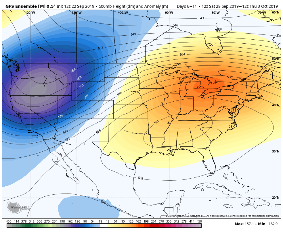
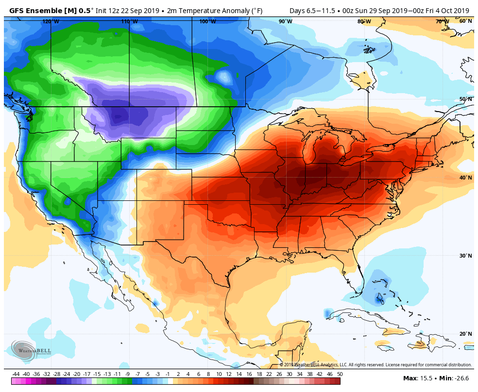
A large ridge of high pressure sat over the Ohio Valley and Mid-Atlantic states for prolonged periods this summer, and it has continued to reappear this Autumn. September 2019 will end as one of the warmest Septembers in US history, with the majority of warmth emanating from those regions.

GFS Ensemble showing the large ridge that is causing heat and humidity this week.

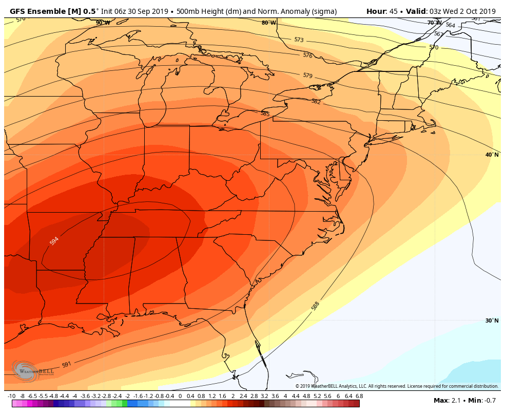
A ridge of high pressure in this position helps to facilitate a warm, humid pattern across the Eastern United States. When these ridges amplify and slow down, they can lead to stretches of anomalous warmth and draw in humidity and moisture from multiple sources.

This ridge was no different. Thus far, the NYC Metro Area has been able to escape the worst of the heat, but the same cannot be said for our neighbors to the south (we’re looking at you, Washington).

Backdoor front will signal pattern change

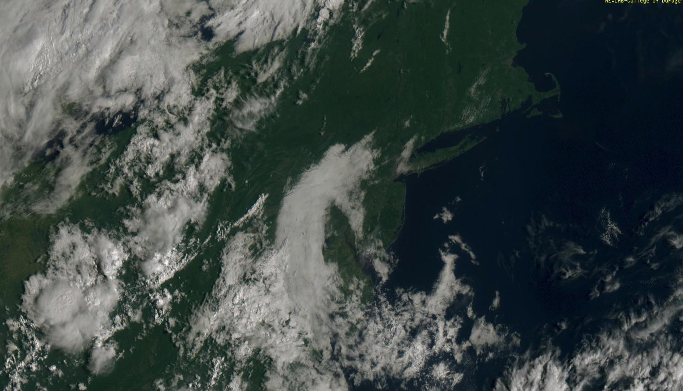
The temperature forecast on Wednesday is very complicated. A frontal boundary will be sinking southward from New England, with a wind shift bringing cooler air southward from the Gulf of Maine. Parts of Connecticut and Southeast New York will see a 10-15 degree temperature drop during the afternoon hours.

NAM model showing heat, followed by a front moving south from New England

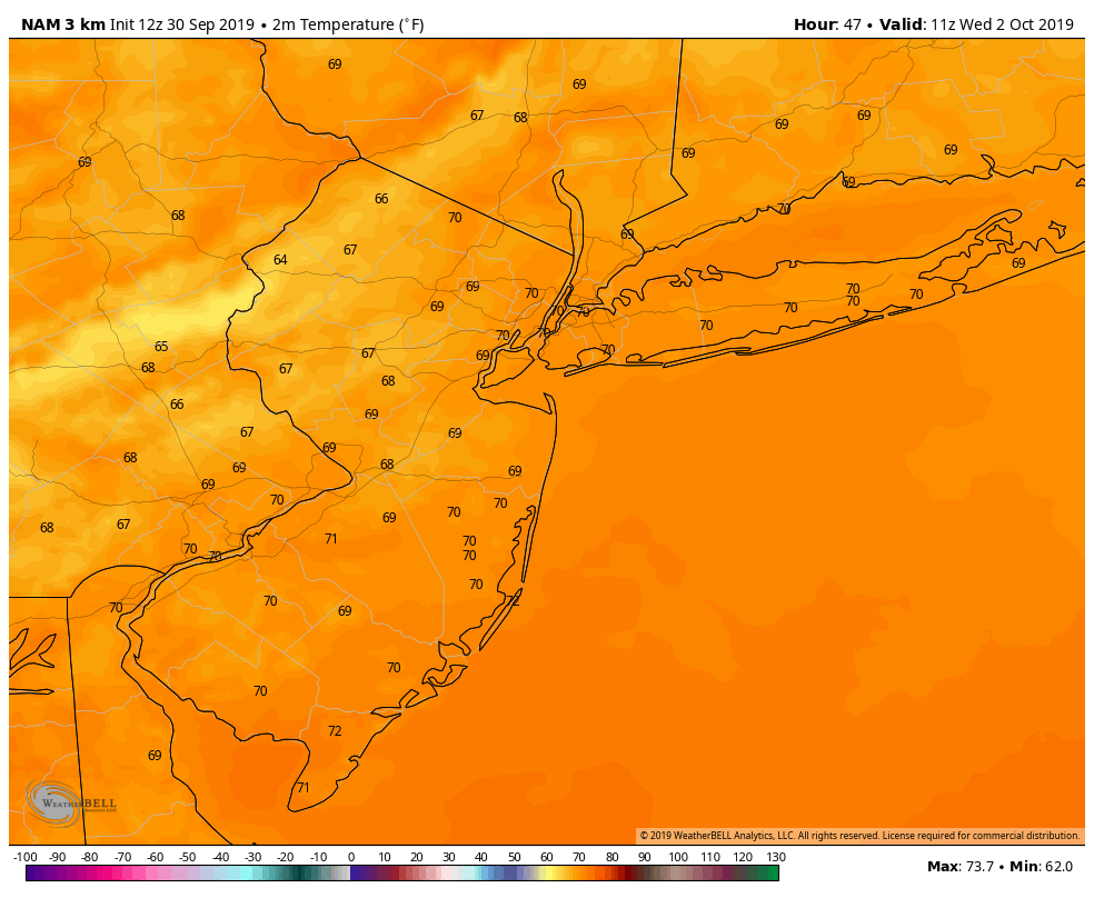
Exactly where this front sets up during the afternoon will be key. Areas just south of the front will see enhanced warmth and humidity, and that could be just enough to push parts of New Jersey and the NYC Metro over 90 and near all time monthly record highs.

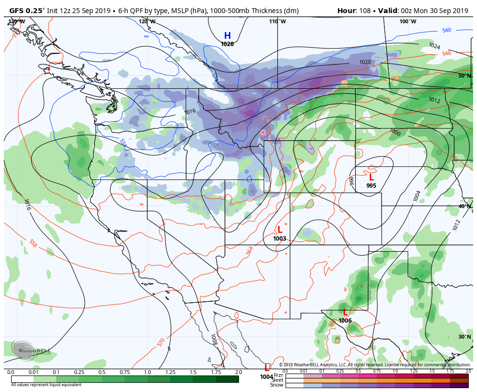
By the latter half of the week, temperatures will begin trending downward. Multiple disturbances will ride over the top of the ridge and begin de-amplifying it, allowing cooler air to move in and bringing an end to the warmth and humidity.

This pattern, with a more active flow and cooler temperatures, appears likely to settle in for at least a week or two as we move into the middle part of October.

Saturday Briefing: Showers and storms possible this afternoon

An approaching frontal boundary is expected to kick off the development of showers and thunderstorms across parts of the Northeast this afternoon. The Storm Prediction Center has placed parts of the area in a Marginal Risk (Level 1 of 5) for severe thunderstorms through tonight.

Read more

PM Briefing: More warmth and humidity is on the way, but it could be worse

There will be a moment sometime next week when you will find yourself complaining (or wanting to complain) about the warmth and humidity in New York City. It may be advantageous for you to consider that it could be much worse.

Take Montana, for example, where it appears increasingly likely that a significant, severe and highly anomalous winter storm will occur this weekend. The National Weather Service is forecasting blizzard conditions with 18 to 36 inches of snow and widespread tree damage – including the potential for extreme impacts to the agricultural and power infrastructure.

The very same trough and disturbance causing blizzard conditions in the Northwest US will be responsible for ramping up a ridge in the Central and Eastern states. This will, in turn, lead to the warming temperatures and rising humidity in the NYC Area.

An anomalous and near record-breaking ridge

Most forecast guidance is in good agreement that a very large ridge will build across the Central and Eastern United States starting this weekend. By early next week, this ridge could be one of the strongest on record for this time of year in the mid levels of the atmosphere (the ECMWF is forecasting heights at the 99th percentile).

European model showing a large ridge over the Eastern US early next week.

Temperatures will average 10 or more degrees above normal across a large part of the Ohio Valley, Tennessee Valley and Mid Atlantic States. This ridge of high pressure is expected to persist until the first few days of October.

What does this mean in terms of sensible weather? Summer-like conditions. The average high temperature in New York City is falling to near 70 degrees this time of year, and most forecast models suggest high temperatures will reach at least the middle 80’s for multiple days. Rising humidity levels won’t help, either.

An equally anomalous trough and storm to our west

While we suffer through unusually warm temperatures and humidity, parts of Montana, Idaho, and Washington – as well as British Columbia and Saskatchewan – will experience blizzard conditions. Almost all model guidance is in good agreement in an unusually early and severe winter storm in those areas this weekend.

A large trough will swing into the Pacific Northwest states this weekend, forcing the development of a strong surface low pressure system. Unusually cold air lingering to the north of the storm will get tugged southward, and precipitation is expected to change to snow across the aforementioned areas, especially the higher elevations.

Winter Storm Watches have been issued for parts of the mentioned states, with the potential for significant snowfall. High winds are also expected, resulting in the potential for tree damage and power outages.

Pattern will change, but it will take some time

By the time we move into the second week of October, the weather pattern is likely to change across the United States. This change will allow a more progressive pattern to take hold – kicking out the heat and humidity and allowing more typical Autumn weather to take over.

The timing of this change remains in question, but we’re currently targeting the second week of October for the change. Stay tuned for more as we draw closer – and stay cool!

Warmth and humidity to return again as anomalous ridge develops

If you were thinking that we had seen the last of warmth and humidity this year, think again. Forecast model guidance is in excellent agreement that a large ridge will develop across the Central and Eastern United States in the next 5 days. This will lead to the development of anomalously warm conditions from the Plains to the East Coast.

In the Northeast, temperatures could average several degrees above normal for more than a week. At times, forecast model guidance suggests that temperatures could average 15 to 20 degrees above average. Those kind of numbers will lead to unusual – and likely uncomfortable – warmth and humidity.

A summer-like ridge expected to form

Large and sprawling ridges of high pressure have developed across the Central and Eastern United States a few times already this Summer – and multiple times in the past few weeks. This one, though, looks to be particularly strong. Guidance suggests that heights in the mid levels of the atmosphere could approach summer-like levels during the week ahead.

Ensemble guidance continues to suggest that a large ridge will form in the Eastern US over the next several days.

When large ridges of high pressure like this develop, the airmass and air flow can quickly lead to abnormal warmth. Temperatures across the Central United States, particularly from the Plains toward the Ohio Valley, are likely to average 10 or more degrees above normal in the next week.

This warmth will eventually make it into the Eastern United States as well, with temperatures skyrocketing well above normal as we move through the last several days of September. There are some signals that this warmth could continue into the early part of October as well.

Here in New York City, this type of atmospheric pattern almost always means two things: Warmth and humidity. Dew points will gradually rise, and as the airmass around us modifies and the ridge remains in place, temperatures will eventually reach several degrees above normal, too. The forecast during the week ahead is likely to feature temperatures warming into the 80’s by the weeks end.

Temperatures are likely to average several degrees above normal through the end of September.

Tropics expected to remain active

Medium range weather model guidance is also in excellent agreement that conditions will remain favorable for tropical development in the Atlantic over the next 10-14 days. Tropical Storm Karen recently formed and is expected to pass near Puerto Rico before moving northward – but the systems path after that time also remains an uncertainty.

Additional tropical cyclone development is anticipated with clusters of thunderstorms emerging off of Africa in the next week. Multiple systems could develop and begin a general westward movement through the Tropical Atlantic.