-2")
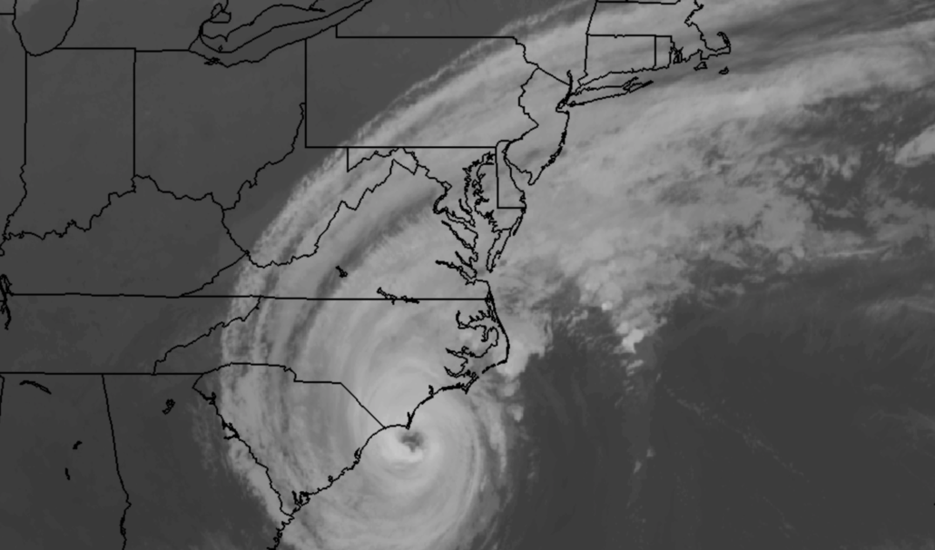
Dorian set to pass east of NYC, some beaches closed through Saturday
Hurricane Dorian, good for nothing other than a beautiful sunset in the Northeast and some viral marketing for Sharpie markers, is finally set to meet her demise. The hurricane which has brought tragedy to the Bahamas and is still ravaging parts of South and North Carolina tonight, will begin to interact with a frontal system on Friday and Saturday.
As it does so, it will undergo a transition to a post tropical cyclone. This occurs when the system loses its warm, tropical characteristics – and in this case, the frontal system will send the storm barreling into the higher latitudes of the Northern Atlantic Ocean by the end of the weekend.
Before the post tropical transition occurs, Dorian will slide just to the east of the Mid-Atlantic and New England coastlines. While direct impacts from wind and rain are not expected, high surf and dangerous rip tides are likely at area beaches. As a result, New York City announced today that they are closing area beaches to swimmers through Saturday evening.
Northeast coastline will get a glancing blow from Dorian
While the core of Dorian will pass well offshore, the system has expanded significantly in size. This will bring some impacts to the area coasts. Along the shores of New Jersey and Long Island, some showers are expected on Friday afternoon. Some of these could contain tropical downpours.
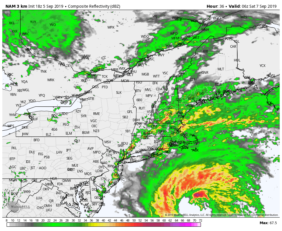
Simulated Radar from the NAM model late Friday night 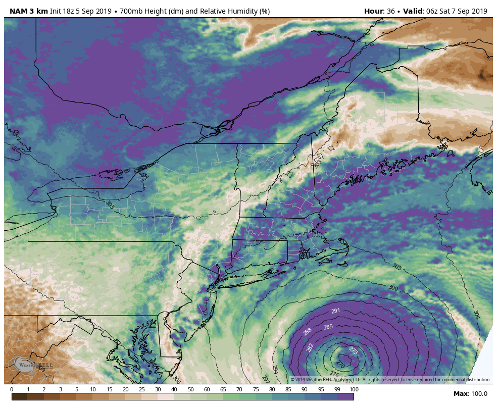
700hPa Relative Humidity from the NAM model
Forecast models are in good agreement that the most likely area for steady rainfall will be near the beach, but showers will be possible as far west as New York City as a frontal system swings through the area late Friday evening into Saturday morning. This is the same front that will ultimately be responsible for sending the storm well out to sea.
In addition to rainfall, high surf and dangerous rip currents are expected at the beaches. We don’t recommend swimming this weekend, even if the beaches are open. If you do choose to swim, please do so carefully and with somebody else nearby.
Bottom Line: While we’ll escape most impacts from Dorian in NYC and NJ, some showers are still possible. At the area coasts, showers may be steady with some local downpours. Area waters will also experience high surf and dangerous rip currents. The storm moves away from the area by Saturday afternoon.
Much improved weather for this weekend
Dorian will be a distant memory by the time Saturday afternoon rolls around. Improving weather is likely, with dry conditions and plenty of sunshine. Temperatures are likely to be seasonable in the mid 70’s, but the air will feel refreshing with lower dew points and humidity in place.
The pleasant weather is expected to continue until at least the middle of next week.
Leave a Reply
Want to join the discussion?Feel free to contribute!